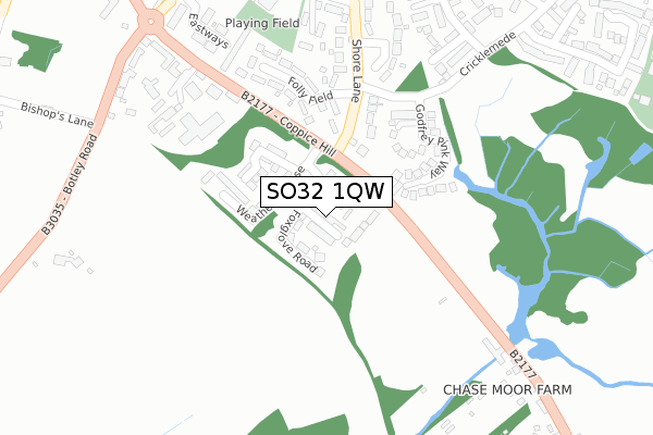
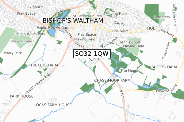
SO32 1QW is located in the Bishop's Waltham electoral ward, within the local authority district of Winchester and the English Parliamentary constituency of Meon Valley. The Sub Integrated Care Board (ICB) Location is NHS Hampshire and Isle of Wight ICB - D9Y0V and the police force is Hampshire. This postcode has been in use since November 2019.


GetTheData
Source: OS Open Zoomstack (Ordnance Survey)
Licence: Open Government Licence (requires attribution)
Attribution: Contains OS data © Crown copyright and database right 2025
Source: Open Postcode Geo
Licence: Open Government Licence (requires attribution)
Attribution: Contains OS data © Crown copyright and database right 2025; Contains Royal Mail data © Royal Mail copyright and database right 2025; Source: Office for National Statistics licensed under the Open Government Licence v.3.0
| Easting | 455627 |
| Northing | 117013 |
| Latitude | 50.949868 |
| Longitude | -1.209479 |
GetTheData
Source: Open Postcode Geo
Licence: Open Government Licence
| Country | England |
| Postcode District | SO32 |
➜ See where SO32 is on a map ➜ Where is Bishop's Waltham? | |
GetTheData
Source: Land Registry Price Paid Data
Licence: Open Government Licence
| Ward | Bishop's Waltham |
| Constituency | Meon Valley |
GetTheData
Source: ONS Postcode Database
Licence: Open Government Licence
9, BLUEBELL WAY, BISHOPS WALTHAM, SOUTHAMPTON, SO32 1QW 2020 29 JUL £408,000 |
6, BLUEBELL WAY, BISHOPS WALTHAM, SOUTHAMPTON, SO32 1QW 2020 13 JUL £420,000 |
4, BLUEBELL WAY, BISHOPS WALTHAM, SOUTHAMPTON, SO32 1QW 2020 16 MAR £379,950 |
3, BLUEBELL WAY, BISHOPS WALTHAM, SOUTHAMPTON, SO32 1QW 2020 16 MAR £379,950 |
1, BLUEBELL WAY, BISHOPS WALTHAM, SOUTHAMPTON, SO32 1QW 2020 5 MAR £379,950 |
2, BLUEBELL WAY, BISHOPS WALTHAM, SOUTHAMPTON, SO32 1QW 2020 24 JAN £379,950 |
➜ Bishop's Waltham house prices
GetTheData
Source: HM Land Registry Price Paid Data
Licence: Contains HM Land Registry data © Crown copyright and database right 2025. This data is licensed under the Open Government Licence v3.0.
| Coppice Hill (B2177 Coppice Hill) | Bishop's Waltham | 125m |
| Coppice Hill (B2177 Coppice Hill) | Bishop's Waltham | 131m |
| Godfrey Pink Way (Cricklemede) | Bishop's Waltham | 264m |
| Godfrey Pink Way (Cricklemede) | Bishop's Waltham | 270m |
| Botley Road | Bishop's Waltham | 374m |
| Botley Station | 5.1km |
GetTheData
Source: NaPTAN
Licence: Open Government Licence
GetTheData
Source: ONS Postcode Database
Licence: Open Government Licence


➜ Get more ratings from the Food Standards Agency
GetTheData
Source: Food Standards Agency
Licence: FSA terms & conditions
| Last Collection | |||
|---|---|---|---|
| Location | Mon-Fri | Sat | Distance |
| Waltham Mill | 16:45 | 07:45 | 370m |
| Bishops Waltham Post Office | 17:30 | 12:00 | 495m |
| Bishops Waltham Post Office | 17:30 | 12:00 | 496m |
GetTheData
Source: Dracos
Licence: Creative Commons Attribution-ShareAlike
The below table lists the International Territorial Level (ITL) codes (formerly Nomenclature of Territorial Units for Statistics (NUTS) codes) and Local Administrative Units (LAU) codes for SO32 1QW:
| ITL 1 Code | Name |
|---|---|
| TLJ | South East (England) |
| ITL 2 Code | Name |
| TLJ3 | Hampshire and Isle of Wight |
| ITL 3 Code | Name |
| TLJ36 | Central Hampshire |
| LAU 1 Code | Name |
| E07000094 | Winchester |
GetTheData
Source: ONS Postcode Directory
Licence: Open Government Licence
The below table lists the Census Output Area (OA), Lower Layer Super Output Area (LSOA), and Middle Layer Super Output Area (MSOA) for SO32 1QW:
| Code | Name | |
|---|---|---|
| OA | E00117985 | |
| LSOA | E01023223 | Winchester 012D |
| MSOA | E02004840 | Winchester 012 |
GetTheData
Source: ONS Postcode Directory
Licence: Open Government Licence
| SO32 1PB | Godfrey Pink Way | 200m |
| SO32 1EB | Folly Field | 217m |
| SO32 1DY | Shore Lane | 247m |
| SO32 1AG | Coppice Hill | 299m |
| SO32 1EA | Penfords Paddock | 326m |
| SO32 1EX | Eastways | 345m |
| SO32 1ED | Little Shore Lane | 358m |
| SO32 1AH | Winchester Road | 369m |
| SO32 1SD | Cherry Gardens | 377m |
| SO32 1DQ | Botley Road | 378m |
GetTheData
Source: Open Postcode Geo; Land Registry Price Paid Data
Licence: Open Government Licence