SO31 1EY open data databoard
- Home
- Postcode
- SO
- SO31
- SO31 1
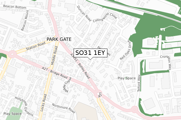
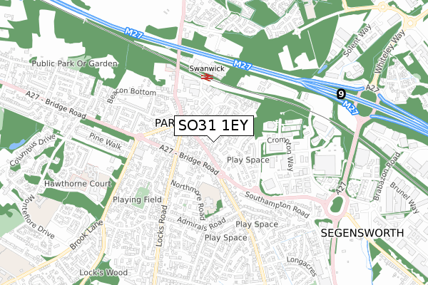
SO31 1EY is located in the Park Gate electoral ward, within the local authority district of Fareham and the English Parliamentary constituency of Fareham. The Sub Integrated Care Board (ICB) Location is NHS Hampshire and Isle of Wight ICB - D9Y0V and the police force is Hampshire. This postcode has been in use since June 2018.
SO31 1EY maps


Source: OS Open Zoomstack (Ordnance Survey)
Licence: Open Government Licence (requires attribution)
Attribution: Contains OS data © Crown copyright and database right 2025
Source: Open Postcode GeoLicence: Open Government Licence (requires attribution)
Attribution: Contains OS data © Crown copyright and database right 2025; Contains Royal Mail data © Royal Mail copyright and database right 2025; Source: Office for National Statistics licensed under the Open Government Licence v.3.0
SO31 1EY geodata
| Easting | 451796 |
| Northing | 108346 |
| Latitude | 50.872291 |
| Longitude | -1.265240 |
Where is SO31 1EY?
| Country | England |
| Postcode District | SO31 |
Politics
| Ward | Park Gate |
|---|
| Constituency | Fareham |
|---|
Transport
Nearest bus stops to SO31 1EY
| Duncan Road (Botley Road) | Park Gate | 94m |
| Duncan Road (Botley Road) | Park Gate | 97m |
| Lower Duncan Road (Duncan Road) | Park Gate | 119m |
| Park Gate (A27 Bridge Road) | Park Gate | 196m |
| Park Gate (Locks Road) | Park Gate | 251m |
Nearest railway stations to SO31 1EY
| Swanwick Station | 0.4km |
| Bursledon Station | 3.1km |
| Hamble Station | 4.5km |
Broadband
Broadband access in SO31 1EY (2020 data)
| Percentage of properties with Next Generation Access | 100.0% |
| Percentage of properties with Superfast Broadband | 100.0% |
| Percentage of properties with Ultrafast Broadband | 0.0% |
| Percentage of properties with Full Fibre Broadband | 0.0% |
Superfast Broadband is between 30Mbps and 300Mbps
Ultrafast Broadband is > 300Mbps
Broadband speed in SO31 1EY (2019 data)
Download
| Median download speed | 41.6Mbps |
| Average download speed | 43.0Mbps |
| Maximum download speed | 60.61Mbps |
Upload
| Median upload speed | 10.0Mbps |
| Average upload speed | 9.5Mbps |
| Maximum upload speed | 14.78Mbps |
Broadband limitations in SO31 1EY (2020 data)
| Percentage of properties unable to receive 2Mbps | 0.0% |
| Percentage of properties unable to receive 5Mbps | 0.0% |
| Percentage of properties unable to receive 10Mbps | 0.0% |
| Percentage of properties unable to receive 30Mbps | 0.0% |
Deprivation
18.3% of English postcodes are less deprived than
SO31 1EY:
Food Standards Agency
Three nearest food hygiene ratings to SO31 1EY (metres)
Park Gate Tandoori
Locks Heath Working Mens Club
Locks Heath Working Mens Club
150m
The 1:1 Diet Coach Collins
➜ Get more ratings from the Food Standards Agency
Nearest post box to SO31 1EY
| | Last Collection | |
|---|
| Location | Mon-Fri | Sat | Distance |
|---|
| Middle Road | 17:30 | 09:15 | 207m |
| Middle Road | 17:30 | 09:15 | 207m |
| Park Gate Post Office | 17:15 | 11:30 | 214m |
SO31 1EY ITL and SO31 1EY LAU
The below table lists the International Territorial Level (ITL) codes (formerly Nomenclature of Territorial Units for Statistics (NUTS) codes) and Local Administrative Units (LAU) codes for SO31 1EY:
| ITL 1 Code | Name |
|---|
| TLJ | South East (England) |
| ITL 2 Code | Name |
|---|
| TLJ3 | Hampshire and Isle of Wight |
| ITL 3 Code | Name |
|---|
| TLJ35 | South Hampshire |
| LAU 1 Code | Name |
|---|
| E07000087 | Fareham |
SO31 1EY census areas
The below table lists the Census Output Area (OA), Lower Layer Super Output Area (LSOA), and Middle Layer Super Output Area (MSOA) for SO31 1EY:
| Code | Name |
|---|
| OA | E00168111 | |
|---|
| LSOA | E01022754 | Fareham 002C |
|---|
| MSOA | E02004728 | Fareham 002 |
|---|
Nearest postcodes to SO31 1EY


