Property/Postcode Data Search:
SO18 2FA open data databoard
SO18 2FA is located in the Swaythling electoral ward, within the unitary authority of Southampton and the English Parliamentary constituency of Romsey and Southampton North. The Sub Integrated Care Board (ICB) Location is NHS Hampshire and Isle of Wight ICB - D9Y0V and the police force is Hampshire. This postcode has been in use since August 2017.
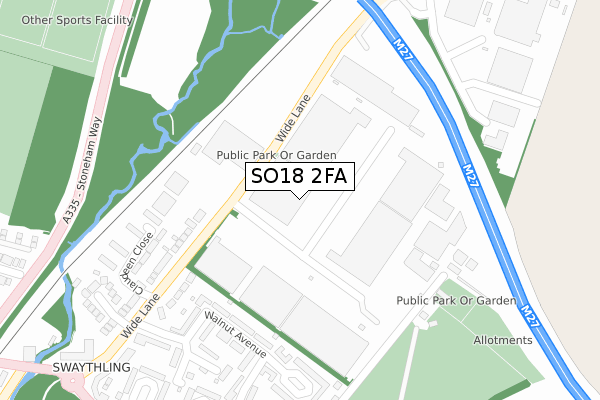
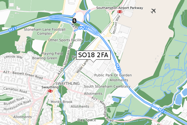
SO18 2FA maps


Source: OS Open Zoomstack (Ordnance Survey)
Licence: Open Government Licence (requires attribution)
Attribution: Contains OS data © Crown copyright and database right 2025
Source: Open Postcode Geo
Licence: Open Government Licence (requires attribution)
Attribution: Contains OS data © Crown copyright and database right 2025; Contains Royal Mail data © Royal Mail copyright and database right 2025; Source: Office for National Statistics licensed under the Open Government Licence v.3.0
Licence: Open Government Licence (requires attribution)
Attribution: Contains OS data © Crown copyright and database right 2025
Source: Open Postcode Geo
Licence: Open Government Licence (requires attribution)
Attribution: Contains OS data © Crown copyright and database right 2025; Contains Royal Mail data © Royal Mail copyright and database right 2025; Source: Office for National Statistics licensed under the Open Government Licence v.3.0
SO18 2FA geodata
| Easting | 444493 |
| Northing | 116317 |
| Latitude | 50.944573 |
| Longitude | -1.368054 |
Where is SO18 2FA?
| Country | England |
| Postcode District | SO18 |
Politics
| Ward | Swaythling |
|---|---|
| Constituency | Romsey And Southampton North |
Transport
Nearest bus stops to SO18 2FA
| Ford's (Wide Lane) | Swaythling | 100m |
| Ford's (Wide Lane) | Swaythling | 104m |
| Walnut Avenue (Wide Lane) | Swaythling | 277m |
| Walnut Avenue (Wide Lane) | Swaythling | 318m |
| Octavia Road (Mansbridge Road) | Mansbridge | 440m |
Nearest railway stations to SO18 2FA
| Swaythling Station | 0.7km |
| Southampton Airport Parkway Station | 0.8km |
| St Denys Station | 2.8km |
Deprivation
87.4% of English postcodes are less deprived than SO18 2FA:Food Standards Agency
Three nearest food hygiene ratings to SO18 2FA (metres)
Global E-Commerce Experts Ltd
Unit 5
0m
Exporta UKEU Ltd
Unit 1
221m
CLINOVA
INTERNATIONAL HOUSE GEORGE CURL WAY EASTLEIGH SO18 2RZ
366m
➜ Get more ratings from the Food Standards Agency
Nearest post box to SO18 2FA
| Last Collection | |||
|---|---|---|---|
| Location | Mon-Fri | Sat | Distance |
| Wide Lane Post Office | 16:30 | 12:30 | 465m |
| Southampton Mail Centre | 19:30 | 14:00 | 581m |
| Octavia Road | 16:00 | 12:30 | 629m |
SO18 2FA ITL and SO18 2FA LAU
The below table lists the International Territorial Level (ITL) codes (formerly Nomenclature of Territorial Units for Statistics (NUTS) codes) and Local Administrative Units (LAU) codes for SO18 2FA:
| ITL 1 Code | Name |
|---|---|
| TLJ | South East (England) |
| ITL 2 Code | Name |
| TLJ3 | Hampshire and Isle of Wight |
| ITL 3 Code | Name |
| TLJ32 | Southampton |
| LAU 1 Code | Name |
| E06000045 | Southampton |
SO18 2FA census areas
The below table lists the Census Output Area (OA), Lower Layer Super Output Area (LSOA), and Middle Layer Super Output Area (MSOA) for SO18 2FA:
| Code | Name | |
|---|---|---|
| OA | E00087223 | |
| LSOA | E01017265 | Southampton 003B |
| MSOA | E02003551 | Southampton 003 |
Nearest postcodes to SO18 2FA
| SO18 2HJ | Wide Lane | 205m |
| SO18 2HS | Walnut Avenue | 228m |
| SO18 2HH | Wide Lane | 261m |
| SO18 2HQ | Claudeen Close | 272m |
| SO18 2QU | Walnut Avenue | 297m |
| SO18 2QJ | Claudeen Close | 300m |
| SO18 2HT | Walnut Avenue | 329m |
| SO18 2HR | Northleigh Corner | 331m |
| SO18 2HN | Wide Lane | 351m |
| SO18 2LH | Capon Close | 361m |