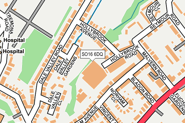
SO16 6DQ is located in the Bassett electoral ward, within the unitary authority of Southampton and the English Parliamentary constituency of Romsey and Southampton North. The Sub Integrated Care Board (ICB) Location is NHS Hampshire and Isle of Wight ICB - D9Y0V and the police force is Hampshire. This postcode has been in use since March 2017.


GetTheData
Source: OS OpenMap – Local (Ordnance Survey)
Source: OS VectorMap District (Ordnance Survey)
Licence: Open Government Licence (requires attribution)
| Easting | 440327 |
| Northing | 114941 |
| Latitude | 50.932506 |
| Longitude | -1.427502 |
GetTheData
Source: Open Postcode Geo
Licence: Open Government Licence
| Country | England |
| Postcode District | SO16 |
➜ See where SO16 is on a map ➜ Where is Southampton? | |
GetTheData
Source: Land Registry Price Paid Data
Licence: Open Government Licence
| Ward | Bassett |
| Constituency | Romsey And Southampton North |
GetTheData
Source: ONS Postcode Database
Licence: Open Government Licence
| Hollybrook Avenue (Dale Valley Road) | Shirley Warren | 142m |
| Hollybrook Avenue (Dale Valley Road) | Shirley Warren | 172m |
| Dale Valley Close (Dale Valley Road) | Shirley Warren | 172m |
| Dale Valley Road (Dale Road) | Shirley Warren | 275m |
| General Hospital A&e (Tremona Road) | Southampton General | 283m |
| Millbrook (Hants) Station | 2.4km |
| Southampton Central Station | 3km |
| St Denys Station | 3km |
GetTheData
Source: NaPTAN
Licence: Open Government Licence
GetTheData
Source: ONS Postcode Database
Licence: Open Government Licence

➜ Get more ratings from the Food Standards Agency
GetTheData
Source: Food Standards Agency
Licence: FSA terms & conditions
| Last Collection | |||
|---|---|---|---|
| Location | Mon-Fri | Sat | Distance |
| Dale Valley Road(84) | 17:30 | 11:30 | 162m |
| Malvern Road | 17:30 | 12:30 | 264m |
| St James Park Road | 16:00 | 12:30 | 481m |
GetTheData
Source: Dracos
Licence: Creative Commons Attribution-ShareAlike
The below table lists the International Territorial Level (ITL) codes (formerly Nomenclature of Territorial Units for Statistics (NUTS) codes) and Local Administrative Units (LAU) codes for SO16 6DQ:
| ITL 1 Code | Name |
|---|---|
| TLJ | South East (England) |
| ITL 2 Code | Name |
| TLJ3 | Hampshire and Isle of Wight |
| ITL 3 Code | Name |
| TLJ32 | Southampton |
| LAU 1 Code | Name |
| E06000045 | Southampton |
GetTheData
Source: ONS Postcode Directory
Licence: Open Government Licence
The below table lists the Census Output Area (OA), Lower Layer Super Output Area (LSOA), and Middle Layer Super Output Area (MSOA) for SO16 6DQ:
| Code | Name | |
|---|---|---|
| OA | E00086625 | |
| LSOA | E01017152 | Southampton 006D |
| MSOA | E02003554 | Southampton 006 |
GetTheData
Source: ONS Postcode Directory
Licence: Open Government Licence
| SO16 6PB | Northbrook Industrial Estate | 65m |
| SO16 6QT | Dale Valley Gardens | 68m |
| SO16 6RA | Hollybrook Avenue | 71m |
| SO16 6RB | Hollybrook Road | 77m |
| SO16 6SL | Hollybrook Avenue | 93m |
| SO16 6QS | Dale Valley Road | 101m |
| SO16 6PX | Norham Avenue | 103m |
| SO16 6QZ | Hollybrook Avenue | 118m |
| SO16 6PU | Norham Avenue | 126m |
| SO16 6ST | Malvern Road | 136m |
GetTheData
Source: Open Postcode Geo; Land Registry Price Paid Data
Licence: Open Government Licence