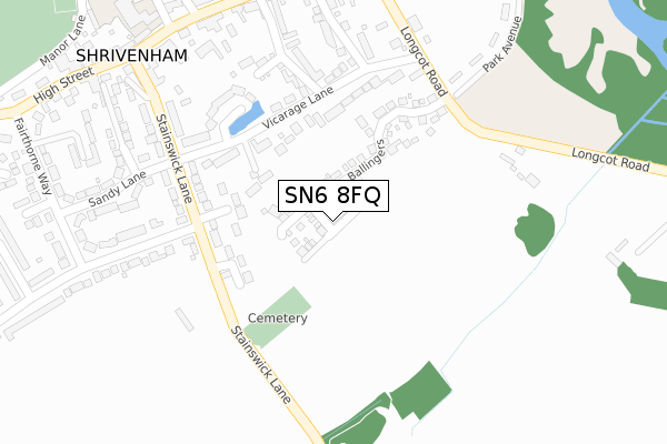
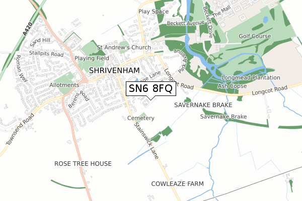
SN6 8FQ is located in the Watchfield & Shrivenham electoral ward, within the local authority district of Vale of White Horse and the English Parliamentary constituency of Wantage. The Sub Integrated Care Board (ICB) Location is NHS Bath and North East Somerset, Swindon and Wiltshire ICB - 92 and the police force is Thames Valley. This postcode has been in use since January 2018.


GetTheData
Source: OS Open Zoomstack (Ordnance Survey)
Licence: Open Government Licence (requires attribution)
Attribution: Contains OS data © Crown copyright and database right 2025
Source: Open Postcode Geo
Licence: Open Government Licence (requires attribution)
Attribution: Contains OS data © Crown copyright and database right 2025; Contains Royal Mail data © Royal Mail copyright and database right 2025; Source: Office for National Statistics licensed under the Open Government Licence v.3.0
| Easting | 424294 |
| Northing | 188649 |
| Latitude | 51.596169 |
| Longitude | -1.650660 |
GetTheData
Source: Open Postcode Geo
Licence: Open Government Licence
| Country | England |
| Postcode District | SN6 |
➜ See where SN6 is on a map ➜ Where is Shrivenham? | |
GetTheData
Source: Land Registry Price Paid Data
Licence: Open Government Licence
| Ward | Watchfield & Shrivenham |
| Constituency | Wantage |
GetTheData
Source: ONS Postcode Database
Licence: Open Government Licence
2024 20 FEB £600,000 |
2023 17 MAR £591,000 |
2022 14 OCT £565,000 |
7, GEALER GROVE, SHRIVENHAM, SWINDON, SN6 8FQ 2019 2 DEC £350,000 |
5, GEALER GROVE, SHRIVENHAM, SWINDON, SN6 8FQ 2019 30 AUG £455,000 |
8, GEALER GROVE, SHRIVENHAM, SWINDON, SN6 8FQ 2019 27 JUN £370,000 |
2019 26 JUN £520,000 |
6, GEALER GROVE, SHRIVENHAM, SWINDON, SN6 8FQ 2019 21 JUN £300,000 |
2, GEALER GROVE, SHRIVENHAM, SWINDON, SN6 8FQ 2018 20 DEC £535,000 |
2018 20 DEC £465,000 |
GetTheData
Source: HM Land Registry Price Paid Data
Licence: Contains HM Land Registry data © Crown copyright and database right 2025. This data is licensed under the Open Government Licence v3.0.
| High Street Surgery (High Street) | Shrivenham | 362m |
| High Street Surgery (High Street) | Shrivenham | 392m |
| Green (Townsend Road) | Shrivenham | 667m |
| Charlbury Road (Station Road) | Shrivenham | 693m |
| Charlbury Road (Station Road) | Shrivenham | 704m |
GetTheData
Source: NaPTAN
Licence: Open Government Licence
| Percentage of properties with Next Generation Access | 100.0% |
| Percentage of properties with Superfast Broadband | 100.0% |
| Percentage of properties with Ultrafast Broadband | 100.0% |
| Percentage of properties with Full Fibre Broadband | 100.0% |
Superfast Broadband is between 30Mbps and 300Mbps
Ultrafast Broadband is > 300Mbps
| Percentage of properties unable to receive 2Mbps | 0.0% |
| Percentage of properties unable to receive 5Mbps | 0.0% |
| Percentage of properties unable to receive 10Mbps | 0.0% |
| Percentage of properties unable to receive 30Mbps | 0.0% |
GetTheData
Source: Ofcom
Licence: Ofcom Terms of Use (requires attribution)
GetTheData
Source: ONS Postcode Database
Licence: Open Government Licence


➜ Get more ratings from the Food Standards Agency
GetTheData
Source: Food Standards Agency
Licence: FSA terms & conditions
| Last Collection | |||
|---|---|---|---|
| Location | Mon-Fri | Sat | Distance |
| Shrivenham Post Office | 18:30 | 12:30 | 394m |
| Sand Hill | 16:45 | 09:30 | 1,078m |
| South Marston Post Office | 17:00 | 12:00 | 3,485m |
GetTheData
Source: Dracos
Licence: Creative Commons Attribution-ShareAlike
The below table lists the International Territorial Level (ITL) codes (formerly Nomenclature of Territorial Units for Statistics (NUTS) codes) and Local Administrative Units (LAU) codes for SN6 8FQ:
| ITL 1 Code | Name |
|---|---|
| TLJ | South East (England) |
| ITL 2 Code | Name |
| TLJ1 | Berkshire, Buckinghamshire and Oxfordshire |
| ITL 3 Code | Name |
| TLJ14 | Oxfordshire CC |
| LAU 1 Code | Name |
| E07000180 | Vale of White Horse |
GetTheData
Source: ONS Postcode Directory
Licence: Open Government Licence
The below table lists the Census Output Area (OA), Lower Layer Super Output Area (LSOA), and Middle Layer Super Output Area (MSOA) for SN6 8FQ:
| Code | Name | |
|---|---|---|
| OA | E00146414 | |
| LSOA | E01028745 | Vale of White Horse 016A |
| MSOA | E02006886 | Vale of White Horse 016 |
GetTheData
Source: ONS Postcode Directory
Licence: Open Government Licence
| SN6 8DY | Stonefield Close | 142m |
| SN6 8DT | Vicarage Lane | 158m |
| SN6 8DX | Stainswick Lane | 232m |
| SN6 8EJ | Canon Hills Gardens | 247m |
| SN6 8DS | Hazells Lane | 247m |
| SN6 8ER | Catherine Close | 297m |
| SN6 8EA | Fairthorne Way | 325m |
| SN6 8DU | Stainswick Lane | 335m |
| SN6 8DZ | Sandy Lane | 348m |
| SN6 8AN | High Street | 357m |
GetTheData
Source: Open Postcode Geo; Land Registry Price Paid Data
Licence: Open Government Licence