SN6 8FN maps, stats, and open data
SN6 8FN is located in the Watchfield & Shrivenham electoral ward, within the local authority district of Vale of White Horse and the English Parliamentary constituency of Wantage. The Sub Integrated Care Board (ICB) Location is NHS Bath and North East Somerset, Swindon and Wiltshire ICB - 92 and the police force is Thames Valley. This postcode has been in use since January 2018.
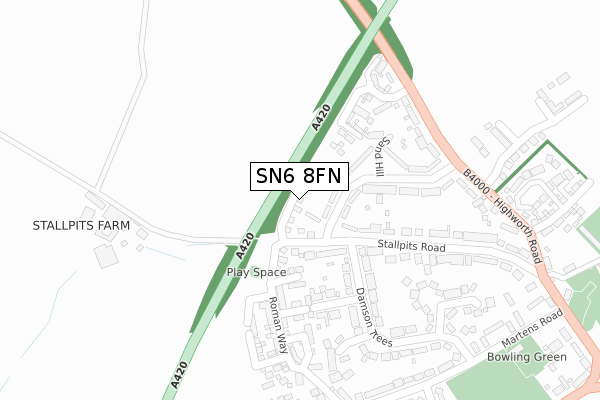
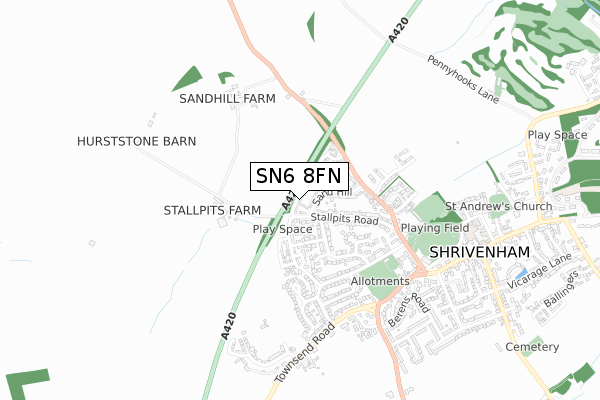
SN6 8FN maps


Licence: Open Government Licence (requires attribution)
Attribution: Contains OS data © Crown copyright and database right 2025
Source: Open Postcode Geo
Licence: Open Government Licence (requires attribution)
Attribution: Contains OS data © Crown copyright and database right 2025; Contains Royal Mail data © Royal Mail copyright and database right 2025; Source: Office for National Statistics licensed under the Open Government Licence v.3.0
SN6 8FN geodata
| Easting | 423235 |
| Northing | 189098 |
| Latitude | 51.600250 |
| Longitude | -1.665918 |
Where is SN6 8FN?
| Country | England |
| Postcode District | SN6 |
Politics
| Ward | Watchfield & Shrivenham |
|---|---|
| Constituency | Wantage |
House Prices
Sales of detached houses in SN6 8FN
2, POUND CLOSE, SHRIVENHAM, SWINDON, SN6 8FN 2020 30 JUN £349,995 |
1, POUND CLOSE, SHRIVENHAM, SWINDON, SN6 8FN 2020 20 MAR £354,995 |
3, POUND CLOSE, SHRIVENHAM, SWINDON, SN6 8FN 2019 2 AUG £404,995 |
6, POUND CLOSE, SHRIVENHAM, SWINDON, SN6 8FN 2019 7 JUN £509,995 |
Licence: Contains HM Land Registry data © Crown copyright and database right 2025. This data is licensed under the Open Government Licence v3.0.
Transport
Nearest bus stops to SN6 8FN
| Green (Townsend Road) | Shrivenham | 535m |
| Green (Townsend Road) | Shrivenham | 537m |
| Green (Station Road) | Shrivenham | 549m |
| Charlbury Road (Station Road) | Shrivenham | 689m |
| Charlbury Road (Station Road) | Shrivenham | 689m |
Broadband
Broadband access in SN6 8FN (2020 data)
| Percentage of properties with Next Generation Access | 100.0% |
| Percentage of properties with Superfast Broadband | 100.0% |
| Percentage of properties with Ultrafast Broadband | 0.0% |
| Percentage of properties with Full Fibre Broadband | 0.0% |
Superfast Broadband is between 30Mbps and 300Mbps
Ultrafast Broadband is > 300Mbps
Broadband limitations in SN6 8FN (2020 data)
| Percentage of properties unable to receive 2Mbps | 0.0% |
| Percentage of properties unable to receive 5Mbps | 0.0% |
| Percentage of properties unable to receive 10Mbps | 0.0% |
| Percentage of properties unable to receive 30Mbps | 0.0% |
Deprivation
4.4% of English postcodes are less deprived than SN6 8FN:Food Standards Agency
Three nearest food hygiene ratings to SN6 8FN (metres)


➜ Get more ratings from the Food Standards Agency
Nearest post box to SN6 8FN
| Last Collection | |||
|---|---|---|---|
| Location | Mon-Fri | Sat | Distance |
| Sand Hill | 16:45 | 09:30 | 74m |
| Shrivenham Post Office | 18:30 | 12:30 | 795m |
| South Marston Post Office | 17:00 | 12:00 | 2,475m |
SN6 8FN ITL and SN6 8FN LAU
The below table lists the International Territorial Level (ITL) codes (formerly Nomenclature of Territorial Units for Statistics (NUTS) codes) and Local Administrative Units (LAU) codes for SN6 8FN:
| ITL 1 Code | Name |
|---|---|
| TLJ | South East (England) |
| ITL 2 Code | Name |
| TLJ1 | Berkshire, Buckinghamshire and Oxfordshire |
| ITL 3 Code | Name |
| TLJ14 | Oxfordshire CC |
| LAU 1 Code | Name |
| E07000180 | Vale of White Horse |
SN6 8FN census areas
The below table lists the Census Output Area (OA), Lower Layer Super Output Area (LSOA), and Middle Layer Super Output Area (MSOA) for SN6 8FN:
| Code | Name | |
|---|---|---|
| OA | E00146415 | |
| LSOA | E01028746 | Vale of White Horse 016B |
| MSOA | E02006886 | Vale of White Horse 016 |
Nearest postcodes to SN6 8FN
| SN6 8BE | Stallpits Road | 77m |
| SN6 8BD | Farleigh Road | 149m |
| SN6 8BQ | Sandhill | 154m |
| SN6 8BB | Damson Trees | 229m |
| SN6 8BH | Highworth Road | 249m |
| SN6 8BG | Stallpits Road | 250m |
| SN6 8AP | Forrest Close | 257m |
| SN6 8BP | Stallpits Lane | 262m |
| SN6 8BA | Martens Close | 289m |
| SN6 8BW | Friars Close | 346m |