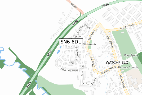
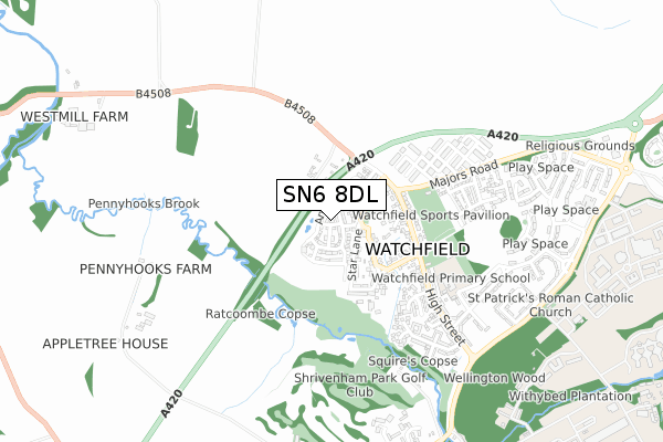
SN6 8DL maps, stats, and open data
SN6 8DL is located in the Watchfield & Shrivenham electoral ward, within the local authority district of Vale of White Horse and the English Parliamentary constituency of Wantage. The Sub Integrated Care Board (ICB) Location is NHS Bath and North East Somerset, Swindon and Wiltshire ICB - 92 and the police force is Thames Valley. This postcode has been in use since June 2018.
SN6 8DL maps


Licence: Open Government Licence (requires attribution)
Attribution: Contains OS data © Crown copyright and database right 2025
Source: Open Postcode Geo
Licence: Open Government Licence (requires attribution)
Attribution: Contains OS data © Crown copyright and database right 2025; Contains Royal Mail data © Royal Mail copyright and database right 2025; Source: Office for National Statistics licensed under the Open Government Licence v.3.0
SN6 8DL geodata
| Easting | 424201 |
| Northing | 190437 |
| Latitude | 51.612249 |
| Longitude | -1.651879 |
Where is SN6 8DL?
| Country | England |
| Postcode District | SN6 |
Politics
| Ward | Watchfield & Shrivenham |
|---|---|
| Constituency | Wantage |
House Prices
Sales of detached houses in SN6 8DL
1, ARGOSY STREET, WATCHFIELD, SWINDON, SN6 8DL 2019 25 JAN £499,995 |
3, ARGOSY STREET, WATCHFIELD, SWINDON, SN6 8DL 2018 10 AUG £411,346 |
2, ARGOSY STREET, WATCHFIELD, SWINDON, SN6 8DL 2018 29 JUN £416,995 |
4, ARGOSY STREET, WATCHFIELD, SWINDON, SN6 8DL 2018 25 MAY £409,995 |
Licence: Contains HM Land Registry data © Crown copyright and database right 2025. This data is licensed under the Open Government Licence v3.0.
Transport
Nearest bus stops to SN6 8DL
| Post Office (High Street) | Watchfield | 288m |
| Post Office (High Street) | Watchfield | 299m |
| Majors Road West (Majors Road) | Watchfield | 451m |
| Majors Road West (Majors Road) | Watchfield | 457m |
| Squires Road (High Street) | Watchfield | 459m |
Broadband
Broadband access in SN6 8DL (2020 data)
| Percentage of properties with Next Generation Access | 100.0% |
| Percentage of properties with Superfast Broadband | 100.0% |
| Percentage of properties with Ultrafast Broadband | 0.0% |
| Percentage of properties with Full Fibre Broadband | 0.0% |
Superfast Broadband is between 30Mbps and 300Mbps
Ultrafast Broadband is > 300Mbps
Broadband limitations in SN6 8DL (2020 data)
| Percentage of properties unable to receive 2Mbps | 0.0% |
| Percentage of properties unable to receive 5Mbps | 0.0% |
| Percentage of properties unable to receive 10Mbps | 0.0% |
| Percentage of properties unable to receive 30Mbps | 0.0% |
Deprivation
10.5% of English postcodes are less deprived than SN6 8DL:Food Standards Agency
Three nearest food hygiene ratings to SN6 8DL (metres)


➜ Get more ratings from the Food Standards Agency
Nearest post box to SN6 8DL
| Last Collection | |||
|---|---|---|---|
| Location | Mon-Fri | Sat | Distance |
| Shrivenham Post Office | 18:30 | 12:30 | 1,526m |
| Sand Hill | 16:45 | 09:30 | 1,649m |
| Sevenhampton | 16:45 | 09:30 | 3,578m |
SN6 8DL ITL and SN6 8DL LAU
The below table lists the International Territorial Level (ITL) codes (formerly Nomenclature of Territorial Units for Statistics (NUTS) codes) and Local Administrative Units (LAU) codes for SN6 8DL:
| ITL 1 Code | Name |
|---|---|
| TLJ | South East (England) |
| ITL 2 Code | Name |
| TLJ1 | Berkshire, Buckinghamshire and Oxfordshire |
| ITL 3 Code | Name |
| TLJ14 | Oxfordshire CC |
| LAU 1 Code | Name |
| E07000180 | Vale of White Horse |
SN6 8DL census areas
The below table lists the Census Output Area (OA), Lower Layer Super Output Area (LSOA), and Middle Layer Super Output Area (MSOA) for SN6 8DL:
| Code | Name | |
|---|---|---|
| OA | E00146424 | |
| LSOA | E01028747 | Vale of White Horse 016C |
| MSOA | E02006886 | Vale of White Horse 016 |
Nearest postcodes to SN6 8DL
| SN6 8TG | Star Lane | 119m |
| SN6 8TD | Oak Road | 210m |
| SN6 8TL | High Street | 243m |
| SN6 8TF | Eagle Lane | 243m |
| SN6 8TB | Oxford Square | 283m |
| SN6 8TA | Chapel Hill | 290m |
| SN6 8TE | High Street | 292m |
| SN6 8TZ | Shrivenham Hundred Business Park | 397m |
| SN6 8SW | High Street | 399m |
| SN6 8TW | Squires Road | 420m |