SN5 4GX maps, stats, and open data
SN5 4GX is located in the Purton electoral ward, within the unitary authority of Wiltshire and the English Parliamentary constituency of North Wiltshire. The Sub Integrated Care Board (ICB) Location is NHS Bath and North East Somerset, Swindon and Wiltshire ICB - 92 and the police force is Wiltshire. This postcode has been in use since November 2018.
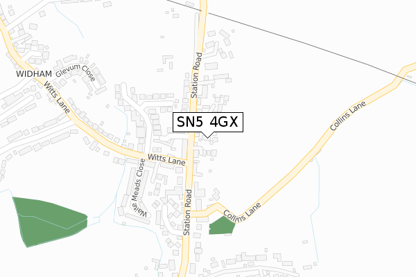
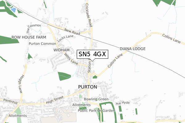
SN5 4GX maps


Licence: Open Government Licence (requires attribution)
Attribution: Contains OS data © Crown copyright and database right 2025
Source: Open Postcode Geo
Licence: Open Government Licence (requires attribution)
Attribution: Contains OS data © Crown copyright and database right 2025; Contains Royal Mail data © Royal Mail copyright and database right 2025; Source: Office for National Statistics licensed under the Open Government Licence v.3.0
SN5 4GX geodata
| Easting | 409421 |
| Northing | 188080 |
| Latitude | 51.591495 |
| Longitude | -1.865392 |
Where is SN5 4GX?
| Country | England |
| Postcode District | SN5 |
Politics
| Ward | Purton |
|---|---|
| Constituency | North Wiltshire |
House Prices
Sales of detached houses in SN5 4GX
2023 3 NOV £655,000 |
2019 1 AUG £384,000 |
2019 14 JUN £500,000 |
2, THE SIDINGS, STATION ROAD, PURTON, SWINDON, SN5 4GX 2019 15 FEB £415,000 |
2018 22 FEB £600,000 |
Licence: Contains HM Land Registry data © Crown copyright and database right 2025. This data is licensed under the Open Government Licence v3.0.
Transport
Nearest bus stops to SN5 4GX
| Witts Lane (Station Road) | Purton | 106m |
| Witts Lane (Station Road) | Purton | 132m |
| The Square (High Street) | Purton | 345m |
| The Square (High Street) | Purton | 359m |
| The Square (Church Street) | Purton | 372m |
Broadband
Broadband access in SN5 4GX (2020 data)
| Percentage of properties with Next Generation Access | 100.0% |
| Percentage of properties with Superfast Broadband | 100.0% |
| Percentage of properties with Ultrafast Broadband | 0.0% |
| Percentage of properties with Full Fibre Broadband | 0.0% |
Superfast Broadband is between 30Mbps and 300Mbps
Ultrafast Broadband is > 300Mbps
Broadband limitations in SN5 4GX (2020 data)
| Percentage of properties unable to receive 2Mbps | 0.0% |
| Percentage of properties unable to receive 5Mbps | 0.0% |
| Percentage of properties unable to receive 10Mbps | 0.0% |
| Percentage of properties unable to receive 30Mbps | 0.0% |
Deprivation
34.3% of English postcodes are less deprived than SN5 4GX:Food Standards Agency
Three nearest food hygiene ratings to SN5 4GX (metres)


➜ Get more ratings from the Food Standards Agency
Nearest post box to SN5 4GX
| Last Collection | |||
|---|---|---|---|
| Location | Mon-Fri | Sat | Distance |
| Dogridge, Purton | 17:00 | 10:00 | 1,374m |
| Common Platt | 16:00 | 09:15 | 2,084m |
| Swinley Drive | 17:30 | 12:30 | 2,357m |
SN5 4GX ITL and SN5 4GX LAU
The below table lists the International Territorial Level (ITL) codes (formerly Nomenclature of Territorial Units for Statistics (NUTS) codes) and Local Administrative Units (LAU) codes for SN5 4GX:
| ITL 1 Code | Name |
|---|---|
| TLK | South West (England) |
| ITL 2 Code | Name |
| TLK1 | Gloucestershire, Wiltshire and Bath/Bristol area |
| ITL 3 Code | Name |
| TLK15 | Wiltshire |
| LAU 1 Code | Name |
| E06000054 | Wiltshire |
SN5 4GX census areas
The below table lists the Census Output Area (OA), Lower Layer Super Output Area (LSOA), and Middle Layer Super Output Area (MSOA) for SN5 4GX:
| Code | Name | |
|---|---|---|
| OA | E00162970 | |
| LSOA | E01031954 | Wiltshire 003A |
| MSOA | E02006646 | Wiltshire 003 |
Nearest postcodes to SN5 4GX
| SN5 4HR | Bamford Close | 35m |
| SN5 4EL | Station Road | 68m |
| SN5 4FD | Shaftesbury Close | 81m |
| SN5 4EN | Station Road | 89m |
| SN5 4FF | Smiths Court | 108m |
| SN5 4AH | Station Road | 114m |
| SN5 4EP | Witts Lane | 149m |
| SN5 4HJ | Pear Tree Close | 150m |
| SN5 4AJ | Station Road | 186m |
| SN5 4ET | Waite Meads Close | 207m |