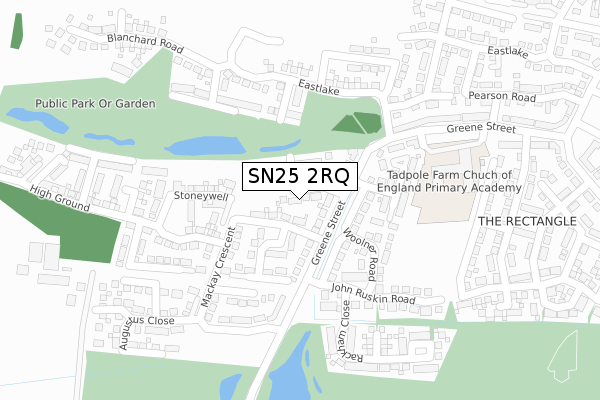
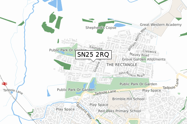
SN25 2RQ is located in the St Andrews electoral ward, within the unitary authority of Swindon and the English Parliamentary constituency of North Swindon. The Sub Integrated Care Board (ICB) Location is NHS Bath and North East Somerset, Swindon and Wiltshire ICB - 92 and the police force is Wiltshire. This postcode has been in use since October 2017.


GetTheData
Source: OS Open Zoomstack (Ordnance Survey)
Licence: Open Government Licence (requires attribution)
Attribution: Contains OS data © Crown copyright and database right 2025
Source: Open Postcode Geo
Licence: Open Government Licence (requires attribution)
Attribution: Contains OS data © Crown copyright and database right 2025; Contains Royal Mail data © Royal Mail copyright and database right 2025; Source: Office for National Statistics licensed under the Open Government Licence v.3.0
| Easting | 412097 |
| Northing | 190110 |
| Latitude | 51.609697 |
| Longitude | -1.826693 |
GetTheData
Source: Open Postcode Geo
Licence: Open Government Licence
| Country | England |
| Postcode District | SN25 |
➜ See where SN25 is on a map ➜ Where is Swindon? | |
GetTheData
Source: Land Registry Price Paid Data
Licence: Open Government Licence
| Ward | St Andrews |
| Constituency | North Swindon |
GetTheData
Source: ONS Postcode Database
Licence: Open Government Licence
2025 14 FEB £412,000 |
2024 7 AUG £375,000 |
2021 24 JUN £395,000 |
15, GIMSON CRESCENT, TADPOLE GARDEN VILLAGE, SWINDON, SN25 2RQ 2021 5 MAR £470,000 |
14, GIMSON CRESCENT, TADPOLE GARDEN VILLAGE, SWINDON, SN25 2RQ 2021 26 FEB £470,000 |
12, GIMSON CRESCENT, TADPOLE GARDEN VILLAGE, SWINDON, SN25 2RQ 2021 26 FEB £500,000 |
17, GIMSON CRESCENT, TADPOLE GARDEN VILLAGE, SWINDON, SN25 2RQ 2020 17 DEC £332,341 |
18, GIMSON CRESCENT, TADPOLE GARDEN VILLAGE, SWINDON, SN25 2RQ 2020 17 DEC £340,000 |
2020 17 DEC £342,000 |
11, GIMSON CRESCENT, TADPOLE GARDEN VILLAGE, SWINDON, SN25 2RQ 2020 17 DEC £385,000 |
GetTheData
Source: HM Land Registry Price Paid Data
Licence: Contains HM Land Registry data © Crown copyright and database right 2025. This data is licensed under the Open Government Licence v3.0.
| Tortworth Road (Redhouse Way) | Redhouse | 752m |
| Tortworth Road (Redhouse Way) | Redhouse | 766m |
| Hartington Road (Oakhurst Way) | Oakhurst | 892m |
| Hartington Road (Oakhurst Way) | Oakhurst | 918m |
| Birkdale Close (Redhouse Way) | Redhouse | 944m |
| Swindon Station | 5.7km |
GetTheData
Source: NaPTAN
Licence: Open Government Licence
| Percentage of properties with Next Generation Access | 100.0% |
| Percentage of properties with Superfast Broadband | 100.0% |
| Percentage of properties with Ultrafast Broadband | 100.0% |
| Percentage of properties with Full Fibre Broadband | 100.0% |
Superfast Broadband is between 30Mbps and 300Mbps
Ultrafast Broadband is > 300Mbps
| Percentage of properties unable to receive 2Mbps | 0.0% |
| Percentage of properties unable to receive 5Mbps | 0.0% |
| Percentage of properties unable to receive 10Mbps | 0.0% |
| Percentage of properties unable to receive 30Mbps | 0.0% |
GetTheData
Source: Ofcom
Licence: Ofcom Terms of Use (requires attribution)
GetTheData
Source: ONS Postcode Database
Licence: Open Government Licence


➜ Get more ratings from the Food Standards Agency
GetTheData
Source: Food Standards Agency
Licence: FSA terms & conditions
| Last Collection | |||
|---|---|---|---|
| Location | Mon-Fri | Sat | Distance |
| Oakhurst Way | 17:30 | 12:15 | 911m |
| Queen Elizabeth Drive | 17:25 | 12:00 | 1,745m |
| Asda(Walmart) | 18:30 | 12:15 | 1,932m |
GetTheData
Source: Dracos
Licence: Creative Commons Attribution-ShareAlike
The below table lists the International Territorial Level (ITL) codes (formerly Nomenclature of Territorial Units for Statistics (NUTS) codes) and Local Administrative Units (LAU) codes for SN25 2RQ:
| ITL 1 Code | Name |
|---|---|
| TLK | South West (England) |
| ITL 2 Code | Name |
| TLK1 | Gloucestershire, Wiltshire and Bath/Bristol area |
| ITL 3 Code | Name |
| TLK14 | Swindon |
| LAU 1 Code | Name |
| E06000030 | Swindon |
GetTheData
Source: ONS Postcode Directory
Licence: Open Government Licence
The below table lists the Census Output Area (OA), Lower Layer Super Output Area (LSOA), and Middle Layer Super Output Area (MSOA) for SN25 2RQ:
| Code | Name | |
|---|---|---|
| OA | E00078246 | |
| LSOA | E01015474 | Swindon 008B |
| MSOA | E02003219 | Swindon 008 |
GetTheData
Source: ONS Postcode Directory
Licence: Open Government Licence
| SN25 2QX | Artisans Lane | 139m |
| SN25 2QT | Rackham Close | 291m |
| SN25 2PS | John Ruskin Road | 357m |
| SN25 2PU | John Ruskin Road | 430m |
| SN25 2QG | Burne Jones Avenue | 445m |
| SN25 2AL | Fawley Close | 469m |
| SN25 2QJ | Eglantyne Avenue | 479m |
| SN25 2PT | William Morris Way | 496m |
| SN25 2AG | Twineham Road | 498m |
| SN25 2AP | Stackpole Crescent | 518m |
GetTheData
Source: Open Postcode Geo; Land Registry Price Paid Data
Licence: Open Government Licence