SN16 0FP maps, stats, and open data
SN16 0FP is located in the Sherston electoral ward, within the unitary authority of Wiltshire and the English Parliamentary constituency of North Wiltshire. The Sub Integrated Care Board (ICB) Location is NHS Bath and North East Somerset, Swindon and Wiltshire ICB - 92 and the police force is Wiltshire. This postcode has been in use since September 2017.
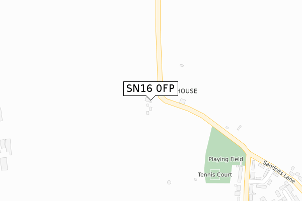
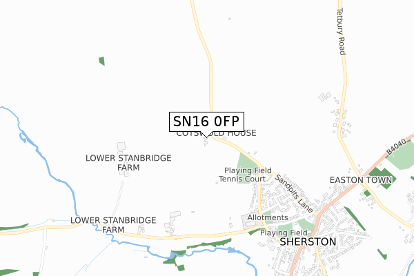
SN16 0FP maps


Licence: Open Government Licence (requires attribution)
Attribution: Contains OS data © Crown copyright and database right 2025
Source: Open Postcode Geo
Licence: Open Government Licence (requires attribution)
Attribution: Contains OS data © Crown copyright and database right 2025; Contains Royal Mail data © Royal Mail copyright and database right 2025; Source: Office for National Statistics licensed under the Open Government Licence v.3.0
SN16 0FP geodata
| Easting | 384775 |
| Northing | 186592 |
| Latitude | 51.577983 |
| Longitude | -2.221099 |
Where is SN16 0FP?
| Country | England |
| Postcode District | SN16 |
Politics
| Ward | Sherston |
|---|---|
| Constituency | North Wiltshire |
Transport
Nearest bus stops to SN16 0FP
| North End Gardens (Knockdown Road) | Sherston | 402m |
| North End Gardens (Knockdown Road) | Sherston | 413m |
| North End Gardens (Sandpits Lane) | Sherston | 487m |
| North End Gardens (Sandpits Lane) | Sherston | 505m |
| Easton Square (Easton Town) | Sherston | 834m |
Broadband
Broadband access in SN16 0FP (2020 data)
| Percentage of properties with Next Generation Access | 100.0% |
| Percentage of properties with Superfast Broadband | 100.0% |
| Percentage of properties with Ultrafast Broadband | 0.0% |
| Percentage of properties with Full Fibre Broadband | 0.0% |
Superfast Broadband is between 30Mbps and 300Mbps
Ultrafast Broadband is > 300Mbps
Broadband limitations in SN16 0FP (2020 data)
| Percentage of properties unable to receive 2Mbps | 0.0% |
| Percentage of properties unable to receive 5Mbps | 0.0% |
| Percentage of properties unable to receive 10Mbps | 0.0% |
| Percentage of properties unable to receive 30Mbps | 0.0% |
Deprivation
26.7% of English postcodes are less deprived than SN16 0FP:Food Standards Agency
Three nearest food hygiene ratings to SN16 0FP (metres)


➜ Get more ratings from the Food Standards Agency
Nearest post box to SN16 0FP
| Last Collection | |||
|---|---|---|---|
| Location | Mon-Fri | Sat | Distance |
| Sopworth | 16:30 | 09:30 | 2,125m |
| Willesley | 17:00 | 09:30 | 2,237m |
| Luckington Post Office | 16:30 | 09:45 | 3,034m |
SN16 0FP ITL and SN16 0FP LAU
The below table lists the International Territorial Level (ITL) codes (formerly Nomenclature of Territorial Units for Statistics (NUTS) codes) and Local Administrative Units (LAU) codes for SN16 0FP:
| ITL 1 Code | Name |
|---|---|
| TLK | South West (England) |
| ITL 2 Code | Name |
| TLK1 | Gloucestershire, Wiltshire and Bath/Bristol area |
| ITL 3 Code | Name |
| TLK15 | Wiltshire |
| LAU 1 Code | Name |
| E06000054 | Wiltshire |
SN16 0FP census areas
The below table lists the Census Output Area (OA), Lower Layer Super Output Area (LSOA), and Middle Layer Super Output Area (MSOA) for SN16 0FP:
| Code | Name | |
|---|---|---|
| OA | E00162997 | |
| LSOA | E01031957 | Wiltshire 005A |
| MSOA | E02006648 | Wiltshire 005 |
Nearest postcodes to SN16 0FP
| SN16 0NJ | Knockdown Road | 412m |
| SN16 0NL | North End Gardens | 444m |
| SN16 0PB | Saxon Close | 526m |
| SN16 0NU | Strongs Close | 526m |
| SN16 0NS | Manor Close | 578m |
| SN16 0SZ | Holmfield | 634m |
| SN16 0NN | Sandpits Lane | 675m |
| SN16 0PG | Carriers Close | 683m |
| SN16 0NP | Green Lane | 693m |
| SN16 0LL | Court Street | 815m |