SN16 0FL maps, stats, and open data
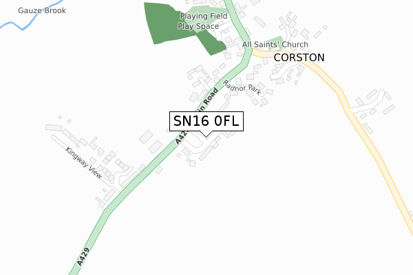
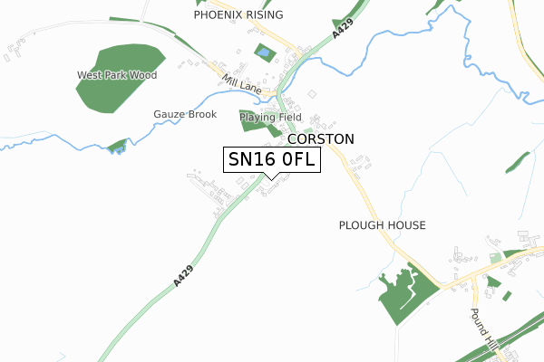
SN16 0FL is located in the Sherston electoral ward, within the unitary authority of Wiltshire and the English Parliamentary constituency of North Wiltshire. The Sub Integrated Care Board (ICB) Location is NHS Bath and North East Somerset, Swindon and Wiltshire ICB - 92 and the police force is Wiltshire. This postcode has been in use since September 2019.
SN16 0FL maps


Licence: Open Government Licence (requires attribution)
Attribution: Contains OS data © Crown copyright and database right 2025
Source: Open Postcode Geo
Licence: Open Government Licence (requires attribution)
Attribution: Contains OS data © Crown copyright and database right 2025; Contains Royal Mail data © Royal Mail copyright and database right 2025; Source: Office for National Statistics licensed under the Open Government Licence v.3.0
SN16 0FL geodata
| Easting | 392393 |
| Northing | 183738 |
| Latitude | 51.552477 |
| Longitude | -2.111103 |
Where is SN16 0FL?
| Country | England |
| Postcode District | SN16 |
Politics
| Ward | Sherston |
|---|---|
| Constituency | North Wiltshire |
House Prices
Sales of detached houses in SN16 0FL
2021 26 MAR £730,000 |
7, SOUTHSIDE CLOSE, CORSTON, MALMESBURY, SN16 0FL 2020 18 DEC £825,000 |
11, SOUTHSIDE CLOSE, CORSTON, MALMESBURY, SN16 0FL 2020 27 NOV £750,000 |
10, SOUTHSIDE CLOSE, CORSTON, MALMESBURY, SN16 0FL 2020 29 OCT £800,000 |
5, SOUTHSIDE CLOSE, CORSTON, MALMESBURY, SN16 0FL 2020 23 OCT £640,000 |
6, SOUTHSIDE CLOSE, CORSTON, MALMESBURY, SN16 0FL 2020 26 MAY £735,000 |
12, SOUTHSIDE CLOSE, CORSTON, MALMESBURY, SN16 0FL 2020 18 MAR £865,000 |
9, SOUTHSIDE CLOSE, CORSTON, MALMESBURY, SN16 0FL 2020 12 MAR £650,000 |
14, SOUTHSIDE CLOSE, CORSTON, MALMESBURY, SN16 0FL 2019 8 NOV £755,000 |
Licence: Contains HM Land Registry data © Crown copyright and database right 2025. This data is licensed under the Open Government Licence v3.0.
Transport
Nearest bus stops to SN16 0FL
| Radnor Arms (Main Road) | Corston | 240m |
| South End (Main Road) | Corston | 250m |
| South End (Main Road) | Corston | 255m |
| Radnor Arms (Main Road) | Corston | 266m |
| Foxley Turn (Main Road) | Corston | 530m |
Deprivation
27.2% of English postcodes are less deprived than SN16 0FL:Food Standards Agency
Three nearest food hygiene ratings to SN16 0FL (metres)

➜ Get more ratings from the Food Standards Agency
Nearest post box to SN16 0FL
| Last Collection | |||
|---|---|---|---|
| Location | Mon-Fri | Sat | Distance |
| High Street Post Office | 18:00 | 13:00 | 3,549m |
| Norton | 16:00 | 09:00 | 3,824m |
| Hollow Street | 16:15 | 09:00 | 3,977m |
SN16 0FL ITL and SN16 0FL LAU
The below table lists the International Territorial Level (ITL) codes (formerly Nomenclature of Territorial Units for Statistics (NUTS) codes) and Local Administrative Units (LAU) codes for SN16 0FL:
| ITL 1 Code | Name |
|---|---|
| TLK | South West (England) |
| ITL 2 Code | Name |
| TLK1 | Gloucestershire, Wiltshire and Bath/Bristol area |
| ITL 3 Code | Name |
| TLK15 | Wiltshire |
| LAU 1 Code | Name |
| E06000054 | Wiltshire |
SN16 0FL census areas
The below table lists the Census Output Area (OA), Lower Layer Super Output Area (LSOA), and Middle Layer Super Output Area (MSOA) for SN16 0FL:
| Code | Name | |
|---|---|---|
| OA | E00162990 | |
| LSOA | E01031960 | Wiltshire 005D |
| MSOA | E02006648 | Wiltshire 005 |
Nearest postcodes to SN16 0FL
| SN16 0HF | 100m | |
| SN16 0HE | Radnor Park | 151m |
| SN16 0JT | Barton Way | 219m |
| SN16 0HP | Granary Close | 226m |
| SN16 0HR | Barnes Close | 279m |
| SN16 0HQ | Chippenham Road | 282m |
| SN16 0HB | 298m | |
| SN16 0HG | Kingway View | 323m |
| SN16 0HD | 325m | |
| SN16 0HA | Rodbourne Road | 410m |