Property/Postcode Data Search:
SN15 5BD maps, stats, and open data
SN15 5BD is located in the Kington electoral ward, within the unitary authority of Wiltshire and the English Parliamentary constituency of North Wiltshire. The Sub Integrated Care Board (ICB) Location is NHS Bath and North East Somerset, Swindon and Wiltshire ICB - 92 and the police force is Wiltshire. This postcode has been in use since June 2019.
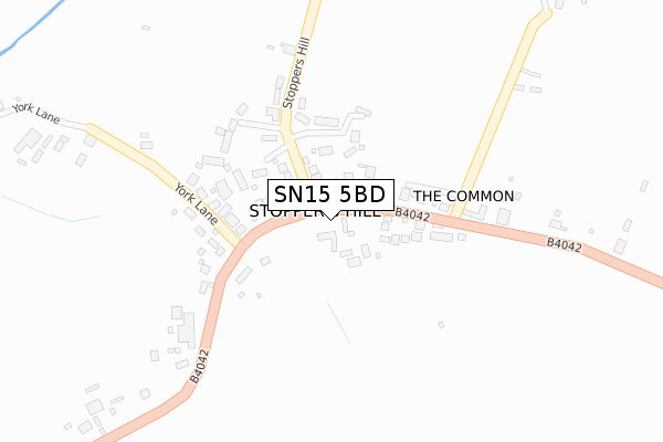
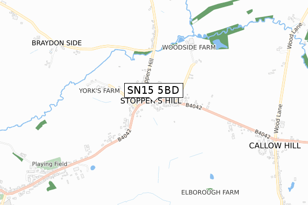
SN15 5BD maps


Source: OS Open Zoomstack (Ordnance Survey)
Licence: Open Government Licence (requires attribution)
Attribution: Contains OS data © Crown copyright and database right 2025
Source: Open Postcode Geo
Licence: Open Government Licence (requires attribution)
Attribution: Contains OS data © Crown copyright and database right 2025; Contains Royal Mail data © Royal Mail copyright and database right 2025; Source: Office for National Statistics licensed under the Open Government Licence v.3.0
Licence: Open Government Licence (requires attribution)
Attribution: Contains OS data © Crown copyright and database right 2025
Source: Open Postcode Geo
Licence: Open Government Licence (requires attribution)
Attribution: Contains OS data © Crown copyright and database right 2025; Contains Royal Mail data © Royal Mail copyright and database right 2025; Source: Office for National Statistics licensed under the Open Government Licence v.3.0
SN15 5BD geodata
| Easting | 392170 |
| Northing | 179124 |
| Latitude | 51.510987 |
| Longitude | -2.114215 |
Where is SN15 5BD?
| Country | England |
| Postcode District | SN15 |
Politics
| Ward | Kington |
|---|---|
| Constituency | North Wiltshire |
Transport
Nearest bus stops to SN15 5BD
| Pretty Chimneys (Malmesbury Road) | Kington St Michael | 1,412m |
| Pretty Chimneys (Malmesbury Road) | Kington St Michael | 1,477m |
| Valetta Gardens (Valletta Gardens) | Stanton St Quintin | 1,617m |
Deprivation
17% of English postcodes are less deprived than SN15 5BD:Food Standards Agency
Three nearest food hygiene ratings to SN15 5BD (metres)
HUBOO Technologies LTD
Unit 1
194m
Chippenham Pitstop

Oakleigh Acres
590m
Stanton Manor Hotel
Stanton Manor
1,713m
➜ Get more ratings from the Food Standards Agency
Nearest post box to SN15 5BD
| Last Collection | |||
|---|---|---|---|
| Location | Mon-Fri | Sat | Distance |
| Draycott Cerne | 16:45 | 08:00 | 1,437m |
| Doveys Terrace | 17:00 | 09:00 | 1,965m |
| The Close | 16:45 | 09:00 | 2,496m |
SN15 5BD ITL and SN15 5BD LAU
The below table lists the International Territorial Level (ITL) codes (formerly Nomenclature of Territorial Units for Statistics (NUTS) codes) and Local Administrative Units (LAU) codes for SN15 5BD:
| ITL 1 Code | Name |
|---|---|
| TLK | South West (England) |
| ITL 2 Code | Name |
| TLK1 | Gloucestershire, Wiltshire and Bath/Bristol area |
| ITL 3 Code | Name |
| TLK15 | Wiltshire |
| LAU 1 Code | Name |
| E06000054 | Wiltshire |
SN15 5BD census areas
The below table lists the Census Output Area (OA), Lower Layer Super Output Area (LSOA), and Middle Layer Super Output Area (MSOA) for SN15 5BD:
| Code | Name | |
|---|---|---|
| OA | E00162893 | |
| LSOA | E01031939 | Wiltshire 008A |
| MSOA | E02006651 | Wiltshire 008 |
Nearest postcodes to SN15 5BD
| SN15 5LH | 648m | |
| SN14 6AB | 917m | |
| SN15 5LD | 1238m | |
| SN14 6BH | Malmesbury Road | 1452m |
| SN15 5PA | 1475m | |
| SN14 6BN | 1512m | |
| SN14 6DD | 1532m | |
| SN14 6HE | Kington Lane | 1536m |
| SN14 6DT | Rectory Close | 1590m |
| SN14 6DF | Court Gardens | 1608m |