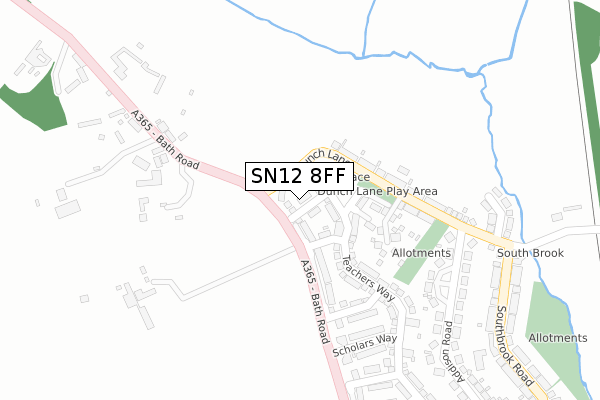
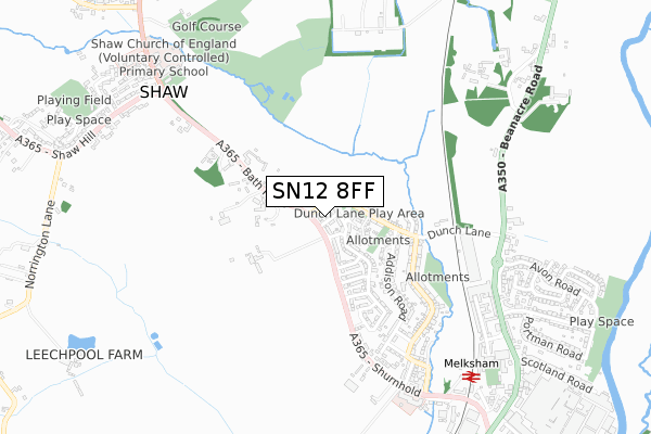
SN12 8FF is located in the Melksham Without North & Shurnhold electoral ward, within the unitary authority of Wiltshire and the English Parliamentary constituency of Chippenham. The Sub Integrated Care Board (ICB) Location is NHS Bath and North East Somerset, Swindon and Wiltshire ICB - 92 and the police force is Wiltshire. This postcode has been in use since April 2018.


GetTheData
Source: OS Open Zoomstack (Ordnance Survey)
Licence: Open Government Licence (requires attribution)
Attribution: Contains OS data © Crown copyright and database right 2025
Source: Open Postcode Geo
Licence: Open Government Licence (requires attribution)
Attribution: Contains OS data © Crown copyright and database right 2025; Contains Royal Mail data © Royal Mail copyright and database right 2025; Source: Office for National Statistics licensed under the Open Government Licence v.3.0
| Easting | 389470 |
| Northing | 165195 |
| Latitude | 51.385698 |
| Longitude | -2.152702 |
GetTheData
Source: Open Postcode Geo
Licence: Open Government Licence
| Country | England |
| Postcode District | SN12 |
➜ See where SN12 is on a map ➜ Where is Melksham? | |
GetTheData
Source: Land Registry Price Paid Data
Licence: Open Government Licence
| Ward | Melksham Without North & Shurnhold |
| Constituency | Chippenham |
GetTheData
Source: ONS Postcode Database
Licence: Open Government Licence
2022 19 AUG £452,000 |
2018 30 NOV £340,000 |
2018 9 AUG £350,000 |
9, FIELDSVIEW, MELKSHAM, SN12 8FF 2018 27 JUL £350,995 |
12, FIELDSVIEW, MELKSHAM, SN12 8FF 2018 29 JUN £349,995 |
2018 31 MAY £344,995 |
GetTheData
Source: HM Land Registry Price Paid Data
Licence: Contains HM Land Registry data © Crown copyright and database right 2025. This data is licensed under the Open Government Licence v3.0.
| Wiltshire Council Offices (Bath Road) | Melksham | 203m |
| Wiltshire Council Offices (Bath Road) | Melksham | 226m |
| Dunch Lane | Melksham | 263m |
| Dunch Lane | Melksham | 268m |
| The Green (Addison Road) | Melksham | 284m |
| Melksham Station | 0.9km |
GetTheData
Source: NaPTAN
Licence: Open Government Licence
| Percentage of properties with Next Generation Access | 91.7% |
| Percentage of properties with Superfast Broadband | 91.7% |
| Percentage of properties with Ultrafast Broadband | 91.7% |
| Percentage of properties with Full Fibre Broadband | 91.7% |
Superfast Broadband is between 30Mbps and 300Mbps
Ultrafast Broadband is > 300Mbps
| Median download speed | 8.1Mbps |
| Average download speed | 7.6Mbps |
| Maximum download speed | 9.61Mbps |
| Median upload speed | 0.8Mbps |
| Average upload speed | 0.9Mbps |
| Maximum upload speed | 1.21Mbps |
| Percentage of properties unable to receive 2Mbps | 0.0% |
| Percentage of properties unable to receive 5Mbps | 0.0% |
| Percentage of properties unable to receive 10Mbps | 0.0% |
| Percentage of properties unable to receive 30Mbps | 8.3% |
GetTheData
Source: Ofcom
Licence: Ofcom Terms of Use (requires attribution)
GetTheData
Source: ONS Postcode Database
Licence: Open Government Licence


➜ Get more ratings from the Food Standards Agency
GetTheData
Source: Food Standards Agency
Licence: FSA terms & conditions
| Last Collection | |||
|---|---|---|---|
| Location | Mon-Fri | Sat | Distance |
| Beanacre Road | 17:30 | 11:00 | 777m |
| Bath Road Post Office | 18:00 | 11:15 | 1,210m |
| Beanacre | 17:30 | 07:00 | 1,232m |
GetTheData
Source: Dracos
Licence: Creative Commons Attribution-ShareAlike
The below table lists the International Territorial Level (ITL) codes (formerly Nomenclature of Territorial Units for Statistics (NUTS) codes) and Local Administrative Units (LAU) codes for SN12 8FF:
| ITL 1 Code | Name |
|---|---|
| TLK | South West (England) |
| ITL 2 Code | Name |
| TLK1 | Gloucestershire, Wiltshire and Bath/Bristol area |
| ITL 3 Code | Name |
| TLK15 | Wiltshire |
| LAU 1 Code | Name |
| E06000054 | Wiltshire |
GetTheData
Source: ONS Postcode Directory
Licence: Open Government Licence
The below table lists the Census Output Area (OA), Lower Layer Super Output Area (LSOA), and Middle Layer Super Output Area (MSOA) for SN12 8FF:
| Code | Name | |
|---|---|---|
| OA | E00163538 | |
| LSOA | E01032063 | Wiltshire 020A |
| MSOA | E02006678 | Wiltshire 020 |
GetTheData
Source: ONS Postcode Directory
Licence: Open Government Licence
| SN12 8DX | Dunch Lane | 170m |
| SN12 8EG | Bath Road | 259m |
| SN12 8DP | Addison Road | 318m |
| SN12 8DU | Northbrook Road | 324m |
| SN12 8EE | Bath Road | 328m |
| SN12 8DR | Addison Road | 357m |
| SN12 8FG | Brook Close | 399m |
| SN12 8EF | Bath Road | 428m |
| SN12 8DS | Southbrook Road | 444m |
| SN12 8DT | Southbrook Road | 481m |
GetTheData
Source: Open Postcode Geo; Land Registry Price Paid Data
Licence: Open Government Licence