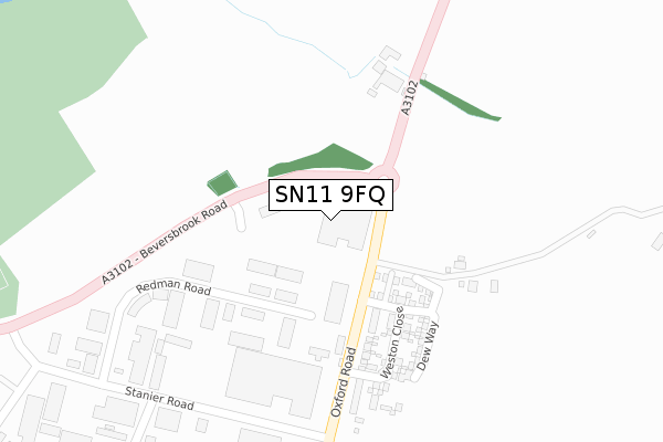
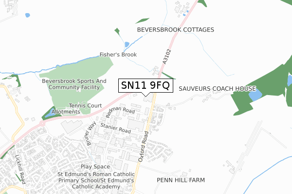
SN11 9FQ is located in the Calne North electoral ward, within the unitary authority of Wiltshire and the English Parliamentary constituency of North Wiltshire. The Sub Integrated Care Board (ICB) Location is NHS Bath and North East Somerset, Swindon and Wiltshire ICB - 92 and the police force is Wiltshire. This postcode has been in use since January 2018.


GetTheData
Source: OS Open Zoomstack (Ordnance Survey)
Licence: Open Government Licence (requires attribution)
Attribution: Contains OS data © Crown copyright and database right 2025
Source: Open Postcode Geo
Licence: Open Government Licence (requires attribution)
Attribution: Contains OS data © Crown copyright and database right 2025; Contains Royal Mail data © Royal Mail copyright and database right 2025; Source: Office for National Statistics licensed under the Open Government Licence v.3.0
| Easting | 400505 |
| Northing | 172783 |
| Latitude | 51.454027 |
| Longitude | -1.994115 |
GetTheData
Source: Open Postcode Geo
Licence: Open Government Licence
| Country | England |
| Postcode District | SN11 |
➜ See where SN11 is on a map ➜ Where is Calne? | |
GetTheData
Source: Land Registry Price Paid Data
Licence: Open Government Licence
| Ward | Calne North |
| Constituency | North Wiltshire |
GetTheData
Source: ONS Postcode Database
Licence: Open Government Licence
| High Penn | Calne | 71m |
| High Penn | Calne | 94m |
| Porte Marsh Industrial Estate (Oxford Road) | Calne | 323m |
| Porte Marsh Industrial Estate (Oxford Road) | Calne | 345m |
| Porte Marsh Road (Stanier Road) | Calne | 375m |
GetTheData
Source: NaPTAN
Licence: Open Government Licence
GetTheData
Source: ONS Postcode Database
Licence: Open Government Licence


➜ Get more ratings from the Food Standards Agency
GetTheData
Source: Food Standards Agency
Licence: FSA terms & conditions
| Last Collection | |||
|---|---|---|---|
| Location | Mon-Fri | Sat | Distance |
| Porte Marsh Industrial Estate | 18:00 | 12:00 | 535m |
| Calne March | 17:45 | 12:00 | 1,088m |
| William Street | 17:45 | 12:00 | 1,096m |
GetTheData
Source: Dracos
Licence: Creative Commons Attribution-ShareAlike
The below table lists the International Territorial Level (ITL) codes (formerly Nomenclature of Territorial Units for Statistics (NUTS) codes) and Local Administrative Units (LAU) codes for SN11 9FQ:
| ITL 1 Code | Name |
|---|---|
| TLK | South West (England) |
| ITL 2 Code | Name |
| TLK1 | Gloucestershire, Wiltshire and Bath/Bristol area |
| ITL 3 Code | Name |
| TLK15 | Wiltshire |
| LAU 1 Code | Name |
| E06000054 | Wiltshire |
GetTheData
Source: ONS Postcode Directory
Licence: Open Government Licence
The below table lists the Census Output Area (OA), Lower Layer Super Output Area (LSOA), and Middle Layer Super Output Area (MSOA) for SN11 9FQ:
| Code | Name | |
|---|---|---|
| OA | E00166344 | |
| LSOA | E01032690 | Wiltshire 015F |
| MSOA | E02006657 | Wiltshire 015 |
GetTheData
Source: ONS Postcode Directory
Licence: Open Government Licence
| SN11 8RS | Oxford Road | 183m |
| SN11 9RA | Redman Road | 222m |
| SN11 9PL | Beversbrook Industrial Estate | 233m |
| SN11 9PX | Stanier Road | 426m |
| SN11 9PT | Harris Road | 473m |
| SN11 8RU | 494m | |
| SN11 8RX | Beversbrook | 634m |
| SN11 9RD | Clarke Avenue | 692m |
| SN11 9BW | Porte Marsh Road | 693m |
| SN11 9RN | Linnet Road | 702m |
GetTheData
Source: Open Postcode Geo; Land Registry Price Paid Data
Licence: Open Government Licence