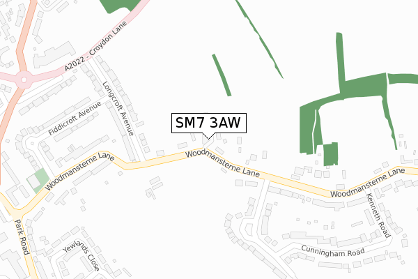
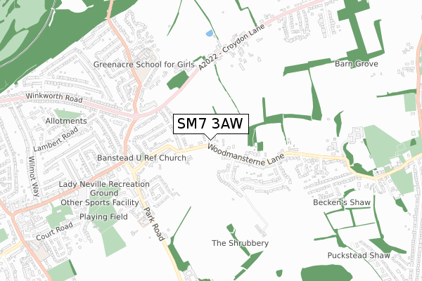
SM7 3AW is located in the Banstead Village electoral ward, within the local authority district of Reigate and Banstead and the English Parliamentary constituency of Reigate. The Sub Integrated Care Board (ICB) Location is NHS Surrey Heartlands ICB - 92A and the police force is Surrey. This postcode has been in use since August 2019.


GetTheData
Source: OS Open Zoomstack (Ordnance Survey)
Licence: Open Government Licence (requires attribution)
Attribution: Contains OS data © Crown copyright and database right 2025
Source: Open Postcode Geo
Licence: Open Government Licence (requires attribution)
Attribution: Contains OS data © Crown copyright and database right 2025; Contains Royal Mail data © Royal Mail copyright and database right 2025; Source: Office for National Statistics licensed under the Open Government Licence v.3.0
| Easting | 526363 |
| Northing | 160073 |
| Latitude | 51.325728 |
| Longitude | -0.187797 |
GetTheData
Source: Open Postcode Geo
Licence: Open Government Licence
| Country | England |
| Postcode District | SM7 |
➜ See where SM7 is on a map ➜ Where is Banstead? | |
GetTheData
Source: Land Registry Price Paid Data
Licence: Open Government Licence
| Ward | Banstead Village |
| Constituency | Reigate |
GetTheData
Source: ONS Postcode Database
Licence: Open Government Licence
3, FARLEY CLOSE, BANSTEAD, SM7 3AW 2020 22 JUN £1,245,000 |
4, FARLEY CLOSE, BANSTEAD, SM7 3AW 2020 11 JUN £1,375,000 |
5, FARLEY CLOSE, BANSTEAD, SM7 3AW 2019 29 NOV £995,000 |
7, FARLEY CLOSE, BANSTEAD, SM7 3AW 2019 23 AUG £1,265,000 |
GetTheData
Source: HM Land Registry Price Paid Data
Licence: Contains HM Land Registry data © Crown copyright and database right 2025. This data is licensed under the Open Government Licence v3.0.
| Croydon Lane South (Croydon Lane) | Banstead | 352m |
| Woodmansterne Lane | Banstead | 381m |
| Croydon Lane South (Croydon Lane) | Banstead | 383m |
| Woodmansterne Lane | Banstead | 389m |
| Boundary Farm (Croydon Lane) | Banstead | 453m |
| Banstead Station | 1.8km |
| Belmont Station | 2.2km |
| Chipstead Station | 2.2km |
GetTheData
Source: NaPTAN
Licence: Open Government Licence
GetTheData
Source: ONS Postcode Database
Licence: Open Government Licence


➜ Get more ratings from the Food Standards Agency
GetTheData
Source: Food Standards Agency
Licence: FSA terms & conditions
| Last Collection | |||
|---|---|---|---|
| Location | Mon-Fri | Sat | Distance |
| Longcroft Avenue (1) | 17:00 | 12:00 | 300m |
| Banstead Road (151) | 18:30 | 12:00 | 656m |
| Fairlawn Grove / Croy Lane | 17:00 | 12:00 | 855m |
GetTheData
Source: Dracos
Licence: Creative Commons Attribution-ShareAlike
The below table lists the International Territorial Level (ITL) codes (formerly Nomenclature of Territorial Units for Statistics (NUTS) codes) and Local Administrative Units (LAU) codes for SM7 3AW:
| ITL 1 Code | Name |
|---|---|
| TLJ | South East (England) |
| ITL 2 Code | Name |
| TLJ2 | Surrey, East and West Sussex |
| ITL 3 Code | Name |
| TLJ26 | East Surrey |
| LAU 1 Code | Name |
| E07000211 | Reigate and Banstead |
GetTheData
Source: ONS Postcode Directory
Licence: Open Government Licence
The below table lists the Census Output Area (OA), Lower Layer Super Output Area (LSOA), and Middle Layer Super Output Area (MSOA) for SM7 3AW:
| Code | Name | |
|---|---|---|
| OA | E00155876 | |
| LSOA | E01030561 | Reigate and Banstead 002C |
| MSOA | E02006376 | Reigate and Banstead 002 |
GetTheData
Source: ONS Postcode Directory
Licence: Open Government Licence
| SM7 3EZ | Woodmansterne Lane | 157m |
| SM7 3AE | Longcroft Avenue | 231m |
| SM7 3EY | Woodmansterne Lane | 246m |
| SM7 3HF | Chalmers Road | 296m |
| SM7 3EX | Woodmansterne Lane | 303m |
| SM7 3HE | Woodmansterne Lane | 309m |
| SM7 3ES | Woodmansterne Lane | 330m |
| SM7 3AD | Fiddicroft Avenue | 354m |
| SM7 3AF | Croydon Lane South | 384m |
| SM7 3HG | Cunningham Road | 400m |
GetTheData
Source: Open Postcode Geo; Land Registry Price Paid Data
Licence: Open Government Licence