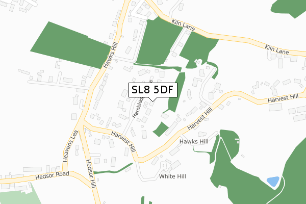
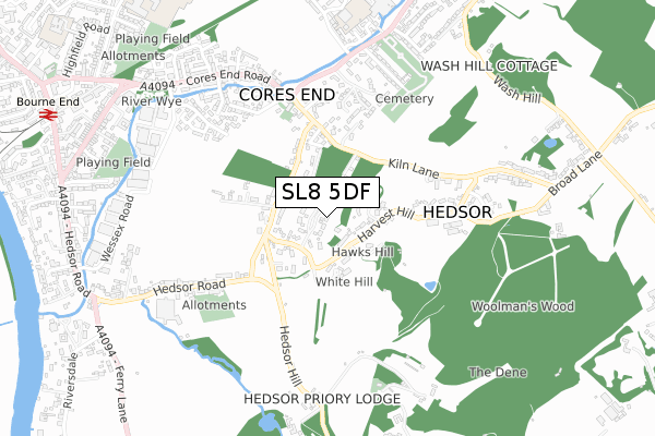
SL8 5DF is located in the The Wooburns, Bourne End and Hedsor electoral ward, within the unitary authority of Buckinghamshire and the English Parliamentary constituency of Beaconsfield. The Sub Integrated Care Board (ICB) Location is NHS Buckinghamshire, Oxfordshire and Berkshire West ICB - 14Y and the police force is Thames Valley. This postcode has been in use since February 2019.


GetTheData
Source: OS Open Zoomstack (Ordnance Survey)
Licence: Open Government Licence (requires attribution)
Attribution: Contains OS data © Crown copyright and database right 2025
Source: Open Postcode Geo
Licence: Open Government Licence (requires attribution)
Attribution: Contains OS data © Crown copyright and database right 2025; Contains Royal Mail data © Royal Mail copyright and database right 2025; Source: Office for National Statistics licensed under the Open Government Licence v.3.0
| Easting | 490525 |
| Northing | 186861 |
| Latitude | 51.573362 |
| Longitude | -0.695135 |
GetTheData
Source: Open Postcode Geo
Licence: Open Government Licence
| Country | England |
| Postcode District | SL8 |
➜ See where SL8 is on a map ➜ Where is Hedsor? | |
GetTheData
Source: Land Registry Price Paid Data
Licence: Open Government Licence
| Ward | The Wooburns, Bourne End And Hedsor |
| Constituency | Beaconsfield |
GetTheData
Source: ONS Postcode Database
Licence: Open Government Licence
| Brookbank | Cores End | 513m |
| Brookbank | Cores End | 531m |
| Cemetery (Brookbank) | Wooburn | 675m |
| Cemetery (Brookbank) | Wooburn | 696m |
| Cores End (Cores End Road) | Bourne End | 714m |
| Bourne End Station | 1.1km |
| Cookham Station | 2.6km |
| Marlow Station | 4.9km |
GetTheData
Source: NaPTAN
Licence: Open Government Licence
GetTheData
Source: ONS Postcode Database
Licence: Open Government Licence


➜ Get more ratings from the Food Standards Agency
GetTheData
Source: Food Standards Agency
Licence: FSA terms & conditions
| Last Collection | |||
|---|---|---|---|
| Location | Mon-Fri | Sat | Distance |
| Princess Road | 16:30 | 11:15 | 489m |
| Brookfield Road | 16:00 | 10:00 | 666m |
| Cores End Road | 17:30 | 11:15 | 765m |
GetTheData
Source: Dracos
Licence: Creative Commons Attribution-ShareAlike
The below table lists the International Territorial Level (ITL) codes (formerly Nomenclature of Territorial Units for Statistics (NUTS) codes) and Local Administrative Units (LAU) codes for SL8 5DF:
| ITL 1 Code | Name |
|---|---|
| TLJ | South East (England) |
| ITL 2 Code | Name |
| TLJ1 | Berkshire, Buckinghamshire and Oxfordshire |
| ITL 3 Code | Name |
| TLJ13 | Buckinghamshire |
| LAU 1 Code | Name |
| E06000060 | Buckinghamshire |
GetTheData
Source: ONS Postcode Directory
Licence: Open Government Licence
The below table lists the Census Output Area (OA), Lower Layer Super Output Area (LSOA), and Middle Layer Super Output Area (MSOA) for SL8 5DF:
| Code | Name | |
|---|---|---|
| OA | E00090043 | |
| LSOA | E01017849 | Wycombe 021D |
| MSOA | E02003716 | Wycombe 021 |
GetTheData
Source: ONS Postcode Directory
Licence: Open Government Licence
| SL8 5JJ | Harvest Hill | 103m |
| SL8 5JH | Hawks Hill | 189m |
| SL8 5FW | Four Winds | 236m |
| SL8 5JL | Heavens Lea | 263m |
| SL8 5JQ | Hawks Hill | 285m |
| SL8 5JG | Kiln Lane | 285m |
| SL8 5JF | Clifton Place | 304m |
| SL8 5JE | Kiln Lane | 328m |
| HP10 0QE | Brookhouse Drive | 433m |
| HP10 0JQ | Kiln Lane | 441m |
GetTheData
Source: Open Postcode Geo; Land Registry Price Paid Data
Licence: Open Government Licence