Property/Postcode Data Search:
SL3 8FA maps, stats, and open data
SL3 8FA is located in the Langley Meads electoral ward, within the unitary authority of Slough and the English Parliamentary constituency of Slough. The Sub Integrated Care Board (ICB) Location is NHS Frimley ICB - D4U1Y and the police force is Thames Valley. This postcode has been in use since August 2019.
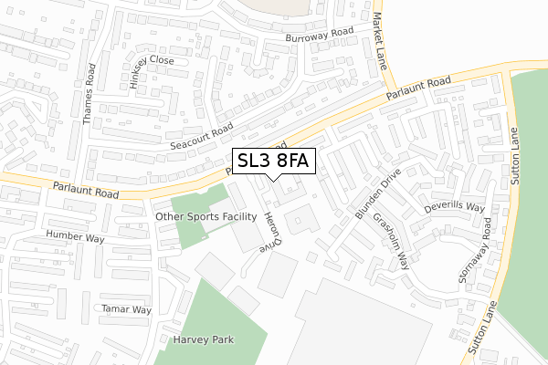
SL3 8FA maps


Source: OS Open Zoomstack (Ordnance Survey)
Licence: Open Government Licence (requires attribution)
Attribution: Contains OS data © Crown copyright and database right 2025
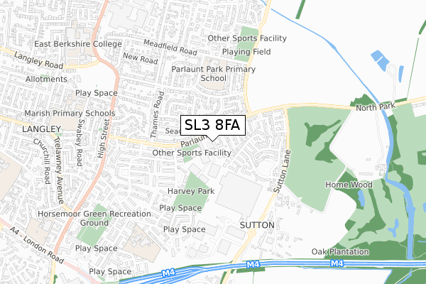
Source: Open Postcode Geo
Licence: Open Government Licence (requires attribution)
Attribution: Contains OS data © Crown copyright and database right 2025; Contains Royal Mail data © Royal Mail copyright and database right 2025; Source: Office for National Statistics licensed under the Open Government Licence v.3.0
Licence: Open Government Licence (requires attribution)
Attribution: Contains OS data © Crown copyright and database right 2025
Source: Open Postcode Geo
Licence: Open Government Licence (requires attribution)
Attribution: Contains OS data © Crown copyright and database right 2025; Contains Royal Mail data © Royal Mail copyright and database right 2025; Source: Office for National Statistics licensed under the Open Government Licence v.3.0
SL3 8FA geodata
| Easting | 501843 |
| Northing | 178880 |
| Latitude | 51.499695 |
| Longitude | -0.534182 |
Where is SL3 8FA?
| Country | England |
| Postcode District | SL3 |
Politics
| Ward | Langley Meads |
|---|---|
| Constituency | Slough |
Transport
Nearest bus stops to SL3 8FA
| Langley Leisure Centre (Parlaunt Road) | Langley | 183m |
| Langley Leisure Centre (Parlaunt Road) | Langley | 184m |
| Market Lane (Parlaunt Road) | Langley | 223m |
| Market Lane (Parlaunt Road) | Langley | 224m |
| Humber Way (Tamar Way) | Langley | 238m |
Nearest railway stations to SL3 8FA
| Langley (Berks) Station | 1.1km |
| Iver Station | 2.1km |
| Datchet Station | 3.6km |
Deprivation
52.2% of English postcodes are less deprived than SL3 8FA:Food Standards Agency
Three nearest food hygiene ratings to SL3 8FA (metres)
Eurest Services at Virgin Media

UNIT G HERON DRIVE
199m
Nisa Local

20 PARLAUNT ROAD
355m
LLoyds Pharmacy
18 PARLAUNT ROAD
362m
➜ Get more ratings from the Food Standards Agency
Nearest post box to SL3 8FA
| Last Collection | |||
|---|---|---|---|
| Location | Mon-Fri | Sat | Distance |
| Parlaunt Road Post Office | 18:00 | 13:00 | 336m |
| High Street | 18:30 | 13:00 | 585m |
| Meadfield Road | 18:15 | 11:30 | 655m |
SL3 8FA ITL and SL3 8FA LAU
The below table lists the International Territorial Level (ITL) codes (formerly Nomenclature of Territorial Units for Statistics (NUTS) codes) and Local Administrative Units (LAU) codes for SL3 8FA:
| ITL 1 Code | Name |
|---|---|
| TLJ | South East (England) |
| ITL 2 Code | Name |
| TLJ1 | Berkshire, Buckinghamshire and Oxfordshire |
| ITL 3 Code | Name |
| TLJ11 | Berkshire |
| LAU 1 Code | Name |
| E06000039 | Slough |
SL3 8FA census areas
The below table lists the Census Output Area (OA), Lower Layer Super Output Area (LSOA), and Middle Layer Super Output Area (MSOA) for SL3 8FA:
| Code | Name | |
|---|---|---|
| OA | E00083264 | |
| LSOA | E01016492 | Slough 013D |
| MSOA | E02003419 | Slough 013 |
Nearest postcodes to SL3 8FA
| SL3 8BA | Parlaunt Road | 79m |
| SL3 8BE | Parlaunt Road | 111m |
| SL3 8EW | Seacourt Road | 112m |
| SL3 8EP | Seacourt Road | 152m |
| SL3 8AZ | Parlaunt Road | 158m |
| SL3 8WG | Blunden Drive | 168m |
| SL3 8ER | Windrush Avenue | 216m |
| SL3 8BG | Parlaunt Road | 216m |
| SL3 8TA | Tamar Way | 245m |
| SL3 8WQ | Blunden Drive | 248m |