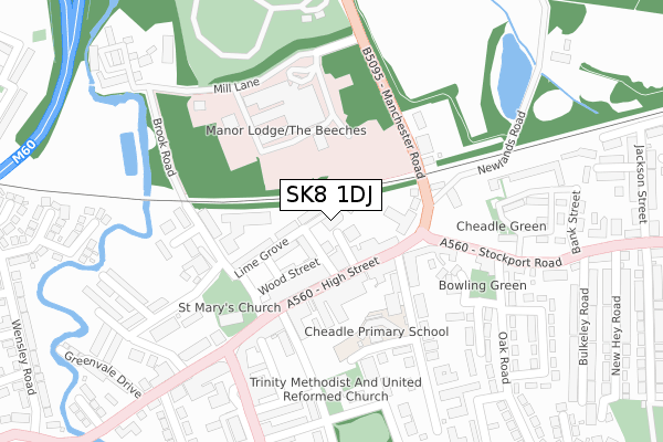
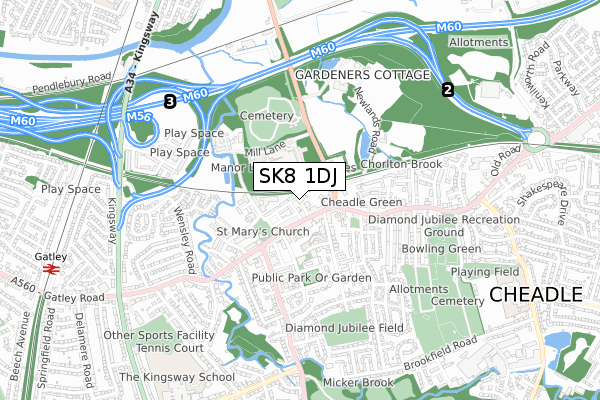
SK8 1DJ is located in the Cheadle West & Gatley electoral ward, within the metropolitan district of Stockport and the English Parliamentary constituency of Cheadle. The Sub Integrated Care Board (ICB) Location is NHS Greater Manchester ICB - 01W and the police force is Greater Manchester. This postcode has been in use since June 2019.


GetTheData
Source: OS Open Zoomstack (Ordnance Survey)
Licence: Open Government Licence (requires attribution)
Attribution: Contains OS data © Crown copyright and database right 2025
Source: Open Postcode Geo
Licence: Open Government Licence (requires attribution)
Attribution: Contains OS data © Crown copyright and database right 2025; Contains Royal Mail data © Royal Mail copyright and database right 2025; Source: Office for National Statistics licensed under the Open Government Licence v.3.0
| Easting | 385786 |
| Northing | 388765 |
| Latitude | 53.395538 |
| Longitude | -2.215217 |
GetTheData
Source: Open Postcode Geo
Licence: Open Government Licence
| Country | England |
| Postcode District | SK8 |
➜ See where SK8 is on a map ➜ Where is Cheadle? | |
GetTheData
Source: Land Registry Price Paid Data
Licence: Open Government Licence
| Ward | Cheadle West & Gatley |
| Constituency | Cheadle |
GetTheData
Source: ONS Postcode Database
Licence: Open Government Licence
| High St/Boots (High St) | Cheadle | 76m |
| High St/Warwick Mall (High St) | Cheadle | 99m |
| High St/George & Dragon (High St) | Cheadle | 126m |
| Stockport Rd/Cheadle Green (Stockport Rd) | Cheadle | 214m |
| Manchester Rd/Alexandra Hospital (Manchester Rd) | Cheadle | 263m |
| Gatley Station | 1.1km |
| East Didsbury Station | 1.6km |
| Cheadle Hulme Station | 2.8km |
GetTheData
Source: NaPTAN
Licence: Open Government Licence
GetTheData
Source: ONS Postcode Database
Licence: Open Government Licence


➜ Get more ratings from the Food Standards Agency
GetTheData
Source: Food Standards Agency
Licence: FSA terms & conditions
| Last Collection | |||
|---|---|---|---|
| Location | Mon-Fri | Sat | Distance |
| Eden Place | 18:45 | 56m | |
| High Street | 17:30 | 11:30 | 117m |
| Queens Gardens | 17:15 | 11:30 | 294m |
GetTheData
Source: Dracos
Licence: Creative Commons Attribution-ShareAlike
The below table lists the International Territorial Level (ITL) codes (formerly Nomenclature of Territorial Units for Statistics (NUTS) codes) and Local Administrative Units (LAU) codes for SK8 1DJ:
| ITL 1 Code | Name |
|---|---|
| TLD | North West (England) |
| ITL 2 Code | Name |
| TLD3 | Greater Manchester |
| ITL 3 Code | Name |
| TLD35 | Greater Manchester South East |
| LAU 1 Code | Name |
| E08000007 | Stockport |
GetTheData
Source: ONS Postcode Directory
Licence: Open Government Licence
The below table lists the Census Output Area (OA), Lower Layer Super Output Area (LSOA), and Middle Layer Super Output Area (MSOA) for SK8 1DJ:
| Code | Name | |
|---|---|---|
| OA | E00029224 | |
| LSOA | E01005769 | Stockport 022A |
| MSOA | E02001208 | Stockport 022 |
GetTheData
Source: ONS Postcode Directory
Licence: Open Government Licence
| SK8 1AH | Mary Street | 39m |
| SK8 1AL | High Street | 83m |
| SK8 1AQ | Wood Street | 91m |
| SK8 1PF | Lime Grove | 99m |
| SK8 1AX | High Street | 108m |
| SK8 1AE | High Street | 117m |
| SK8 1BJ | High Street | 133m |
| SK8 2NP | Manchester Road | 168m |
| SK8 1HD | 197m | |
| SK8 1AA | High Street | 207m |
GetTheData
Source: Open Postcode Geo; Land Registry Price Paid Data
Licence: Open Government Licence