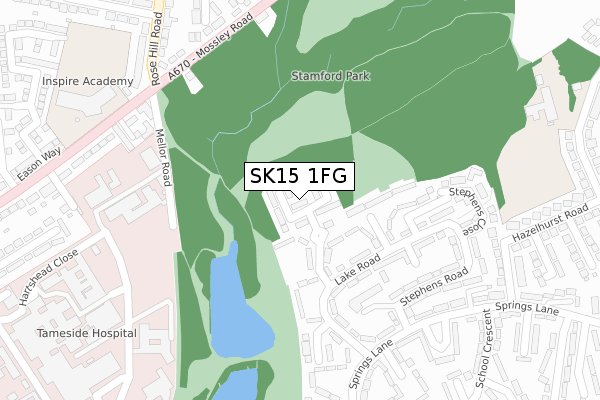
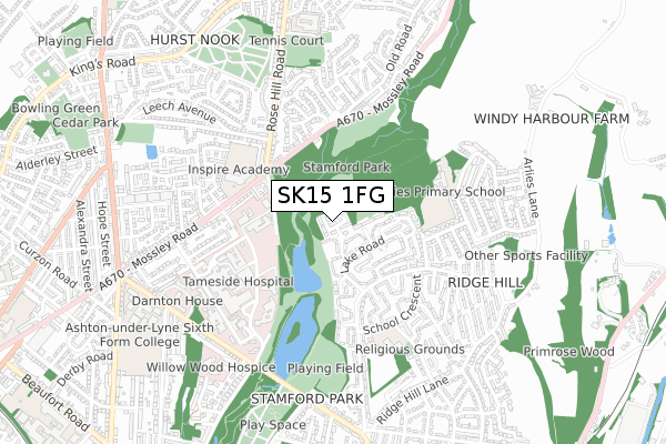
SK15 1FG is located in the Stalybridge North electoral ward, within the metropolitan district of Tameside and the English Parliamentary constituency of Stalybridge and Hyde. The Sub Integrated Care Board (ICB) Location is NHS Greater Manchester ICB - 01Y and the police force is Greater Manchester. This postcode has been in use since June 2019.


GetTheData
Source: OS Open Zoomstack (Ordnance Survey)
Licence: Open Government Licence (requires attribution)
Attribution: Contains OS data © Crown copyright and database right 2025
Source: Open Postcode Geo
Licence: Open Government Licence (requires attribution)
Attribution: Contains OS data © Crown copyright and database right 2025; Contains Royal Mail data © Royal Mail copyright and database right 2025; Source: Office for National Statistics licensed under the Open Government Licence v.3.0
| Easting | 395776 |
| Northing | 399820 |
| Latitude | 53.495082 |
| Longitude | -2.065137 |
GetTheData
Source: Open Postcode Geo
Licence: Open Government Licence
| Country | England |
| Postcode District | SK15 |
➜ See where SK15 is on a map ➜ Where is Stalybridge? | |
GetTheData
Source: Land Registry Price Paid Data
Licence: Open Government Licence
| Ward | Stalybridge North |
| Constituency | Stalybridge And Hyde |
GetTheData
Source: ONS Postcode Database
Licence: Open Government Licence
| Mossley Rd/Park Square (Mossley Rd) | Hazelhurst | 328m |
| Maternity Unit (Sth Bnd) (Hartshead Way) | Tameside General Hospital | 328m |
| Mossley Rd/Park Square (Mossley Rd) | Hazelhurst | 343m |
| Mossley Rd/The Ladysmith (Mossley Rd) | Hazelhurst | 350m |
| Springs Ln/School Cres (Springs Ln) | Ridge Hill | 357m |
| Stalybridge Station | 1.2km |
| Ashton-under-Lyne Station | 2km |
| Mossley (Manchester) Station | 2.7km |
GetTheData
Source: NaPTAN
Licence: Open Government Licence
| Percentage of properties with Next Generation Access | 100.0% |
| Percentage of properties with Superfast Broadband | 100.0% |
| Percentage of properties with Ultrafast Broadband | 100.0% |
| Percentage of properties with Full Fibre Broadband | 100.0% |
Superfast Broadband is between 30Mbps and 300Mbps
Ultrafast Broadband is > 300Mbps
| Percentage of properties unable to receive 2Mbps | 0.0% |
| Percentage of properties unable to receive 5Mbps | 0.0% |
| Percentage of properties unable to receive 10Mbps | 0.0% |
| Percentage of properties unable to receive 30Mbps | 0.0% |
GetTheData
Source: Ofcom
Licence: Ofcom Terms of Use (requires attribution)
GetTheData
Source: ONS Postcode Database
Licence: Open Government Licence


➜ Get more ratings from the Food Standards Agency
GetTheData
Source: Food Standards Agency
Licence: FSA terms & conditions
| Last Collection | |||
|---|---|---|---|
| Location | Mon-Fri | Sat | Distance |
| Ladysmith Road | 17:15 | 11:30 | 394m |
| Springs Lane | 17:15 | 11:30 | 428m |
| Ambleside | 17:15 | 11:30 | 635m |
GetTheData
Source: Dracos
Licence: Creative Commons Attribution-ShareAlike
The below table lists the International Territorial Level (ITL) codes (formerly Nomenclature of Territorial Units for Statistics (NUTS) codes) and Local Administrative Units (LAU) codes for SK15 1FG:
| ITL 1 Code | Name |
|---|---|
| TLD | North West (England) |
| ITL 2 Code | Name |
| TLD3 | Greater Manchester |
| ITL 3 Code | Name |
| TLD35 | Greater Manchester South East |
| LAU 1 Code | Name |
| E08000008 | Tameside |
GetTheData
Source: ONS Postcode Directory
Licence: Open Government Licence
The below table lists the Census Output Area (OA), Lower Layer Super Output Area (LSOA), and Middle Layer Super Output Area (MSOA) for SK15 1FG:
| Code | Name | |
|---|---|---|
| OA | E00030705 | |
| LSOA | E01006064 | Tameside 008B |
| MSOA | E02001236 | Tameside 008 |
GetTheData
Source: ONS Postcode Directory
Licence: Open Government Licence
| SK15 1JF | Mereside | 104m |
| SK15 1JE | Lake Road | 161m |
| SK15 1JJ | Lakes View | 244m |
| SK15 1HX | Stephens Road | 265m |
| SK15 1HS | Springs Lane | 283m |
| OL6 9RT | Park Square | 297m |
| OL6 9SJ | Mossley Road | 299m |
| OL6 9RU | Mossley Road | 322m |
| SK15 1JD | Springs Lane | 331m |
| SK15 1JL | Chadwicks Close | 345m |
GetTheData
Source: Open Postcode Geo; Land Registry Price Paid Data
Licence: Open Government Licence