SK10 2BF maps, stats, and open data
SK10 2BF is located in the Macclesfield Tytherington electoral ward, within the unitary authority of Cheshire East and the English Parliamentary constituency of Macclesfield. The Sub Integrated Care Board (ICB) Location is NHS Cheshire and Merseyside ICB - 27D and the police force is Cheshire. This postcode has been in use since August 2017.
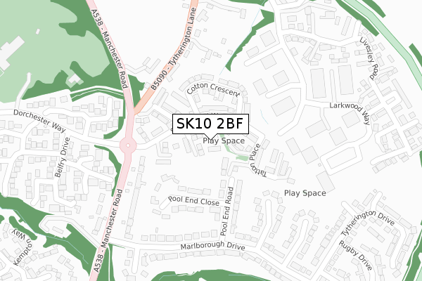
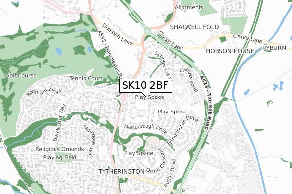
SK10 2BF maps


Licence: Open Government Licence (requires attribution)
Attribution: Contains OS data © Crown copyright and database right 2025
Source: Open Postcode Geo
Licence: Open Government Licence (requires attribution)
Attribution: Contains OS data © Crown copyright and database right 2025; Contains Royal Mail data © Royal Mail copyright and database right 2025; Source: Office for National Statistics licensed under the Open Government Licence v.3.0
SK10 2BF geodata
| Easting | 391832 |
| Northing | 375971 |
| Latitude | 53.280668 |
| Longitude | -2.123960 |
Where is SK10 2BF?
| Country | England |
| Postcode District | SK10 |
Politics
| Ward | Macclesfield Tytherington |
|---|---|
| Constituency | Macclesfield |
House Prices
Sales of detached houses in SK10 2BF
2023 30 JUN £700,000 |
5, LOVELL RISE, MACCLESFIELD, SK10 2BF 2017 24 NOV £565,995 |
4, LOVELL RISE, MACCLESFIELD, SK10 2BF 2017 3 NOV £719,995 |
3, LOVELL RISE, MACCLESFIELD, SK10 2BF 2017 8 SEP £561,995 |
2, LOVELL RISE, MACCLESFIELD, SK10 2BF 2017 1 SEP £584,995 |
2017 24 AUG £483,995 |
Licence: Contains HM Land Registry data © Crown copyright and database right 2025. This data is licensed under the Open Government Licence v3.0.
Transport
Nearest bus stops to SK10 2BF
| Dorchester Way (Manchester Road) | Tytherington | 191m |
| Larkwood Way (Springwood Way) | Tytherington | 204m |
| Dorchester Way (Manchester Road) | Tytherington | 226m |
| Pool End Road (Marlborough Drive) | Tytherington | 240m |
| Carnoustie Drive (Dorchester Way) | Tytherington | 266m |
Nearest railway stations to SK10 2BF
| Prestbury Station | 2km |
| Macclesfield Station | 2.4km |
| Adlington (Cheshire) Station | 4.4km |
Broadband
Broadband access in SK10 2BF (2020 data)
| Percentage of properties with Next Generation Access | 100.0% |
| Percentage of properties with Superfast Broadband | 100.0% |
| Percentage of properties with Ultrafast Broadband | 100.0% |
| Percentage of properties with Full Fibre Broadband | 0.0% |
Superfast Broadband is between 30Mbps and 300Mbps
Ultrafast Broadband is > 300Mbps
Broadband speed in SK10 2BF (2019 data)
Download
| Median download speed | 200.0Mbps |
| Average download speed | 187.4Mbps |
| Maximum download speed | 350.00Mbps |
Upload
| Median upload speed | 2.5Mbps |
| Average upload speed | 2.5Mbps |
| Maximum upload speed | 3.86Mbps |
Broadband limitations in SK10 2BF (2020 data)
| Percentage of properties unable to receive 2Mbps | 0.0% |
| Percentage of properties unable to receive 5Mbps | 0.0% |
| Percentage of properties unable to receive 10Mbps | 0.0% |
| Percentage of properties unable to receive 30Mbps | 0.0% |
Deprivation
0.6% of English postcodes are less deprived than SK10 2BF:Food Standards Agency
Three nearest food hygiene ratings to SK10 2BF (metres)


➜ Get more ratings from the Food Standards Agency
Nearest post box to SK10 2BF
| Last Collection | |||
|---|---|---|---|
| Location | Mon-Fri | Sat | Distance |
| Marlborough | 18:00 | 12:00 | 333m |
| Tytherington Lane | 18:00 | 12:00 | 341m |
| Tytherington Club | 18:00 | 12:00 | 471m |
SK10 2BF ITL and SK10 2BF LAU
The below table lists the International Territorial Level (ITL) codes (formerly Nomenclature of Territorial Units for Statistics (NUTS) codes) and Local Administrative Units (LAU) codes for SK10 2BF:
| ITL 1 Code | Name |
|---|---|
| TLD | North West (England) |
| ITL 2 Code | Name |
| TLD6 | Cheshire |
| ITL 3 Code | Name |
| TLD62 | Cheshire East |
| LAU 1 Code | Name |
| E06000049 | Cheshire East |
SK10 2BF census areas
The below table lists the Census Output Area (OA), Lower Layer Super Output Area (LSOA), and Middle Layer Super Output Area (MSOA) for SK10 2BF:
| Code | Name | |
|---|---|---|
| OA | E00094087 | |
| LSOA | E01018641 | Cheshire East 014A |
| MSOA | E02003866 | Cheshire East 014 |
Nearest postcodes to SK10 2BF
| SK10 2GW | Springwood Way | 78m |
| SK10 2AT | Canute Close | 125m |
| SK10 2AS | Merlin Close | 139m |
| SK10 2LB | Pool End Road | 168m |
| SK10 2LD | Pool End Close | 173m |
| SK10 2JS | Tytherington Lane | 213m |
| SK10 2LA | Marlborough Close | 215m |
| SK10 2JX | Marlborough Drive | 243m |
| SK10 2TE | Muirfield Drive | 283m |
| SK10 2JP | Manchester Road | 296m |