SG9 9TP maps, stats, and open data
SG9 9TP is located in the Buntingford electoral ward, within the local authority district of East Hertfordshire and the English Parliamentary constituency of North East Hertfordshire. The Sub Integrated Care Board (ICB) Location is NHS Hertfordshire and West Essex ICB - 06K and the police force is Hertfordshire. This postcode has been in use since June 2019.
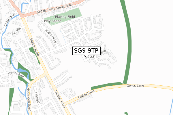
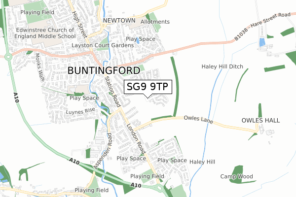
SG9 9TP maps


Licence: Open Government Licence (requires attribution)
Attribution: Contains OS data © Crown copyright and database right 2025
Source: Open Postcode Geo
Licence: Open Government Licence (requires attribution)
Attribution: Contains OS data © Crown copyright and database right 2025; Contains Royal Mail data © Royal Mail copyright and database right 2025; Source: Office for National Statistics licensed under the Open Government Licence v.3.0
SG9 9TP geodata
| Easting | 536724 |
| Northing | 229046 |
| Latitude | 51.943130 |
| Longitude | -0.012270 |
Where is SG9 9TP?
| Country | England |
| Postcode District | SG9 |
Politics
| Ward | Buntingford |
|---|---|
| Constituency | North East Hertfordshire |
House Prices
Sales of detached houses in SG9 9TP
2025 11 FEB £475,000 |
14, BORSBERRY WAY, BUNTINGFORD, SG9 9TP 2022 31 MAR £515,000 |
13, BORSBERRY WAY, BUNTINGFORD, SG9 9TP 2022 18 MAR £515,000 |
12, BORSBERRY WAY, BUNTINGFORD, SG9 9TP 2022 18 MAR £550,000 |
10, BORSBERRY WAY, BUNTINGFORD, SG9 9TP 2022 10 MAR £625,000 |
2022 10 MAR £450,000 |
1, BORSBERRY WAY, BUNTINGFORD, SG9 9TP 2022 13 JAN £720,000 |
15, BORSBERRY WAY, BUNTINGFORD, SG9 9TP 2021 21 DEC £560,000 |
9, BORSBERRY WAY, BUNTINGFORD, SG9 9TP 2021 10 DEC £615,000 |
16, BORSBERRY WAY, BUNTINGFORD, SG9 9TP 2021 19 NOV £710,000 |
Licence: Contains HM Land Registry data © Crown copyright and database right 2025. This data is licensed under the Open Government Licence v3.0.
Transport
Nearest bus stops to SG9 9TP
| Aspenden Road (Station Road) | Buntingford | 256m |
| Aspenden Road (Station Road) | Buntingford | 268m |
| Bridgefoot (Hare Street Road) | Buntingford | 363m |
| Bridgefoot (Hare Street Road) | Buntingford | 375m |
| Kingfisher Park (London Road) | Buntingford | 468m |
Deprivation
5.7% of English postcodes are less deprived than SG9 9TP:Food Standards Agency
Three nearest food hygiene ratings to SG9 9TP (metres)


➜ Get more ratings from the Food Standards Agency
Nearest post box to SG9 9TP
| Last Collection | |||
|---|---|---|---|
| Location | Mon-Fri | Sat | Distance |
| Layston Meadow | 17:00 | 09:30 | 238m |
| Sunny Hill | 17:15 | 07:15 | 349m |
| Buntingford Branch Office | 18:30 | 12:00 | 640m |
SG9 9TP ITL and SG9 9TP LAU
The below table lists the International Territorial Level (ITL) codes (formerly Nomenclature of Territorial Units for Statistics (NUTS) codes) and Local Administrative Units (LAU) codes for SG9 9TP:
| ITL 1 Code | Name |
|---|---|
| TLH | East |
| ITL 2 Code | Name |
| TLH2 | Bedfordshire and Hertfordshire |
| ITL 3 Code | Name |
| TLH23 | Hertfordshire CC |
| LAU 1 Code | Name |
| E07000242 | East Hertfordshire |
SG9 9TP census areas
The below table lists the Census Output Area (OA), Lower Layer Super Output Area (LSOA), and Middle Layer Super Output Area (MSOA) for SG9 9TP:
| Code | Name | |
|---|---|---|
| OA | E00119184 | |
| LSOA | E01023464 | East Hertfordshire 001B |
| MSOA | E02004878 | East Hertfordshire 001 |
Nearest postcodes to SG9 9TP
| SG9 9JQ | Snells Mead | 152m |
| SG9 9JD | Layston Meadow | 188m |
| SG9 9JG | Snells Mead | 191m |
| SG9 9JX | Plashes Drive | 207m |
| SG9 9JA | Owles Lane | 248m |
| SG9 9JH | Snells Mead | 253m |
| SG9 9JE | Snells Mead | 263m |
| SG9 9JF | Snells Mead | 266m |
| SG9 9JJ | London Road | 268m |
| SG9 9FS | Aspenden Road | 295m |