SG9 9RY maps, stats, and open data
SG9 9RY is located in the Buntingford electoral ward, within the local authority district of East Hertfordshire and the English Parliamentary constituency of North East Hertfordshire. The Sub Integrated Care Board (ICB) Location is NHS Hertfordshire and West Essex ICB - 06K and the police force is Hertfordshire. This postcode has been in use since February 2019.
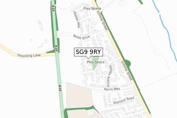
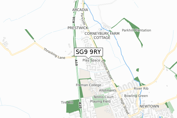
SG9 9RY maps


Licence: Open Government Licence (requires attribution)
Attribution: Contains OS data © Crown copyright and database right 2025
Source: Open Postcode Geo
Licence: Open Government Licence (requires attribution)
Attribution: Contains OS data © Crown copyright and database right 2025; Contains Royal Mail data © Royal Mail copyright and database right 2025; Source: Office for National Statistics licensed under the Open Government Licence v.3.0
SG9 9RY geodata
| Easting | 535621 |
| Northing | 230375 |
| Latitude | 51.955341 |
| Longitude | -0.027782 |
Where is SG9 9RY?
| Country | England |
| Postcode District | SG9 |
Politics
| Ward | Buntingford |
|---|---|
| Constituency | North East Hertfordshire |
House Prices
Sales of detached houses in SG9 9RY
2, ANSELL CLOSE, BUNTINGFORD, SG9 9RY 2019 27 SEP £718,995 |
1, ANSELL CLOSE, BUNTINGFORD, SG9 9RY 2019 29 MAY £724,995 |
4, ANSELL CLOSE, BUNTINGFORD, SG9 9RY 2019 22 FEB £629,995 |
3, ANSELL CLOSE, BUNTINGFORD, SG9 9RY 2019 22 FEB £744,995 |
Licence: Contains HM Land Registry data © Crown copyright and database right 2025. This data is licensed under the Open Government Licence v3.0.
Transport
Nearest bus stops to SG9 9RY
| Freman College (Bowling Green Lane) | Buntingford | 469m |
| Edwinstree C Of E Middle School (Bowling Green Lane) | Buntingford | 752m |
| Greenways (Baldock Road) | Buntingford | 917m |
| Greenways (Baldock Road) | Buntingford | 934m |
| The Crown Inn (High Street) | Buntingford | 1,208m |
Broadband
Broadband access in SG9 9RY (2020 data)
| Percentage of properties with Next Generation Access | 100.0% |
| Percentage of properties with Superfast Broadband | 100.0% |
| Percentage of properties with Ultrafast Broadband | 100.0% |
| Percentage of properties with Full Fibre Broadband | 100.0% |
Superfast Broadband is between 30Mbps and 300Mbps
Ultrafast Broadband is > 300Mbps
Broadband limitations in SG9 9RY (2020 data)
| Percentage of properties unable to receive 2Mbps | 0.0% |
| Percentage of properties unable to receive 5Mbps | 0.0% |
| Percentage of properties unable to receive 10Mbps | 0.0% |
| Percentage of properties unable to receive 30Mbps | 0.0% |
Deprivation
48.2% of English postcodes are less deprived than SG9 9RY:Food Standards Agency
Three nearest food hygiene ratings to SG9 9RY (metres)


➜ Get more ratings from the Food Standards Agency
Nearest post box to SG9 9RY
| Last Collection | |||
|---|---|---|---|
| Location | Mon-Fri | Sat | Distance |
| Vicarage Road | 17:15 | 07:30 | 628m |
| Greenways | 17:00 | 09:00 | 716m |
| Buntingford Branch Office | 18:30 | 12:00 | 1,118m |
SG9 9RY ITL and SG9 9RY LAU
The below table lists the International Territorial Level (ITL) codes (formerly Nomenclature of Territorial Units for Statistics (NUTS) codes) and Local Administrative Units (LAU) codes for SG9 9RY:
| ITL 1 Code | Name |
|---|---|
| TLH | East |
| ITL 2 Code | Name |
| TLH2 | Bedfordshire and Hertfordshire |
| ITL 3 Code | Name |
| TLH23 | Hertfordshire CC |
| LAU 1 Code | Name |
| E07000242 | East Hertfordshire |
SG9 9RY census areas
The below table lists the Census Output Area (OA), Lower Layer Super Output Area (LSOA), and Middle Layer Super Output Area (MSOA) for SG9 9RY:
| Code | Name | |
|---|---|---|
| OA | E00119337 | |
| LSOA | E01023494 | East Hertfordshire 002B |
| MSOA | E02004879 | East Hertfordshire 002 |
Nearest postcodes to SG9 9RY
| SG9 9GF | Applewood | 370m |
| SG9 9AZ | Ermine Street | 431m |
| SG9 9RT | Parkside | 520m |
| SG9 9FN | Woods Way | 545m |
| SG9 9TE | Aylotts Close | 590m |
| SG9 9BE | Vicarage Road | 630m |
| SG9 9TD | Freman Drive | 650m |
| SG9 9BD | Vicarage Road | 660m |
| SG9 9BB | Vicarage Road | 706m |
| SG9 9TA | Bowling Green Lane | 711m |