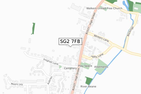
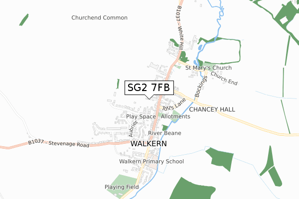
SG2 7FB is located in the Aston, Datchworth & Walkern electoral ward, within the local authority district of East Hertfordshire and the English Parliamentary constituency of North East Hertfordshire. The Sub Integrated Care Board (ICB) Location is NHS Hertfordshire and West Essex ICB - 06K and the police force is Hertfordshire. This postcode has been in use since April 2019.


GetTheData
Source: OS Open Zoomstack (Ordnance Survey)
Licence: Open Government Licence (requires attribution)
Attribution: Contains OS data © Crown copyright and database right 2025
Source: Open Postcode Geo
Licence: Open Government Licence (requires attribution)
Attribution: Contains OS data © Crown copyright and database right 2025; Contains Royal Mail data © Royal Mail copyright and database right 2025; Source: Office for National Statistics licensed under the Open Government Licence v.3.0
| Easting | 528580 |
| Northing | 226150 |
| Latitude | 51.919046 |
| Longitude | -0.131765 |
GetTheData
Source: Open Postcode Geo
Licence: Open Government Licence
| Country | England |
| Postcode District | SG2 |
➜ See where SG2 is on a map ➜ Where is Walkern? | |
GetTheData
Source: Land Registry Price Paid Data
Licence: Open Government Licence
| Ward | Aston, Datchworth & Walkern |
| Constituency | North East Hertfordshire |
GetTheData
Source: ONS Postcode Database
Licence: Open Government Licence
41, WALLACE GREEN WAY, WALKERN, STEVENAGE, SG2 7FB 2024 30 SEP £580,000 |
44, WALLACE GREEN WAY, WALKERN, STEVENAGE, SG2 7FB 2023 17 NOV £710,000 |
28, WALLACE GREEN WAY, WALKERN, STEVENAGE, SG2 7FB 2023 16 JUN £800,000 |
46, WALLACE GREEN WAY, WALKERN, STEVENAGE, SG2 7FB 2023 16 JUN £690,000 |
31, WALLACE GREEN WAY, WALKERN, STEVENAGE, SG2 7FB 2023 21 FEB £685,000 |
40, WALLACE GREEN WAY, WALKERN, STEVENAGE, SG2 7FB 2023 17 FEB £800,000 |
39, WALLACE GREEN WAY, WALKERN, STEVENAGE, SG2 7FB 2022 16 DEC £695,000 |
27, WALLACE GREEN WAY, WALKERN, STEVENAGE, SG2 7FB 2022 9 DEC £495,000 |
49, WALLACE GREEN WAY, WALKERN, STEVENAGE, SG2 7FB 2022 6 DEC £490,000 |
32, WALLACE GREEN WAY, WALKERN, STEVENAGE, SG2 7FB 2022 30 NOV £720,000 |
GetTheData
Source: HM Land Registry Price Paid Data
Licence: Contains HM Land Registry data © Crown copyright and database right 2025. This data is licensed under the Open Government Licence v3.0.
| Cherry Tree Rise (Stevenage Road) | Walkern | 247m |
| Cherry Tree Rise (Stevenage Road) | Walkern | 304m |
| Moors Ley (Stevenage Road) | Walkern | 341m |
| Moors Ley (Stevenage Road) | Walkern | 365m |
| Maltings (High Street) | Walkern | 459m |
GetTheData
Source: NaPTAN
Licence: Open Government Licence
GetTheData
Source: ONS Postcode Database
Licence: Open Government Licence


➜ Get more ratings from the Food Standards Agency
GetTheData
Source: Food Standards Agency
Licence: FSA terms & conditions
| Last Collection | |||
|---|---|---|---|
| Location | Mon-Fri | Sat | Distance |
| Stevenage Road | 16:45 | 09:45 | 224m |
| Walkern | 16:45 | 09:15 | 307m |
| Chells Manor | 18:45 | 12:00 | 2,029m |
GetTheData
Source: Dracos
Licence: Creative Commons Attribution-ShareAlike
The below table lists the International Territorial Level (ITL) codes (formerly Nomenclature of Territorial Units for Statistics (NUTS) codes) and Local Administrative Units (LAU) codes for SG2 7FB:
| ITL 1 Code | Name |
|---|---|
| TLH | East |
| ITL 2 Code | Name |
| TLH2 | Bedfordshire and Hertfordshire |
| ITL 3 Code | Name |
| TLH23 | Hertfordshire CC |
| LAU 1 Code | Name |
| E07000242 | East Hertfordshire |
GetTheData
Source: ONS Postcode Directory
Licence: Open Government Licence
The below table lists the Census Output Area (OA), Lower Layer Super Output Area (LSOA), and Middle Layer Super Output Area (MSOA) for SG2 7FB:
| Code | Name | |
|---|---|---|
| OA | E00119411 | |
| LSOA | E01023509 | East Hertfordshire 002E |
| MSOA | E02004879 | East Hertfordshire 002 |
GetTheData
Source: ONS Postcode Directory
Licence: Open Government Licence
| SG2 7PH | Froghall Lane | 138m |
| SG2 7NJ | Aubries | 141m |
| SG2 7NG | Moors Ley | 142m |
| SG2 7NQ | Moors Ley | 173m |
| SG2 7ND | Wenham Court | 201m |
| SG2 7NH | Stevenage Road | 204m |
| SG2 7JL | Cherry Tree Rise | 219m |
| SG2 7NN | Stevenage Road | 232m |
| SG2 7PJ | Brockwell Shott | 246m |
| SG2 7NU | High Street | 274m |
GetTheData
Source: Open Postcode Geo; Land Registry Price Paid Data
Licence: Open Government Licence