SG11 1DQ maps, stats, and open data
- Home
- Postcode
- SG
- SG11
- SG11 1
SG11 1DQ is located in the Braughing & Standon electoral ward, within the local authority district of East Hertfordshire and the English Parliamentary constituency of North East Hertfordshire. The Sub Integrated Care Board (ICB) Location is NHS Hertfordshire and West Essex ICB - 06K and the police force is Hertfordshire. This postcode has been in use since February 2019.
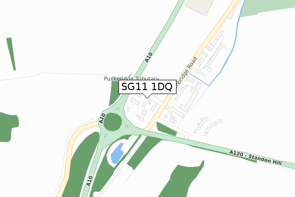
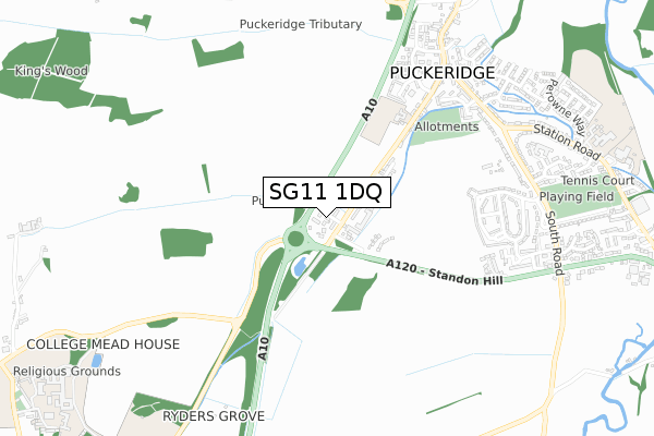
SG11 1DQ maps


Source: OS Open Zoomstack (Ordnance Survey)
Licence: Open Government Licence (requires attribution)
Attribution: Contains OS data © Crown copyright and database right 2025
Source: Open Postcode GeoLicence: Open Government Licence (requires attribution)
Attribution: Contains OS data © Crown copyright and database right 2025; Contains Royal Mail data © Royal Mail copyright and database right 2025; Source: Office for National Statistics licensed under the Open Government Licence v.3.0
SG11 1DQ geodata
| Easting | 538176 |
| Northing | 222718 |
| Latitude | 51.885911 |
| Longitude | 0.006305 |
Where is SG11 1DQ?
| Country | England |
| Postcode District | SG11 |
Politics
| Ward | Braughing & Standon |
|---|
| Constituency | North East Hertfordshire |
|---|
Transport
Nearest bus stops to SG11 1DQ
| Cambridge Road (Standon Hill) | Puckeridge | 138m |
| Cambridge Road (Standon Hill) | Puckeridge | 160m |
| The Crown & Falcon Ph (Station Road) | Puckeridge | 724m |
| The Crown & Falcon Ph (Station Road) | Puckeridge | 733m |
| Chapel Hall (Station Road) | Puckeridge | 809m |
Broadband
Broadband access in SG11 1DQ (2020 data)
| Percentage of properties with Next Generation Access | 100.0% |
| Percentage of properties with Superfast Broadband | 100.0% |
| Percentage of properties with Ultrafast Broadband | 0.0% |
| Percentage of properties with Full Fibre Broadband | 0.0% |
Superfast Broadband is between 30Mbps and 300Mbps
Ultrafast Broadband is > 300Mbps
Broadband speed in SG11 1DQ (2019 data)
Download
| Median download speed | 31.3Mbps |
| Average download speed | 43.3Mbps |
| Maximum download speed | 80.00Mbps |
Upload
| Median upload speed | 6.7Mbps |
| Average upload speed | 9.0Mbps |
| Maximum upload speed | 20.00Mbps |
Broadband limitations in SG11 1DQ (2020 data)
| Percentage of properties unable to receive 2Mbps | 0.0% |
| Percentage of properties unable to receive 5Mbps | 0.0% |
| Percentage of properties unable to receive 10Mbps | 0.0% |
| Percentage of properties unable to receive 30Mbps | 0.0% |
Deprivation
10.4% of English postcodes are less deprived than
SG11 1DQ:
Food Standards Agency
Three nearest food hygiene ratings to SG11 1DQ (metres)
St Thomas Of Canterbury Primary
St Thomas Of Canterbury Jmi School
479m
Crown And Falcon Inn
Puckeridge Local Store
➜ Get more ratings from the Food Standards Agency
Nearest post box to SG11 1DQ
| | Last Collection | |
|---|
| Location | Mon-Fri | Sat | Distance |
|---|
| Stanelow Crescent | 16:00 | 08:30 | 652m |
| Puckeridge | 16:15 | 10:45 | 738m |
| Station Road | 16:00 | 09:45 | 766m |
SG11 1DQ ITL and SG11 1DQ LAU
The below table lists the International Territorial Level (ITL) codes (formerly Nomenclature of Territorial Units for Statistics (NUTS) codes) and Local Administrative Units (LAU) codes for SG11 1DQ:
| ITL 1 Code | Name |
|---|
| TLH | East |
| ITL 2 Code | Name |
|---|
| TLH2 | Bedfordshire and Hertfordshire |
| ITL 3 Code | Name |
|---|
| TLH23 | Hertfordshire CC |
| LAU 1 Code | Name |
|---|
| E07000242 | East Hertfordshire |
SG11 1DQ census areas
The below table lists the Census Output Area (OA), Lower Layer Super Output Area (LSOA), and Middle Layer Super Output Area (MSOA) for SG11 1DQ:
| Code | Name |
|---|
| OA | E00119351 | |
|---|
| LSOA | E01023498 | East Hertfordshire 006A |
|---|
| MSOA | E02004883 | East Hertfordshire 006 |
|---|
Nearest postcodes to SG11 1DQ


