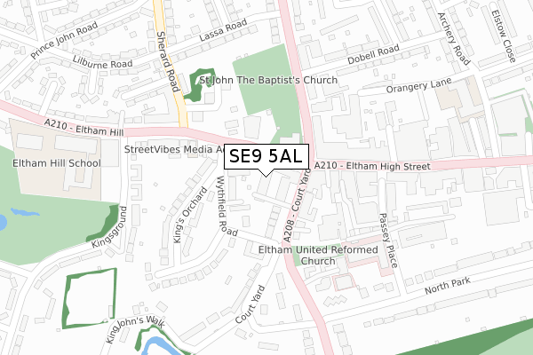
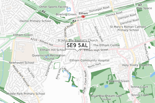
SE9 5AL is located in the Eltham Town & Avery Hill electoral ward, within the London borough of Greenwich and the English Parliamentary constituency of Eltham. The Sub Integrated Care Board (ICB) Location is NHS South East London ICB - 72Q and the police force is Metropolitan Police. This postcode has been in use since January 2018.


GetTheData
Source: OS Open Zoomstack (Ordnance Survey)
Licence: Open Government Licence (requires attribution)
Attribution: Contains OS data © Crown copyright and database right 2025
Source: Open Postcode Geo
Licence: Open Government Licence (requires attribution)
Attribution: Contains OS data © Crown copyright and database right 2025; Contains Royal Mail data © Royal Mail copyright and database right 2025; Source: Office for National Statistics licensed under the Open Government Licence v.3.0
| Easting | 542613 |
| Northing | 174396 |
| Latitude | 51.450596 |
| Longitude | 0.051020 |
GetTheData
Source: Open Postcode Geo
Licence: Open Government Licence
| Country | England |
| Postcode District | SE9 |
➜ See where SE9 is on a map ➜ Where is Eltham? | |
GetTheData
Source: Land Registry Price Paid Data
Licence: Open Government Licence
| Ward | Eltham Town & Avery Hill |
| Constituency | Eltham |
GetTheData
Source: ONS Postcode Database
Licence: Open Government Licence
| Eltham Church High Street (Eltham Hill) | Eltham | 42m |
| Eltham Church Court Yard (Court Yard) | Eltham | 62m |
| Eltham Church Court Yard (Court Yard) | Eltham | 75m |
| Eltham Church Well Hall Road (Well Hall Road) | Eltham | 116m |
| Eltham Church Well Hall Road (Well Hall Road) | Eltham | 130m |
| Eltham Station | 0.6km |
| Mottingham Station | 1.2km |
| New Eltham Station | 1.9km |
GetTheData
Source: NaPTAN
Licence: Open Government Licence
| Percentage of properties with Next Generation Access | 100.0% |
| Percentage of properties with Superfast Broadband | 100.0% |
| Percentage of properties with Ultrafast Broadband | 100.0% |
| Percentage of properties with Full Fibre Broadband | 100.0% |
Superfast Broadband is between 30Mbps and 300Mbps
Ultrafast Broadband is > 300Mbps
| Median download speed | 47.5Mbps |
| Average download speed | 49.0Mbps |
| Maximum download speed | 80.00Mbps |
| Median upload speed | 10.0Mbps |
| Average upload speed | 10.3Mbps |
| Maximum upload speed | 20.00Mbps |
| Percentage of properties unable to receive 2Mbps | 0.0% |
| Percentage of properties unable to receive 5Mbps | 0.0% |
| Percentage of properties unable to receive 10Mbps | 0.0% |
| Percentage of properties unable to receive 30Mbps | 0.0% |
GetTheData
Source: Ofcom
Licence: Ofcom Terms of Use (requires attribution)
GetTheData
Source: ONS Postcode Database
Licence: Open Government Licence


➜ Get more ratings from the Food Standards Agency
GetTheData
Source: Food Standards Agency
Licence: FSA terms & conditions
| Last Collection | |||
|---|---|---|---|
| Location | Mon-Fri | Sat | Distance |
| Well Hall Road | 17:30 | 12:00 | 112m |
| Post Office | 17:30 | 12:00 | 139m |
| Eltham Hill Baths | 17:30 | 12:00 | 172m |
GetTheData
Source: Dracos
Licence: Creative Commons Attribution-ShareAlike
The below table lists the International Territorial Level (ITL) codes (formerly Nomenclature of Territorial Units for Statistics (NUTS) codes) and Local Administrative Units (LAU) codes for SE9 5AL:
| ITL 1 Code | Name |
|---|---|
| TLI | London |
| ITL 2 Code | Name |
| TLI5 | Outer London - East and North East |
| ITL 3 Code | Name |
| TLI51 | Bexley and Greenwich |
| LAU 1 Code | Name |
| E09000011 | Greenwich |
GetTheData
Source: ONS Postcode Directory
Licence: Open Government Licence
The below table lists the Census Output Area (OA), Lower Layer Super Output Area (LSOA), and Middle Layer Super Output Area (MSOA) for SE9 5AL:
| Code | Name | |
|---|---|---|
| OA | E00008058 | |
| LSOA | E01001615 | Greenwich 028C |
| MSOA | E02000340 | Greenwich 028 |
GetTheData
Source: ONS Postcode Directory
Licence: Open Government Licence
| SE9 1BT | Eltham High Street | 33m |
| SE9 5TQ | Wythfield Road | 68m |
| SE9 5PZ | Court Yard | 75m |
| SE9 5PR | Court Yard | 91m |
| SE9 5PP | Court Yard | 110m |
| SE9 1DA | Eltham High Street | 122m |
| SE9 5TG | Wythfield Road | 129m |
| SE9 5TH | Kings Orchard | 139m |
| SE9 6SF | Well Hall Road | 147m |
| SE9 1UW | Eltham High Street | 151m |
GetTheData
Source: Open Postcode Geo; Land Registry Price Paid Data
Licence: Open Government Licence