SE24 9BN maps, stats, and open data
- Home
- Postcode
- SE
- SE24
- SE24 9
SE24 9BN is located in the Herne Hill & Loughborough Junction electoral ward, within the London borough of Lambeth and the English Parliamentary constituency of Dulwich and West Norwood. The Sub Integrated Care Board (ICB) Location is NHS South East London ICB - 72Q and the police force is Metropolitan Police. This postcode has been in use since September 2018.
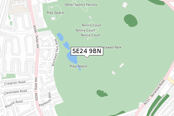
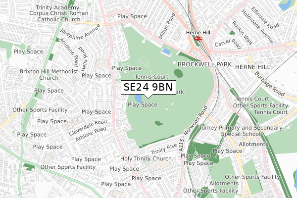
SE24 9BN maps


Source: OS Open Zoomstack (Ordnance Survey)
Licence: Open Government Licence (requires attribution)
Attribution: Contains OS data © Crown copyright and database right 2025
Source: Open Postcode GeoLicence: Open Government Licence (requires attribution)
Attribution: Contains OS data © Crown copyright and database right 2025; Contains Royal Mail data © Royal Mail copyright and database right 2025; Source: Office for National Statistics licensed under the Open Government Licence v.3.0
SE24 9BN geodata
| Easting | 531510 |
| Northing | 173975 |
| Latitude | 51.449498 |
| Longitude | -0.108826 |
Where is SE24 9BN?
| Country | England |
| Postcode District | SE24 |
Politics
| Ward | Herne Hill & Loughborough Junction |
|---|
| Constituency | Dulwich And West Norwood |
|---|
Transport
Nearest bus stops to SE24 9BN
| Craignair Road (Tulse Hill) | Tulse Hill | 303m |
| Craignair Road (Tulse Hill) | Tulse Hill | 329m |
| Jubilee Primary School (Tulse Hill) | Herne Hill | 345m |
| Jubilee Primary School (Tulse Hill) | Herne Hill | 367m |
| Brockwell Park Gardens (Norwood Road) | Tulse Hill | 426m |
Nearest underground/metro/tram to SE24 9BN
| Brixton Underground Station | Brixton | 1,518m |
Nearest railway stations to SE24 9BN
| Herne Hill Station | 0.6km |
| Tulse Hill Station | 1.1km |
| North Dulwich Station | 1.6km |
Deprivation
67.1% of English postcodes are less deprived than
SE24 9BN:
Food Standards Agency
Three nearest food hygiene ratings to SE24 9BN (metres)
First Come First Served
Brockwell Hall Brockwell Park
197m
Fabulous Coffee & Bar Co
Tesco
Petrol Filling Station
318m
➜ Get more ratings from the Food Standards Agency
Nearest post box to SE24 9BN
| | Last Collection | |
|---|
| Location | Mon-Fri | Sat | Distance |
|---|
| Tulse Hill | 17:30 | 12:00 | 417m |
| Dulwich Road | 17:30 | 12:00 | 511m |
| 89 Leander Road | 17:30 | 12:00 | 538m |
SE24 9BN ITL and SE24 9BN LAU
The below table lists the International Territorial Level (ITL) codes (formerly Nomenclature of Territorial Units for Statistics (NUTS) codes) and Local Administrative Units (LAU) codes for SE24 9BN:
| ITL 1 Code | Name |
|---|
| TLI | London |
| ITL 2 Code | Name |
|---|
| TLI4 | Inner London - East |
| ITL 3 Code | Name |
|---|
| TLI45 | Lambeth |
| LAU 1 Code | Name |
|---|
| E09000022 | Lambeth |
SE24 9BN census areas
The below table lists the Census Output Area (OA), Lower Layer Super Output Area (LSOA), and Middle Layer Super Output Area (MSOA) for SE24 9BN:
| Code | Name |
|---|
| OA | E00015490 | |
|---|
| LSOA | E01003074 | Lambeth 018E |
|---|
| MSOA | E02000635 | Lambeth 018 |
|---|
Nearest postcodes to SE24 9BN


