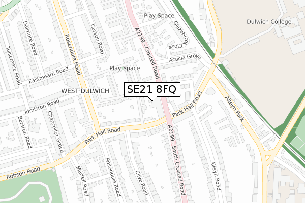
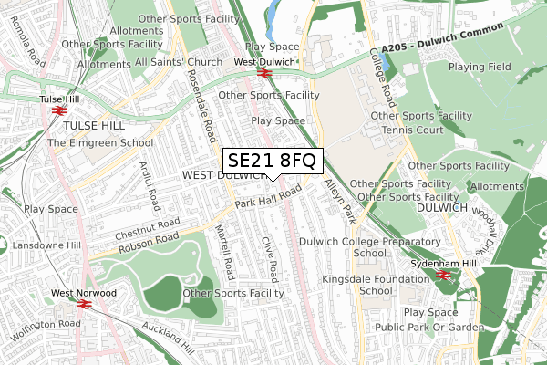
SE21 8FQ is located in the West Dulwich electoral ward, within the London borough of Lambeth and the English Parliamentary constituency of Dulwich and West Norwood. The Sub Integrated Care Board (ICB) Location is NHS South East London ICB - 72Q and the police force is Metropolitan Police. This postcode has been in use since April 2020.


GetTheData
Source: OS Open Zoomstack (Ordnance Survey)
Licence: Open Government Licence (requires attribution)
Attribution: Contains OS data © Crown copyright and database right 2025
Source: Open Postcode Geo
Licence: Open Government Licence (requires attribution)
Attribution: Contains OS data © Crown copyright and database right 2025; Contains Royal Mail data © Royal Mail copyright and database right 2025; Source: Office for National Statistics licensed under the Open Government Licence v.3.0
| Easting | 532538 |
| Northing | 172179 |
| Latitude | 51.433118 |
| Longitude | -0.094712 |
GetTheData
Source: Open Postcode Geo
Licence: Open Government Licence
| Country | England |
| Postcode District | SE21 |
➜ See where SE21 is on a map ➜ Where is London? | |
GetTheData
Source: Land Registry Price Paid Data
Licence: Open Government Licence
| Ward | West Dulwich |
| Constituency | Dulwich And West Norwood |
GetTheData
Source: ONS Postcode Database
Licence: Open Government Licence
| Martell Road | West Dulwich | 203m |
| Park Hall Road Rosendale Road | West Dulwich | 205m |
| Martell Road | West Dulwich | 233m |
| South Croxted Road | West Dulwich | 341m |
| Robson Road | West Norwood | 360m |
| West Norwood Station | 0.7km |
| West Dulwich Station | 0.9km |
| Sydenham Hill Station | 1km |
GetTheData
Source: NaPTAN
Licence: Open Government Licence
GetTheData
Source: ONS Postcode Database
Licence: Open Government Licence


➜ Get more ratings from the Food Standards Agency
GetTheData
Source: Food Standards Agency
Licence: FSA terms & conditions
| Last Collection | |||
|---|---|---|---|
| Location | Mon-Fri | Sat | Distance |
| Clive Road | 17:30 | 12:00 | 246m |
| Rosendale Road | 17:30 | 12:00 | 254m |
| Rosendale Road | 17:30 | 12:00 | 306m |
GetTheData
Source: Dracos
Licence: Creative Commons Attribution-ShareAlike
The below table lists the International Territorial Level (ITL) codes (formerly Nomenclature of Territorial Units for Statistics (NUTS) codes) and Local Administrative Units (LAU) codes for SE21 8FQ:
| ITL 1 Code | Name |
|---|---|
| TLI | London |
| ITL 2 Code | Name |
| TLI4 | Inner London - East |
| ITL 3 Code | Name |
| TLI45 | Lambeth |
| LAU 1 Code | Name |
| E09000022 | Lambeth |
GetTheData
Source: ONS Postcode Directory
Licence: Open Government Licence
The below table lists the Census Output Area (OA), Lower Layer Super Output Area (LSOA), and Middle Layer Super Output Area (MSOA) for SE21 8FQ:
| Code | Name | |
|---|---|---|
| OA | E00015478 | |
| LSOA | E01003064 | Lambeth 028A |
| MSOA | E02000645 | Lambeth 028 |
GetTheData
Source: ONS Postcode Directory
Licence: Open Government Licence
| SE21 8EE | Martell Road | 52m |
| SE21 8ED | Martell Road | 56m |
| SE21 8DE | Tritton Road | 92m |
| SE21 8DT | Rosendale Road | 126m |
| SE21 8EB | Myton Road | 128m |
| SE21 8DS | Rosendale Road | 128m |
| SE21 8DU | Rosendale Road | 131m |
| SE27 9PA | Vale Street | 155m |
| SE21 8DY | Rosendale Road | 160m |
| SE21 8DR | Rosendale Road | 170m |
GetTheData
Source: Open Postcode Geo; Land Registry Price Paid Data
Licence: Open Government Licence