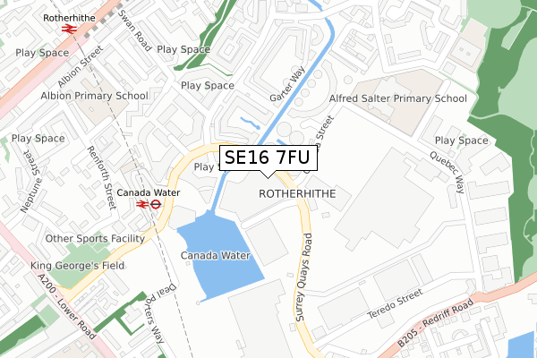
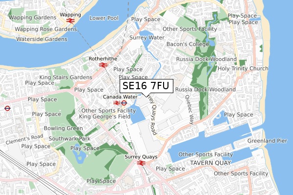
SE16 7FU is located in the Rotherhithe electoral ward, within the London borough of Southwark and the English Parliamentary constituency of Bermondsey and Old Southwark. The Sub Integrated Care Board (ICB) Location is NHS South East London ICB - 72Q and the police force is Metropolitan Police. This postcode has been in use since July 2018.


GetTheData
Source: OS Open Zoomstack (Ordnance Survey)
Licence: Open Government Licence (requires attribution)
Attribution: Contains OS data © Crown copyright and database right 2025
Source: Open Postcode Geo
Licence: Open Government Licence (requires attribution)
Attribution: Contains OS data © Crown copyright and database right 2025; Contains Royal Mail data © Royal Mail copyright and database right 2025; Source: Office for National Statistics licensed under the Open Government Licence v.3.0
| Easting | 535679 |
| Northing | 179513 |
| Latitude | 51.498282 |
| Longitude | -0.046742 |
GetTheData
Source: Open Postcode Geo
Licence: Open Government Licence
| Country | England |
| Postcode District | SE16 |
➜ See where SE16 is on a map ➜ Where is London? | |
GetTheData
Source: Land Registry Price Paid Data
Licence: Open Government Licence
| Ward | Rotherhithe |
| Constituency | Bermondsey And Old Southwark |
GetTheData
Source: ONS Postcode Database
Licence: Open Government Licence
| Canada Street | Canada Water | 30m |
| Canada Street (Surrey Quays Road) | Canada Water | 99m |
| Canada Water Bus Station | Canada Water | 221m |
| Canada Water Bus Station | Canada Water | 221m |
| Canada Water Bus Station | Canada Water | 224m |
| Canada Water Underground Station | Canada Water | 208m |
| Bermondsey Underground Station | Bermondsey | 1,181m |
| Shadwell Dlr Station (Martha Street) | Shadwell | 1,642m |
| Westferry Dlr Station (Westferry Road) | Westferry | 1,863m |
| Canada Water Station | 0.2km |
| Rotherhithe Station | 0.5km |
| Surrey Quays Station | 0.6km |
GetTheData
Source: NaPTAN
Licence: Open Government Licence
| Percentage of properties with Next Generation Access | 100.0% |
| Percentage of properties with Superfast Broadband | 100.0% |
| Percentage of properties with Ultrafast Broadband | 70.0% |
| Percentage of properties with Full Fibre Broadband | 70.0% |
Superfast Broadband is between 30Mbps and 300Mbps
Ultrafast Broadband is > 300Mbps
| Percentage of properties unable to receive 2Mbps | 0.0% |
| Percentage of properties unable to receive 5Mbps | 0.0% |
| Percentage of properties unable to receive 10Mbps | 0.0% |
| Percentage of properties unable to receive 30Mbps | 0.0% |
GetTheData
Source: Ofcom
Licence: Ofcom Terms of Use (requires attribution)
GetTheData
Source: ONS Postcode Database
Licence: Open Government Licence


➜ Get more ratings from the Food Standards Agency
GetTheData
Source: Food Standards Agency
Licence: FSA terms & conditions
| Last Collection | |||
|---|---|---|---|
| Location | Mon-Fri | Sat | Distance |
| Timber Pond Road | 17:30 | 12:00 | 393m |
| Albion Street | 17:30 | 12:00 | 394m |
| Surrey Quays Shopping Centre | 18:30 | 12:00 | 394m |
GetTheData
Source: Dracos
Licence: Creative Commons Attribution-ShareAlike
The below table lists the International Territorial Level (ITL) codes (formerly Nomenclature of Territorial Units for Statistics (NUTS) codes) and Local Administrative Units (LAU) codes for SE16 7FU:
| ITL 1 Code | Name |
|---|---|
| TLI | London |
| ITL 2 Code | Name |
| TLI4 | Inner London - East |
| ITL 3 Code | Name |
| TLI44 | Lewisham and Southwark |
| LAU 1 Code | Name |
| E09000028 | Southwark |
GetTheData
Source: ONS Postcode Directory
Licence: Open Government Licence
The below table lists the Census Output Area (OA), Lower Layer Super Output Area (LSOA), and Middle Layer Super Output Area (MSOA) for SE16 7FU:
| Code | Name | |
|---|---|---|
| OA | E00167486 | |
| LSOA | E01004031 | Southwark 007B |
| MSOA | E02000813 | Southwark 007 |
GetTheData
Source: ONS Postcode Directory
Licence: Open Government Licence
| SE16 6RJ | Water Gardens Square | 46m |
| SE16 6RL | Water Gardens Square | 51m |
| SE16 6RH | Water Gardens Square | 53m |
| SE16 6RN | Water Gardens Square | 78m |
| SE16 6YL | Woodland Crescent | 83m |
| SE16 6RG | Water Gardens Square | 91m |
| SE16 6YH | Woodland Crescent | 94m |
| SE16 7AJ | Surrey Quays Road | 98m |
| SE16 6RF | Water Gardens Square | 98m |
| SE16 6YR | Woodland Crescent | 111m |
GetTheData
Source: Open Postcode Geo; Land Registry Price Paid Data
Licence: Open Government Licence