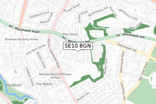
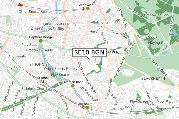
SE10 8GN is located in the Blackheath electoral ward, within the London borough of Lewisham and the English Parliamentary constituency of Lewisham East. The Sub Integrated Care Board (ICB) Location is NHS South East London ICB - 72Q and the police force is Metropolitan Police. This postcode has been in use since February 2018.


GetTheData
Source: OS Open Zoomstack (Ordnance Survey)
Licence: Open Government Licence (requires attribution)
Attribution: Contains OS data © Crown copyright and database right 2025
Source: Open Postcode Geo
Licence: Open Government Licence (requires attribution)
Attribution: Contains OS data © Crown copyright and database right 2025; Contains Royal Mail data © Royal Mail copyright and database right 2025; Source: Office for National Statistics licensed under the Open Government Licence v.3.0
| Easting | 538116 |
| Northing | 176633 |
| Latitude | 51.471812 |
| Longitude | -0.012782 |
GetTheData
Source: Open Postcode Geo
Licence: Open Government Licence
| Country | England |
| Postcode District | SE10 |
➜ See where SE10 is on a map ➜ Where is London? | |
GetTheData
Source: Land Registry Price Paid Data
Licence: Open Government Licence
| Ward | Blackheath |
| Constituency | Lewisham East |
GetTheData
Source: ONS Postcode Database
Licence: Open Government Licence
| Lewisham Road | Greenwich | 105m |
| Sparta Street (Lewisham Road) | Deptford Bridge | 143m |
| Lewisham Road (Blackheath Hill) | Greenwich | 147m |
| Sparta Street (Lewisham Road) | Deptford Bridge | 162m |
| Greenwich South Street Blackheath Road (Greenwich South Street) | Greenwich | 231m |
| Elverson Road Dlr Station (Elverson Road) | Elverson Road | 409m |
| Greenwich Dlr Station (Greenwich High Road) | Greenwich | 700m |
| Deptford Bridge Dlr Station (Deptford Bridge) | Deptford Bridge | 720m |
| Lewisham Dlr Station (Loampit Vale) | Lewisham | 795m |
| Cutty Sark (For Maritime Greenwich) Dlr Station (Creek Road) | Greenwich | 1,105m |
| Lewisham Station | 0.7km |
| Greenwich Station | 0.7km |
| St Johns (London) Station | 0.7km |
GetTheData
Source: NaPTAN
Licence: Open Government Licence
| Percentage of properties with Next Generation Access | 100.0% |
| Percentage of properties with Superfast Broadband | 100.0% |
| Percentage of properties with Ultrafast Broadband | 100.0% |
| Percentage of properties with Full Fibre Broadband | 100.0% |
Superfast Broadband is between 30Mbps and 300Mbps
Ultrafast Broadband is > 300Mbps
| Median download speed | 12.9Mbps |
| Average download speed | 12.0Mbps |
| Maximum download speed | 15.12Mbps |
| Median upload speed | 1.1Mbps |
| Average upload speed | 1.1Mbps |
| Maximum upload speed | 1.23Mbps |
| Percentage of properties unable to receive 2Mbps | 0.0% |
| Percentage of properties unable to receive 5Mbps | 0.0% |
| Percentage of properties unable to receive 10Mbps | 0.0% |
| Percentage of properties unable to receive 30Mbps | 0.0% |
GetTheData
Source: Ofcom
Licence: Ofcom Terms of Use (requires attribution)
GetTheData
Source: ONS Postcode Database
Licence: Open Government Licence


➜ Get more ratings from the Food Standards Agency
GetTheData
Source: Food Standards Agency
Licence: FSA terms & conditions
| Last Collection | |||
|---|---|---|---|
| Location | Mon-Fri | Sat | Distance |
| Post Office | 17:30 | 12:00 | 195m |
| Dartmouth Row | 17:30 | 12:00 | 292m |
| Dartmouth Row | 17:30 | 12:00 | 323m |
GetTheData
Source: Dracos
Licence: Creative Commons Attribution-ShareAlike
The below table lists the International Territorial Level (ITL) codes (formerly Nomenclature of Territorial Units for Statistics (NUTS) codes) and Local Administrative Units (LAU) codes for SE10 8GN:
| ITL 1 Code | Name |
|---|---|
| TLI | London |
| ITL 2 Code | Name |
| TLI4 | Inner London - East |
| ITL 3 Code | Name |
| TLI44 | Lewisham and Southwark |
| LAU 1 Code | Name |
| E09000023 | Lewisham |
GetTheData
Source: ONS Postcode Directory
Licence: Open Government Licence
The below table lists the Census Output Area (OA), Lower Layer Super Output Area (LSOA), and Middle Layer Super Output Area (MSOA) for SE10 8GN:
| Code | Name | |
|---|---|---|
| OA | E00016202 | |
| LSOA | E01003204 | Lewisham 007C |
| MSOA | E02000659 | Lewisham 007 |
GetTheData
Source: ONS Postcode Directory
Licence: Open Government Licence
| SE10 8DS | Sparta Street | 19m |
| SE10 8EU | Blackheath Hill | 43m |
| SE10 8EN | Blackheath Hill | 78m |
| SE10 8TG | Blackheath Hill | 80m |
| SE10 8TF | Dabin Crescent | 110m |
| SE10 8FN | Parkside Avenue | 115m |
| SE10 8TQ | Blackheath Hill | 115m |
| SE10 8AD | Blackheath Hill | 127m |
| SE10 8FP | Parkside Avenue | 131m |
| SE10 8DN | Robinscroft Mews | 147m |
GetTheData
Source: Open Postcode Geo; Land Registry Price Paid Data
Licence: Open Government Licence