Property/Postcode Data Search:
SA62 6FH maps, stats, and open data
SA62 6FH is located in the St David's electoral ward, within the unitary authority of Pembrokeshire and the Welsh Parliamentary constituency of Preseli Pembrokeshire. The Local Health Board is Hywel Dda University and the police force is Dyfed-Powys. This postcode has been in use since April 2020.
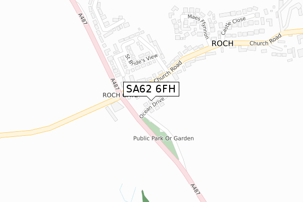
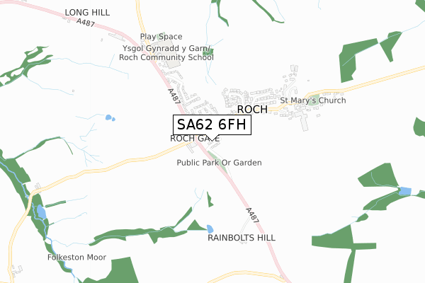
SA62 6FH maps


Source: OS Open Zoomstack (Ordnance Survey)
Licence: Open Government Licence (requires attribution)
Attribution: Contains OS data © Crown copyright and database right 2025
Source: Open Postcode Geo
Licence: Open Government Licence (requires attribution)
Attribution: Contains OS data © Crown copyright and database right 2025; Contains Royal Mail data © Royal Mail copyright and database right 2025; Source: Office for National Statistics licensed under the Open Government Licence v.3.0
Licence: Open Government Licence (requires attribution)
Attribution: Contains OS data © Crown copyright and database right 2025
Source: Open Postcode Geo
Licence: Open Government Licence (requires attribution)
Attribution: Contains OS data © Crown copyright and database right 2025; Contains Royal Mail data © Royal Mail copyright and database right 2025; Source: Office for National Statistics licensed under the Open Government Licence v.3.0
SA62 6FH geodata
| Easting | 175999 |
| Northing | 225634 |
| Latitude | 51.884162 |
| Longitude | -5.256283 |
Where is SA62 6FH?
| Country | Wales |
| Postcode District | SA62 |
Politics
| Ward | St David's |
|---|---|
| Constituency | Preseli Pembrokeshire |
Transport
Nearest bus stops to SA62 6FH
| St David`s Sch (A487) | St David's | 341m |
| St David`s School (A487) | St David's | 350m |
| New Street Playground (New Street) | St David's | 477m |
| Grove Car Park (Gounds) | St David's | 487m |
| St David`s Tourist Ic (High Street) | St David's | 505m |
Deprivation
34.5% of Welsh postcodes are less deprived than SA62 6FH:Food Standards Agency
Three nearest food hygiene ratings to SA62 6FH (metres)
MamGu Welshcakes

Unit 10 Glasfryn Road Business Park Glasfryn Road
0m
Halen Dewi - St Davids Sea Salt

Unit 4 St Davids Assemblies Ltd Glasfryn Road
100m
St Davids Dairy

St Davids Assemblies Ltd Glasfryn Road
100m
➜ Get more ratings from the Food Standards Agency
Nearest post box to SA62 6FH
| Last Collection | |||
|---|---|---|---|
| Location | Mon-Fri | Sat | Distance |
| New St | 15:30 | 12:00 | 434m |
| High St | 12:30 | 12:30 | 546m |
| St. Davids P O | 16:00 | 12:15 | 625m |
SA62 6FH ITL and SA62 6FH LAU
The below table lists the International Territorial Level (ITL) codes (formerly Nomenclature of Territorial Units for Statistics (NUTS) codes) and Local Administrative Units (LAU) codes for SA62 6FH:
| ITL 1 Code | Name |
|---|---|
| TLL | Wales |
| ITL 2 Code | Name |
| TLL1 | West Wales and The Valleys |
| ITL 3 Code | Name |
| TLL14 | South West Wales |
| LAU 1 Code | Name |
| W06000009 | Pembrokeshire |
SA62 6FH census areas
The below table lists the Census Output Area (OA), Lower Layer Super Output Area (LSOA), and Middle Layer Super Output Area (MSOA) for SA62 6FH:
| Code | Name | |
|---|---|---|
| OA | W00003284 | |
| LSOA | W01000612 | Pembrokeshire 003C |
| MSOA | W02000128 | Pembrokeshire 003 |
Nearest postcodes to SA62 6FH
| SA62 6QF | Glasfryn Road | 203m |
| SA62 6NZ | Heol Dewi | 210m |
| SA62 6PA | Maes Dewi | 265m |
| SA62 6QG | Maes Y Mynach | 288m |
| SA62 6NY | Heol Dewi | 297m |
| SA62 6BS | Nun Street | 301m |
| SA62 6QH | Millard Park | 317m |
| SA62 6PB | Noddfa Dewi | 342m |
| SA62 6BP | Nun Street | 349m |
| SA62 6BT | 356m |