Property/Postcode Data Search:
SA14 7RQ maps, stats, and open data
SA14 7RQ is located in the Penygroes electoral ward, within the unitary authority of Carmarthenshire and the Welsh Parliamentary constituency of Carmarthen East and Dinefwr. The Local Health Board is Hywel Dda University and the police force is Dyfed-Powys. This postcode has been in use since August 2019.
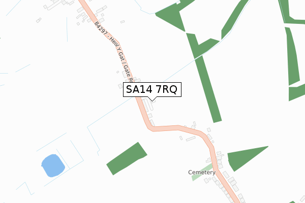
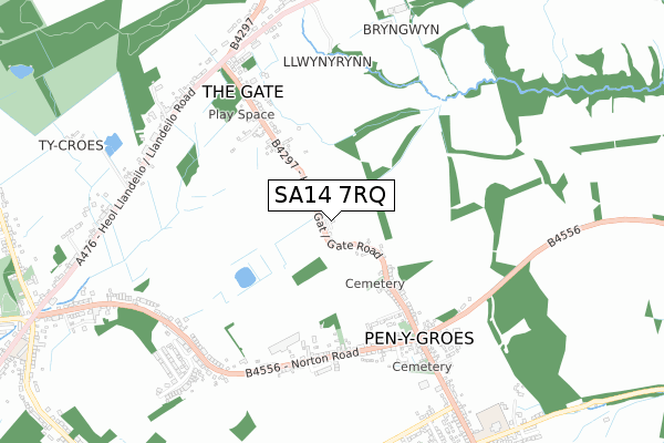
SA14 7RQ maps


Source: OS Open Zoomstack (Ordnance Survey)
Licence: Open Government Licence (requires attribution)
Attribution: Contains OS data © Crown copyright and database right 2025
Source: Open Postcode Geo
Licence: Open Government Licence (requires attribution)
Attribution: Contains OS data © Crown copyright and database right 2025; Contains Royal Mail data © Royal Mail copyright and database right 2025; Source: Office for National Statistics licensed under the Open Government Licence v.3.0
Licence: Open Government Licence (requires attribution)
Attribution: Contains OS data © Crown copyright and database right 2025
Source: Open Postcode Geo
Licence: Open Government Licence (requires attribution)
Attribution: Contains OS data © Crown copyright and database right 2025; Contains Royal Mail data © Royal Mail copyright and database right 2025; Source: Office for National Statistics licensed under the Open Government Licence v.3.0
SA14 7RQ geodata
| Easting | 258159 |
| Northing | 214129 |
| Latitude | 51.807760 |
| Longitude | -4.058796 |
Where is SA14 7RQ?
| Country | Wales |
| Postcode District | SA14 |
Politics
| Ward | Penygroes |
|---|---|
| Constituency | Carmarthen East And Dinefwr |
Transport
Nearest bus stops to SA14 7RQ
| Pumping Station (Heol Y Gat) | Pen-y-groes | 60m |
| Pumping Station (Heol Y Gat) | Pen-y-groes | 67m |
| Bryn-y-fuwch (Gate Road) | Pen-y-groes | 284m |
| Bryn-y-fuwch (Gate Road) | Pen-y-groes | 289m |
| Farmers Arms (Norton Road) | Pen-y-groes | 525m |
Nearest railway stations to SA14 7RQ
| Llandybie Station | 4.1km |
| Ammanford Station | 4.5km |
| Pantyffynnon Station | 5.3km |
Deprivation
29.1% of Welsh postcodes are less deprived than SA14 7RQ:Food Standards Agency
Three nearest food hygiene ratings to SA14 7RQ (metres)
Penygroes Newsagents & Post Office

16 Norton Road
526m
Cafe Cath

10 Bridge Street
633m
GORSLAS SERVICE STATION

Llandeilo Road
786m
➜ Get more ratings from the Food Standards Agency
Nearest post box to SA14 7RQ
| Last Collection | |||
|---|---|---|---|
| Location | Mon-Fri | Sat | Distance |
| Penygroes Post Office | 16:00 | 10:15 | 531m |
| Gate Road | 15:45 | 10:15 | 729m |
| Gorslas Post Office | 16:00 | 10:30 | 1,201m |
SA14 7RQ ITL and SA14 7RQ LAU
The below table lists the International Territorial Level (ITL) codes (formerly Nomenclature of Territorial Units for Statistics (NUTS) codes) and Local Administrative Units (LAU) codes for SA14 7RQ:
| ITL 1 Code | Name |
|---|---|
| TLL | Wales |
| ITL 2 Code | Name |
| TLL1 | West Wales and The Valleys |
| ITL 3 Code | Name |
| TLL14 | South West Wales |
| LAU 1 Code | Name |
| W06000010 | Carmarthenshire |
SA14 7RQ census areas
The below table lists the Census Output Area (OA), Lower Layer Super Output Area (LSOA), and Middle Layer Super Output Area (MSOA) for SA14 7RQ:
| Code | Name | |
|---|---|---|
| OA | W00003832 | |
| LSOA | W01000712 | Carmarthenshire 015D |
| MSOA | W02000156 | Carmarthenshire 015 |
Nearest postcodes to SA14 7RQ
| SA14 7RN | Gate Road | 70m |
| SA14 7RL | Gate Road | 409m |
| SA14 7RT | Norton Road | 487m |
| SA14 7RW | Gate Road | 490m |
| SA14 7RS | Norton Road | 524m |
| SA14 7RU | Norton Road | 582m |
| SA14 7RY | Plas Gwyn Road | 599m |
| SA14 7RP | Bridge Street | 619m |
| SA14 7LG | 694m | |
| SA14 7LH | The Crescent | 696m |