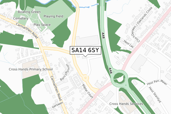
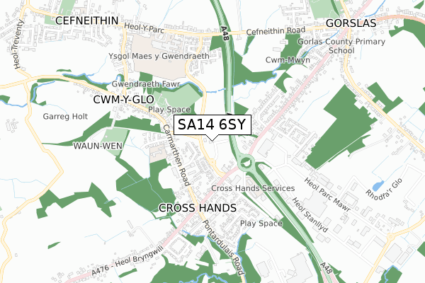
SA14 6SY lies on Carmarthen Road in Cross Hands, Llanelli. SA14 6SY is located in the Llannon electoral ward, within the unitary authority of Carmarthenshire and the Welsh Parliamentary constituency of Llanelli. The Local Health Board is Hywel Dda University and the police force is Dyfed-Powys. This postcode has been in use since August 2017.


GetTheData
Source: OS Open Zoomstack (Ordnance Survey)
Licence: Open Government Licence (requires attribution)
Attribution: Contains OS data © Crown copyright and database right 2025
Source: Open Postcode Geo
Licence: Open Government Licence (requires attribution)
Attribution: Contains OS data © Crown copyright and database right 2025; Contains Royal Mail data © Royal Mail copyright and database right 2025; Source: Office for National Statistics licensed under the Open Government Licence v.3.0
| Easting | 256232 |
| Northing | 213173 |
| Latitude | 51.798678 |
| Longitude | -4.086330 |
GetTheData
Source: Open Postcode Geo
Licence: Open Government Licence
| Street | Carmarthen Road |
| Locality | Cross Hands |
| Town/City | Llanelli |
| Country | Wales |
| Postcode District | SA14 |
➜ See where SA14 is on a map | |
GetTheData
Source: Land Registry Price Paid Data
Licence: Open Government Licence
| Ward | Llannon |
| Constituency | Llanelli |
GetTheData
Source: ONS Postcode Database
Licence: Open Government Licence
| Primary School (Carmarthen Road) | Cross Hands | 268m |
| Primary School (Carmarthen Road) | Cross Hands | 279m |
| Club (Heol Llandeilo) | Cross Hands | 294m |
| Club (Heol Llandeilo) | Cross Hands | 315m |
| Gwernllwyn Country Club (Llandeilo Road) | Cross Hands | 321m |
GetTheData
Source: NaPTAN
Licence: Open Government Licence
GetTheData
Source: ONS Postcode Database
Licence: Open Government Licence


➜ Get more ratings from the Food Standards Agency
GetTheData
Source: Food Standards Agency
Licence: FSA terms & conditions
| Last Collection | |||
|---|---|---|---|
| Location | Mon-Fri | Sat | Distance |
| Cross Hands Post Office | 16:00 | 10:45 | 462m |
| Business Park | 16:15 | 09:00 | 534m |
| Garreg Hollt | 16:30 | 10:30 | 561m |
GetTheData
Source: Dracos
Licence: Creative Commons Attribution-ShareAlike
The below table lists the International Territorial Level (ITL) codes (formerly Nomenclature of Territorial Units for Statistics (NUTS) codes) and Local Administrative Units (LAU) codes for SA14 6SY:
| ITL 1 Code | Name |
|---|---|
| TLL | Wales |
| ITL 2 Code | Name |
| TLL1 | West Wales and The Valleys |
| ITL 3 Code | Name |
| TLL14 | South West Wales |
| LAU 1 Code | Name |
| W06000010 | Carmarthenshire |
GetTheData
Source: ONS Postcode Directory
Licence: Open Government Licence
The below table lists the Census Output Area (OA), Lower Layer Super Output Area (LSOA), and Middle Layer Super Output Area (MSOA) for SA14 6SY:
| Code | Name | |
|---|---|---|
| OA | W00003749 | |
| LSOA | W01000697 | Carmarthenshire 015A |
| MSOA | W02000156 | Carmarthenshire 015 |
GetTheData
Source: ONS Postcode Directory
Licence: Open Government Licence
| SA14 6ST | Bancyffynnon | 201m |
| SA14 6RD | Llandeilo Road | 220m |
| SA14 6RG | Heol Las | 221m |
| SA14 6SU | Carmarthen Road | 322m |
| SA14 6RN | Clos Y Dderwen | 337m |
| SA14 6SZ | Tir Y Dderwen | 363m |
| SA14 6RH | Cross Hands Road | 381m |
| SA14 6NA | Llandeilo Road | 393m |
| SA14 6SP | Carmarthen Road | 420m |
| SA14 6RW | Cross Hands Road | 435m |
GetTheData
Source: Open Postcode Geo; Land Registry Price Paid Data
Licence: Open Government Licence