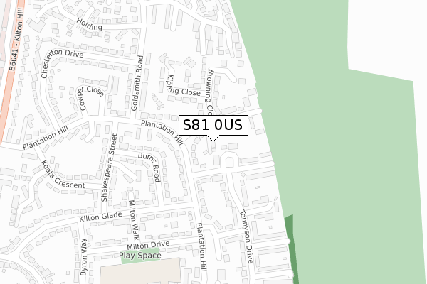
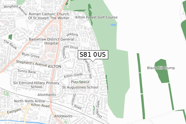
S81 0US is located in the Worksop East electoral ward, within the local authority district of Bassetlaw and the English Parliamentary constituency of Bassetlaw. The Sub Integrated Care Board (ICB) Location is NHS Nottingham and Nottinghamshire ICB - 02Q and the police force is Nottinghamshire. This postcode has been in use since August 2019.


GetTheData
Source: OS Open Zoomstack (Ordnance Survey)
Licence: Open Government Licence (requires attribution)
Attribution: Contains OS data © Crown copyright and database right 2025
Source: Open Postcode Geo
Licence: Open Government Licence (requires attribution)
Attribution: Contains OS data © Crown copyright and database right 2025; Contains Royal Mail data © Royal Mail copyright and database right 2025; Source: Office for National Statistics licensed under the Open Government Licence v.3.0
| Easting | 459938 |
| Northing | 380032 |
| Latitude | 53.313859 |
| Longitude | -1.101815 |
GetTheData
Source: Open Postcode Geo
Licence: Open Government Licence
| Country | England |
| Postcode District | S81 |
➜ See where S81 is on a map ➜ Where is Worksop? | |
GetTheData
Source: Land Registry Price Paid Data
Licence: Open Government Licence
| Ward | Worksop East |
| Constituency | Bassetlaw |
GetTheData
Source: ONS Postcode Database
Licence: Open Government Licence
2020 3 JUL £165,000 |
4, LIME TREE MEWS, WORKSOP, S81 0US 2019 13 SEP £165,000 |
GetTheData
Source: HM Land Registry Price Paid Data
Licence: Contains HM Land Registry data © Crown copyright and database right 2025. This data is licensed under the Open Government Licence v3.0.
| Thackeray Close (Plantation Hill) | Kilton | 92m |
| Coleridge Road (Plantation Hill) | Kilton | 93m |
| Thackeray Close (Plantation Hill) | Kilton | 108m |
| Goldsmith Road | Kilton | 201m |
| Goldsmith Road (Plantation Hill) | Kilton | 218m |
| Worksop Station | 1.4km |
| Shireoaks Station | 4.6km |
GetTheData
Source: NaPTAN
Licence: Open Government Licence
GetTheData
Source: ONS Postcode Database
Licence: Open Government Licence


➜ Get more ratings from the Food Standards Agency
GetTheData
Source: Food Standards Agency
Licence: FSA terms & conditions
| Last Collection | |||
|---|---|---|---|
| Location | Mon-Fri | Sat | Distance |
| Goldsmith Road | 16:00 | 10:30 | 209m |
| Kilton Post Office | 17:00 | 11:30 | 417m |
| Larwood | 16:00 | 10:30 | 595m |
GetTheData
Source: Dracos
Licence: Creative Commons Attribution-ShareAlike
The below table lists the International Territorial Level (ITL) codes (formerly Nomenclature of Territorial Units for Statistics (NUTS) codes) and Local Administrative Units (LAU) codes for S81 0US:
| ITL 1 Code | Name |
|---|---|
| TLF | East Midlands (England) |
| ITL 2 Code | Name |
| TLF1 | Derbyshire and Nottinghamshire |
| ITL 3 Code | Name |
| TLF15 | North Nottinghamshire |
| LAU 1 Code | Name |
| E07000171 | Bassetlaw |
GetTheData
Source: ONS Postcode Directory
Licence: Open Government Licence
The below table lists the Census Output Area (OA), Lower Layer Super Output Area (LSOA), and Middle Layer Super Output Area (MSOA) for S81 0US:
| Code | Name | |
|---|---|---|
| OA | E00142884 | |
| LSOA | E01028043 | Bassetlaw 014C |
| MSOA | E02005848 | Bassetlaw 014 |
GetTheData
Source: ONS Postcode Directory
Licence: Open Government Licence
| S81 0QP | Thackeray Close | 39m |
| S81 0QR | Plantation Hill | 50m |
| S81 0QS | Coleridge Road | 65m |
| S81 0QN | Plantation Hill | 104m |
| S81 0QW | Thackeray Close | 108m |
| S81 0EB | Tennyson Drive | 129m |
| S81 0QL | Plantation Hill | 130m |
| S81 0QT | Browning Close | 135m |
| S81 0QZ | Plantation Hill | 142m |
| S81 0EA | Tennyson Drive | 143m |
GetTheData
Source: Open Postcode Geo; Land Registry Price Paid Data
Licence: Open Government Licence