Property/Postcode Data Search:
S75 3UD maps, stats, and open data
S75 3UD is located in the Dodworth electoral ward, within the metropolitan district of Barnsley and the English Parliamentary constituency of Penistone and Stocksbridge. The Sub Integrated Care Board (ICB) Location is NHS South Yorkshire ICB - 02P and the police force is South Yorkshire. This postcode has been in use since June 2019.
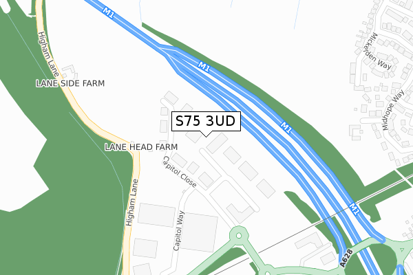
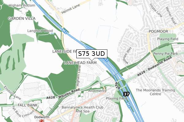
S75 3UD maps


Source: OS Open Zoomstack (Ordnance Survey)
Licence: Open Government Licence (requires attribution)
Attribution: Contains OS data © Crown copyright and database right 2025
Source: Open Postcode Geo
Licence: Open Government Licence (requires attribution)
Attribution: Contains OS data © Crown copyright and database right 2025; Contains Royal Mail data © Royal Mail copyright and database right 2025; Source: Office for National Statistics licensed under the Open Government Licence v.3.0
Licence: Open Government Licence (requires attribution)
Attribution: Contains OS data © Crown copyright and database right 2025
Source: Open Postcode Geo
Licence: Open Government Licence (requires attribution)
Attribution: Contains OS data © Crown copyright and database right 2025; Contains Royal Mail data © Royal Mail copyright and database right 2025; Source: Office for National Statistics licensed under the Open Government Licence v.3.0
S75 3UD geodata
| Easting | 431804 |
| Northing | 406179 |
| Latitude | 53.551302 |
| Longitude | -1.521442 |
Where is S75 3UD?
| Country | England |
| Postcode District | S75 |
Politics
| Ward | Dodworth |
|---|---|
| Constituency | Penistone And Stocksbridge |
Transport
Nearest bus stops to S75 3UD
| South Road (Barnsley Road) | Dodworth | 427m |
| South Road (Barnsley Road) | Dodworth | 443m |
| Park Hill Grove (Barnsley Road) | Dodworth | 464m |
| Park Hill Grove (Barnsley Road) | Dodworth | 488m |
| Higham Lane (Barnsley Road) | Dodworth | 605m |
Nearest railway stations to S75 3UD
| Dodworth Station | 1km |
| Barnsley Station | 3km |
| Silkstone Common Station | 3.3km |
Deprivation
61.5% of English postcodes are less deprived than S75 3UD:Food Standards Agency
Three nearest food hygiene ratings to S75 3UD (metres)
NHSBT Barnsley

Unit D
210m
Dodworth Valley

Toby Carvery Dodworth Valley
416m
Aspire in the Community

Gate Inn
465m
➜ Get more ratings from the Food Standards Agency
Nearest post box to S75 3UD
| Last Collection | |||
|---|---|---|---|
| Location | Mon-Fri | Sat | Distance |
| 26 South Road | 16:00 | 08:30 | 591m |
| 85 Barnsley Road | 16:00 | 08:30 | 699m |
| Westmoor Crescent | 16:45 | 11:15 | 794m |
S75 3UD ITL and S75 3UD LAU
The below table lists the International Territorial Level (ITL) codes (formerly Nomenclature of Territorial Units for Statistics (NUTS) codes) and Local Administrative Units (LAU) codes for S75 3UD:
| ITL 1 Code | Name |
|---|---|
| TLE | Yorkshire and The Humber |
| ITL 2 Code | Name |
| TLE3 | South Yorkshire |
| ITL 3 Code | Name |
| TLE31 | Barnsley, Doncaster and Rotherham |
| LAU 1 Code | Name |
| E08000016 | Barnsley |
S75 3UD census areas
The below table lists the Census Output Area (OA), Lower Layer Super Output Area (LSOA), and Middle Layer Super Output Area (MSOA) for S75 3UD:
| Code | Name | |
|---|---|---|
| OA | E00037402 | |
| LSOA | E01007382 | Barnsley 019A |
| MSOA | E02001527 | Barnsley 019 |
Nearest postcodes to S75 3UD
| S75 3UB | Capitol Close | 127m |
| S75 3TZ | Capitol Court | 182m |
| S75 2JR | Pogmoor Lane | 339m |
| S75 2LY | Drury Farm Court | 381m |
| S75 2JS | Hunters Cottages | 381m |
| S75 1PN | Higham Lane | 399m |
| S75 3LF | Castle View | 417m |
| S75 2LX | Ancote Close | 417m |
| S75 2LS | Midhope Way | 438m |
| S75 3LE | The Gate | 445m |