Property/Postcode Data Search:
S75 3BZ maps, stats, and open data
S75 3BZ is located in the Penistone East electoral ward, within the metropolitan district of Barnsley and the English Parliamentary constituency of Penistone and Stocksbridge. The Sub Integrated Care Board (ICB) Location is NHS South Yorkshire ICB - 02P and the police force is South Yorkshire. This postcode has been in use since March 2018.
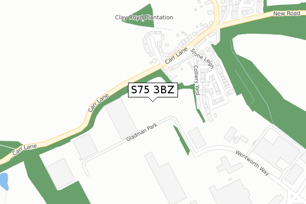
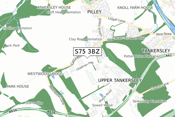
S75 3BZ maps


Source: OS Open Zoomstack (Ordnance Survey)
Licence: Open Government Licence (requires attribution)
Attribution: Contains OS data © Crown copyright and database right 2025
Source: Open Postcode Geo
Licence: Open Government Licence (requires attribution)
Attribution: Contains OS data © Crown copyright and database right 2025; Contains Royal Mail data © Royal Mail copyright and database right 2025; Source: Office for National Statistics licensed under the Open Government Licence v.3.0
Licence: Open Government Licence (requires attribution)
Attribution: Contains OS data © Crown copyright and database right 2025
Source: Open Postcode Geo
Licence: Open Government Licence (requires attribution)
Attribution: Contains OS data © Crown copyright and database right 2025; Contains Royal Mail data © Royal Mail copyright and database right 2025; Source: Office for National Statistics licensed under the Open Government Licence v.3.0
S75 3BZ geodata
| Easting | 433406 |
| Northing | 399861 |
| Latitude | 53.494417 |
| Longitude | -1.497934 |
Where is S75 3BZ?
| Country | England |
| Postcode District | S75 |
Politics
| Ward | Penistone East |
|---|---|
| Constituency | Penistone And Stocksbridge |
Transport
Nearest bus stops to S75 3BZ
| Pilley Green (New Road) | Pilley | 374m |
| New Road (Carr Lane) | Pilley | 396m |
| Maple Road | Tankersley | 562m |
| Lidgett Lane (Pilley Green) | Pilley | 562m |
| Lidgett Lane (Pilley Green) | Pilley | 566m |
Nearest railway stations to S75 3BZ
| Chapeltown Station | 4.1km |
| Elsecar Station | 4.7km |
| Silkstone Common Station | 6.3km |
Deprivation
51% of English postcodes are less deprived than S75 3BZ:Food Standards Agency
Three nearest food hygiene ratings to S75 3BZ (metres)
Community Shop - Mobile

Shop And Warehouse Company Shop Ltd
339m
Baxterstorey - Mercedes Benz

Mercedes Benz
478m
Company Shop

Shop And Warehouse The Company Shop
479m
➜ Get more ratings from the Food Standards Agency
Nearest post box to S75 3BZ
| Last Collection | |||
|---|---|---|---|
| Location | Mon-Fri | Sat | Distance |
| Pilley Green | 16:45 | 10:30 | 410m |
| Wentworth Way | 18:45 | 10:30 | 598m |
| Wentworth Way | 18:45 | 635m | |
S75 3BZ ITL and S75 3BZ LAU
The below table lists the International Territorial Level (ITL) codes (formerly Nomenclature of Territorial Units for Statistics (NUTS) codes) and Local Administrative Units (LAU) codes for S75 3BZ:
| ITL 1 Code | Name |
|---|---|
| TLE | Yorkshire and The Humber |
| ITL 2 Code | Name |
| TLE3 | South Yorkshire |
| ITL 3 Code | Name |
| TLE31 | Barnsley, Doncaster and Rotherham |
| LAU 1 Code | Name |
| E08000016 | Barnsley |
S75 3BZ census areas
The below table lists the Census Output Area (OA), Lower Layer Super Output Area (LSOA), and Middle Layer Super Output Area (MSOA) for S75 3BZ:
| Code | Name | |
|---|---|---|
| OA | E00037619 | |
| LSOA | E01007424 | Barnsley 028E |
| MSOA | E02001536 | Barnsley 028 |
Nearest postcodes to S75 3BZ
| S75 3BG | Princess Grove | 232m |
| S75 3BA | Stone Row Court | 232m |
| S75 3BD | Stone Leigh | 261m |
| S75 3BE | Carr Lane | 266m |
| S75 3AE | Pilley Green | 474m |
| S75 3AB | Pilley Green | 489m |
| S75 3AZ | Silkstone Close | 524m |
| S35 7DE | 603m | |
| S75 3AY | Wharncliffe Court | 659m |
| S75 3AG | Lidgett Lane | 705m |