Property/Postcode Data Search:
S71 5AF maps, stats, and open data
S71 5AF is located in the Stairfoot electoral ward, within the metropolitan district of Barnsley and the English Parliamentary constituency of Barnsley East. The Sub Integrated Care Board (ICB) Location is NHS South Yorkshire ICB - 02P and the police force is South Yorkshire. This postcode has been in use since July 2018.
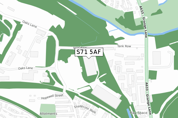
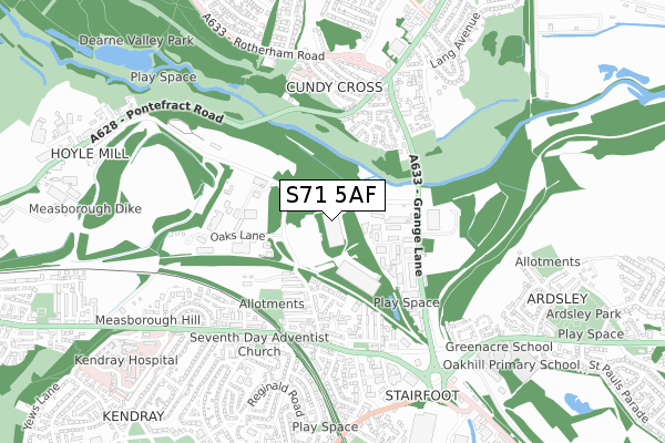
S71 5AF maps


Source: OS Open Zoomstack (Ordnance Survey)
Licence: Open Government Licence (requires attribution)
Attribution: Contains OS data © Crown copyright and database right 2025
Source: Open Postcode Geo
Licence: Open Government Licence (requires attribution)
Attribution: Contains OS data © Crown copyright and database right 2025; Contains Royal Mail data © Royal Mail copyright and database right 2025; Source: Office for National Statistics licensed under the Open Government Licence v.3.0
Licence: Open Government Licence (requires attribution)
Attribution: Contains OS data © Crown copyright and database right 2025
Source: Open Postcode Geo
Licence: Open Government Licence (requires attribution)
Attribution: Contains OS data © Crown copyright and database right 2025; Contains Royal Mail data © Royal Mail copyright and database right 2025; Source: Office for National Statistics licensed under the Open Government Licence v.3.0
S71 5AF geodata
| Easting | 436899 |
| Northing | 406105 |
| Latitude | 53.550306 |
| Longitude | -1.444554 |
Where is S71 5AF?
| Country | England |
| Postcode District | S71 |
Politics
| Ward | Stairfoot |
|---|---|
| Constituency | Barnsley East |
Transport
Nearest bus stops to S71 5AF
| Cherrys Road (Pontefract Road) | Cundy Cross | 425m |
| Raymond Road (Doncaster Road) | Kendray | 469m |
| Cherrys Road (Pontefract Road) | Cundy Cross | 494m |
| Gordon Street (Doncaster Road) | Stairfoot | 501m |
| Hunningley Close (Doncaster Road) | Stairfoot | 511m |
Nearest railway stations to S71 5AF
| Barnsley Station | 2.2km |
| Wombwell Station | 4.1km |
Deprivation
81.6% of English postcodes are less deprived than S71 5AF:Food Standards Agency
Three nearest food hygiene ratings to S71 5AF (metres)
PRL Logistics
Warehouse 2
0m
Wards Cash and Carry

Unit 15 Oaks Business Park
348m
The Mill of the Black Monks

The Old Mill
396m
➜ Get more ratings from the Food Standards Agency
Nearest post box to S71 5AF
| Last Collection | |||
|---|---|---|---|
| Location | Mon-Fri | Sat | Distance |
| Stairfoot Post Office | 17:10 | 11:45 | 506m |
| Lundwood Post Office | 17:00 | 12:00 | 514m |
| 241 Doncaster Road | 16:00 | 11:00 | 650m |
S71 5AF ITL and S71 5AF LAU
The below table lists the International Territorial Level (ITL) codes (formerly Nomenclature of Territorial Units for Statistics (NUTS) codes) and Local Administrative Units (LAU) codes for S71 5AF:
| ITL 1 Code | Name |
|---|---|
| TLE | Yorkshire and The Humber |
| ITL 2 Code | Name |
| TLE3 | South Yorkshire |
| ITL 3 Code | Name |
| TLE31 | Barnsley, Doncaster and Rotherham |
| LAU 1 Code | Name |
| E08000016 | Barnsley |
S71 5AF census areas
The below table lists the Census Output Area (OA), Lower Layer Super Output Area (LSOA), and Middle Layer Super Output Area (MSOA) for S71 5AF:
| Code | Name | |
|---|---|---|
| OA | E00037093 | |
| LSOA | E01007322 | Barnsley 015C |
| MSOA | E02001523 | Barnsley 015 |
Nearest postcodes to S71 5AF
| S70 3ES | Hoyle Mill Road | 256m |
| S70 3FE | Sheepcote Walk | 265m |
| S70 3ET | Hopewell Street | 273m |
| S70 3ER | Conway Street | 290m |
| S70 3EN | Hoyle Mill Road | 308m |
| S70 3FH | Rosedene Close | 323m |
| S70 3EP | Victoria Street | 350m |
| S70 3EL | Hoyle Mill Road | 364m |
| S70 3EW | Foster Street | 370m |
| S70 3PT | School Street | 380m |