Property/Postcode Data Search:
S70 1EG maps, stats, and open data
S70 1EG is located in the Kingstone electoral ward, within the metropolitan district of Barnsley and the English Parliamentary constituency of Barnsley Central. The Sub Integrated Care Board (ICB) Location is NHS South Yorkshire ICB - 02P and the police force is South Yorkshire. This postcode has been in use since September 2019.
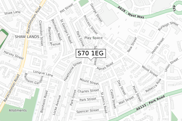
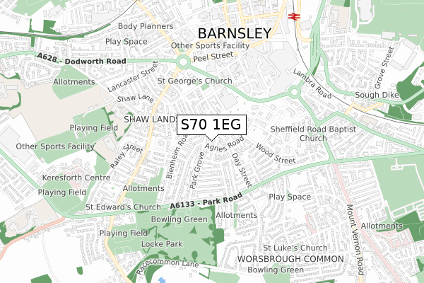
S70 1EG maps


Source: OS Open Zoomstack (Ordnance Survey)
Licence: Open Government Licence (requires attribution)
Attribution: Contains OS data © Crown copyright and database right 2025
Source: Open Postcode Geo
Licence: Open Government Licence (requires attribution)
Attribution: Contains OS data © Crown copyright and database right 2025; Contains Royal Mail data © Royal Mail copyright and database right 2025; Source: Office for National Statistics licensed under the Open Government Licence v.3.0
Licence: Open Government Licence (requires attribution)
Attribution: Contains OS data © Crown copyright and database right 2025
Source: Open Postcode Geo
Licence: Open Government Licence (requires attribution)
Attribution: Contains OS data © Crown copyright and database right 2025; Contains Royal Mail data © Royal Mail copyright and database right 2025; Source: Office for National Statistics licensed under the Open Government Licence v.3.0
S70 1EG geodata
| Easting | 434243 |
| Northing | 405807 |
| Latitude | 53.547806 |
| Longitude | -1.484671 |
Where is S70 1EG?
| Country | England |
| Postcode District | S70 |
Politics
| Ward | Kingstone |
|---|---|
| Constituency | Barnsley Central |
Transport
Nearest bus stops to S70 1EG
| Princess Street (New Street) | Barnsley Town Centre | 215m |
| Joseph Street (New Street) | Barnsley Town Centre | 235m |
| Sheffield Road (West Way) | Barnsley Town Centre | 318m |
| West Way (Upper New Street) | Barnsley Town Centre | 339m |
| Allatt Close (Wood Street) | Worsbrough Common | 342m |
Nearest railway stations to S70 1EG
| Barnsley Station | 0.9km |
| Dodworth Station | 3.1km |
| Darton Station | 5.5km |
Deprivation
85.3% of English postcodes are less deprived than S70 1EG:Food Standards Agency
Three nearest food hygiene ratings to S70 1EG (metres)
Heaven and Ale

66 Agnes Road
59m
Agnes Road Premier

50-52 Agnes Road
122m
The New Orient Express

48 Agnes Road
122m
➜ Get more ratings from the Food Standards Agency
Nearest post box to S70 1EG
| Last Collection | |||
|---|---|---|---|
| Location | Mon-Fri | Sat | Distance |
| Post Office | 18:30 | 11:00 | 93m |
| Princess Street | 18:30 | 10:45 | 313m |
| Park Road | 18:30 | 11:00 | 356m |
S70 1EG ITL and S70 1EG LAU
The below table lists the International Territorial Level (ITL) codes (formerly Nomenclature of Territorial Units for Statistics (NUTS) codes) and Local Administrative Units (LAU) codes for S70 1EG:
| ITL 1 Code | Name |
|---|---|
| TLE | Yorkshire and The Humber |
| ITL 2 Code | Name |
| TLE3 | South Yorkshire |
| ITL 3 Code | Name |
| TLE31 | Barnsley, Doncaster and Rotherham |
| LAU 1 Code | Name |
| E08000016 | Barnsley |
S70 1EG census areas
The below table lists the Census Output Area (OA), Lower Layer Super Output Area (LSOA), and Middle Layer Super Output Area (MSOA) for S70 1EG:
| Code | Name | |
|---|---|---|
| OA | E00037583 | |
| LSOA | E01007417 | Barnsley 013D |
| MSOA | E02001521 | Barnsley 013 |
Nearest postcodes to S70 1EG
| S70 1QB | Park Grove | 36m |
| S70 1PE | Spring Street | 58m |
| S70 1NJ | Agnes Road | 60m |
| S70 1PB | Spring Street | 83m |
| S70 1NY | Peasehill Close | 110m |
| S70 1NH | Agnes Road | 111m |
| S70 1PD | Saville Terrace | 116m |
| S70 1QE | Park Grove | 117m |
| S70 1NU | Nursery Street | 123m |
| S70 1QA | Park Grove | 126m |