Property/Postcode Data Search:
S70 1DR maps, stats, and open data
S70 1DR is located in the Central electoral ward, within the metropolitan district of Barnsley and the English Parliamentary constituency of Barnsley Central. The Sub Integrated Care Board (ICB) Location is NHS South Yorkshire ICB - 02P and the police force is South Yorkshire. This postcode has been in use since February 2019.
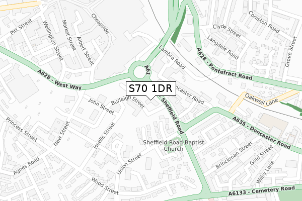
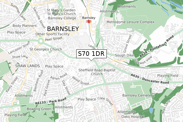
S70 1DR maps


Source: OS Open Zoomstack (Ordnance Survey)
Licence: Open Government Licence (requires attribution)
Attribution: Contains OS data © Crown copyright and database right 2025
Source: Open Postcode Geo
Licence: Open Government Licence (requires attribution)
Attribution: Contains OS data © Crown copyright and database right 2025; Contains Royal Mail data © Royal Mail copyright and database right 2025; Source: Office for National Statistics licensed under the Open Government Licence v.3.0
Licence: Open Government Licence (requires attribution)
Attribution: Contains OS data © Crown copyright and database right 2025
Source: Open Postcode Geo
Licence: Open Government Licence (requires attribution)
Attribution: Contains OS data © Crown copyright and database right 2025; Contains Royal Mail data © Royal Mail copyright and database right 2025; Source: Office for National Statistics licensed under the Open Government Licence v.3.0
S70 1DR geodata
| Easting | 434766 |
| Northing | 406004 |
| Latitude | 53.549543 |
| Longitude | -1.476757 |
Where is S70 1DR?
| Country | England |
| Postcode District | S70 |
Politics
| Ward | Central |
|---|---|
| Constituency | Barnsley Central |
Transport
Nearest bus stops to S70 1DR
| West Way (Sheffield Road) | Barnsley Town Centre | 26m |
| Taylor Row (Sheffield Road) | Barnsley Town Centre | 69m |
| Taylor Row (Sheffield Road) | Barnsley Town Centre | 80m |
| New Street (West Way) | Barnsley Town Centre | 138m |
| West Way (Upper New Street) | Barnsley Town Centre | 250m |
Nearest railway stations to S70 1DR
| Barnsley Station | 0.5km |
| Dodworth Station | 3.7km |
| Wombwell Station | 5.4km |
Deprivation
79.8% of English postcodes are less deprived than S70 1DR:Food Standards Agency
Three nearest food hygiene ratings to S70 1DR (metres)
Raja Barnsley

36-38 Sheffield Road
56m
Ab'z
34b Sheffield Road
56m
Manx Arms

32 Sheffield Road
56m
➜ Get more ratings from the Food Standards Agency
Nearest post box to S70 1DR
| Last Collection | |||
|---|---|---|---|
| Location | Mon-Fri | Sat | Distance |
| Union Court | 18:30 | 11:00 | 171m |
| New Street | 19:00 | 11:00 | 241m |
| St Peters Church | 18:30 | 11:00 | 365m |
S70 1DR ITL and S70 1DR LAU
The below table lists the International Territorial Level (ITL) codes (formerly Nomenclature of Territorial Units for Statistics (NUTS) codes) and Local Administrative Units (LAU) codes for S70 1DR:
| ITL 1 Code | Name |
|---|---|
| TLE | Yorkshire and The Humber |
| ITL 2 Code | Name |
| TLE3 | South Yorkshire |
| ITL 3 Code | Name |
| TLE31 | Barnsley, Doncaster and Rotherham |
| LAU 1 Code | Name |
| E08000016 | Barnsley |
S70 1DR census areas
The below table lists the Census Output Area (OA), Lower Layer Super Output Area (LSOA), and Middle Layer Super Output Area (MSOA) for S70 1DR:
| Code | Name | |
|---|---|---|
| OA | E00037180 | |
| LSOA | E01007340 | Barnsley 013B |
| MSOA | E02001521 | Barnsley 013 |
Nearest postcodes to S70 1DR
| S70 1HP | Sheffield Road | 54m |
| S70 1TH | Doncaster Road | 73m |
| S70 1JL | Copper Close | 82m |
| S70 1HS | Sheffield Road | 104m |
| S70 1JR | Britannia Close | 113m |
| S70 1TL | Doncaster Road | 125m |
| S70 1HU | Quarry Street | 141m |
| S70 1JP | Duke Crescent | 187m |
| S70 1TW | Doncaster Road | 194m |
| S70 1JW | Duke Crescent | 200m |