Property/Postcode Data Search:
S66 1BU maps, stats, and open data
S66 1BU is located in the Thurcroft & Wickersley South electoral ward, within the metropolitan district of Rotherham and the English Parliamentary constituency of Rother Valley. The Sub Integrated Care Board (ICB) Location is NHS South Yorkshire ICB - 03L and the police force is South Yorkshire. This postcode has been in use since February 2020.
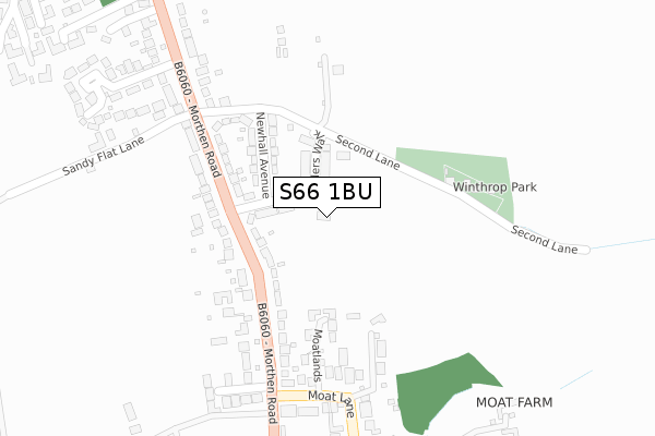
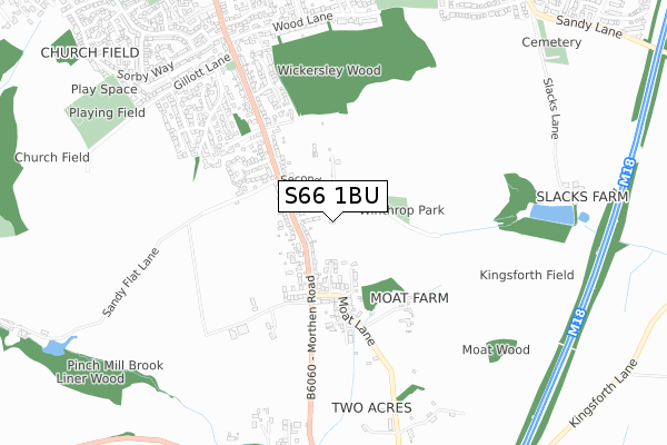
S66 1BU maps


Source: OS Open Zoomstack (Ordnance Survey)
Licence: Open Government Licence (requires attribution)
Attribution: Contains OS data © Crown copyright and database right 2025
Source: Open Postcode Geo
Licence: Open Government Licence (requires attribution)
Attribution: Contains OS data © Crown copyright and database right 2025; Contains Royal Mail data © Royal Mail copyright and database right 2025; Source: Office for National Statistics licensed under the Open Government Licence v.3.0
Licence: Open Government Licence (requires attribution)
Attribution: Contains OS data © Crown copyright and database right 2025
Source: Open Postcode Geo
Licence: Open Government Licence (requires attribution)
Attribution: Contains OS data © Crown copyright and database right 2025; Contains Royal Mail data © Royal Mail copyright and database right 2025; Source: Office for National Statistics licensed under the Open Government Licence v.3.0
S66 1BU geodata
| Easting | 448429 |
| Northing | 390751 |
| Latitude | 53.411375 |
| Longitude | -1.272906 |
Where is S66 1BU?
| Country | England |
| Postcode District | S66 |
Politics
| Ward | Thurcroft & Wickersley South |
|---|---|
| Constituency | Rother Valley |
House Prices
Sales of detached houses in S66 1BU
2023 30 OCT £390,000 |
1, SYLVESTER AVENUE, WICKERSLEY, ROTHERHAM, S66 1BU 2022 4 NOV £422,495 |
3, SYLVESTER AVENUE, WICKERSLEY, ROTHERHAM, S66 1BU 2022 30 SEP £365,995 |
5, SYLVESTER AVENUE, WICKERSLEY, ROTHERHAM, S66 1BU 2022 30 SEP £359,995 |
9, SYLVESTER AVENUE, WICKERSLEY, ROTHERHAM, S66 1BU 2022 26 AUG £493,495 |
7, SYLVESTER AVENUE, WICKERSLEY, ROTHERHAM, S66 1BU 2022 26 AUG £354,995 |
6, SYLVESTER AVENUE, WICKERSLEY, ROTHERHAM, S66 1BU 2022 30 JUN £370,995 |
8, SYLVESTER AVENUE, WICKERSLEY, ROTHERHAM, S66 1BU 2022 30 JUN £300,495 |
10, SYLVESTER AVENUE, WICKERSLEY, ROTHERHAM, S66 1BU 2022 30 JUN £349,995 |
2022 1 JUN £389,995 |
Source: HM Land Registry Price Paid Data
Licence: Contains HM Land Registry data © Crown copyright and database right 2025. This data is licensed under the Open Government Licence v3.0.
Licence: Contains HM Land Registry data © Crown copyright and database right 2025. This data is licensed under the Open Government Licence v3.0.
Transport
Nearest bus stops to S66 1BU
| Nethermoor Drive (Morthen Road) | Wickersley | 154m |
| Nethermoor Drive (Morthen Road) | Wickersley | 189m |
| Moat Lane (Morthen Road) | Morthen | 235m |
| Moat Lane (Morthen Road) | Morthen | 286m |
| Newhall Avenue (Morthen Road) | Wickersley | 299m |
Deprivation
57.9% of English postcodes are less deprived than S66 1BU:Food Standards Agency
Three nearest food hygiene ratings to S66 1BU (metres)
Wickersley Social Club

40 Morthen Road
882m
Wickersley St Albans C of E J & I School

Morthen Road
1,125m
Breakfast Club Wickersley Kids' Club

St Albans Church Of England Primary School
1,160m
➜ Get more ratings from the Food Standards Agency
Nearest post box to S66 1BU
| Last Collection | |||
|---|---|---|---|
| Location | Mon-Fri | Sat | Distance |
| Morthen Road | 16:30 | 12:00 | 169m |
| Morthen Road | 16:00 | 11:00 | 728m |
| 52 Sorby Way | 16:00 | 11:15 | 925m |
S66 1BU ITL and S66 1BU LAU
The below table lists the International Territorial Level (ITL) codes (formerly Nomenclature of Territorial Units for Statistics (NUTS) codes) and Local Administrative Units (LAU) codes for S66 1BU:
| ITL 1 Code | Name |
|---|---|
| TLE | Yorkshire and The Humber |
| ITL 2 Code | Name |
| TLE3 | South Yorkshire |
| ITL 3 Code | Name |
| TLE31 | Barnsley, Doncaster and Rotherham |
| LAU 1 Code | Name |
| E08000018 | Rotherham |
S66 1BU census areas
The below table lists the Census Output Area (OA), Lower Layer Super Output Area (LSOA), and Middle Layer Super Output Area (MSOA) for S66 1BU:
| Code | Name | |
|---|---|---|
| OA | E00038956 | |
| LSOA | E01007687 | Rotherham 022B |
| MSOA | E02001599 | Rotherham 022 |
Nearest postcodes to S66 1BU
| S66 1EB | Nethermoor Drive | 106m |
| S66 1DY | Morthen Road | 143m |
| S66 1ED | Newhall Avenue | 164m |
| S66 1DQ | Moatlands | 211m |
| S66 1EA | Morthen Road | 245m |
| S66 1EF | Sandy Flat Lane | 350m |
| S66 1DZ | Moat Lane | 351m |
| S66 1BG | Morthen View | 357m |
| S66 1EQ | Springvale Close | 408m |
| S66 1EZ | Oaklands | 421m |