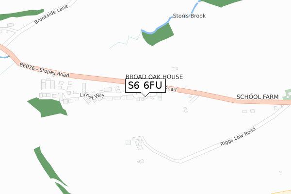
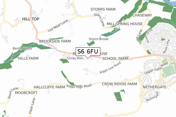
S6 6FU maps, stats, and open data
S6 6FU is located in the Stannington electoral ward, within the metropolitan district of Sheffield and the English Parliamentary constituency of Sheffield, Hallam. The Sub Integrated Care Board (ICB) Location is NHS South Yorkshire ICB - 03N and the police force is South Yorkshire. This postcode has been in use since June 2018.
S6 6FU maps


Licence: Open Government Licence (requires attribution)
Attribution: Contains OS data © Crown copyright and database right 2025
Source: Open Postcode Geo
Licence: Open Government Licence (requires attribution)
Attribution: Contains OS data © Crown copyright and database right 2025; Contains Royal Mail data © Royal Mail copyright and database right 2025; Source: Office for National Statistics licensed under the Open Government Licence v.3.0
S6 6FU geodata
| Easting | 429128 |
| Northing | 388669 |
| Latitude | 53.394074 |
| Longitude | -1.563447 |
Where is S6 6FU?
| Country | England |
| Postcode District | S6 |
Politics
| Ward | Stannington |
|---|---|
| Constituency | Sheffield, Hallam |
Transport
Nearest bus stops to S6 6FU
| Griffs (Stopes Road) | Stannington | 85m |
| Griffs (Stopes Road) | Stannington | 90m |
| Riggs Low Road (Stannington Road) | Stannington | 521m |
| Brookside Lane (Brookside Bank Road) | Storrs | 551m |
| Brookside Lane (Brookside Bank Road) | Storrs | 552m |
Broadband
Broadband access in S6 6FU (2020 data)
| Percentage of properties with Next Generation Access | 100.0% |
| Percentage of properties with Superfast Broadband | 100.0% |
| Percentage of properties with Ultrafast Broadband | 100.0% |
| Percentage of properties with Full Fibre Broadband | 100.0% |
Superfast Broadband is between 30Mbps and 300Mbps
Ultrafast Broadband is > 300Mbps
Broadband limitations in S6 6FU (2020 data)
| Percentage of properties unable to receive 2Mbps | 0.0% |
| Percentage of properties unable to receive 5Mbps | 0.0% |
| Percentage of properties unable to receive 10Mbps | 0.0% |
| Percentage of properties unable to receive 30Mbps | 0.0% |
Deprivation
41.2% of English postcodes are less deprived than S6 6FU:Food Standards Agency
Three nearest food hygiene ratings to S6 6FU (metres)


➜ Get more ratings from the Food Standards Agency
Nearest post box to S6 6FU
| Last Collection | |||
|---|---|---|---|
| Location | Mon-Fri | Sat | Distance |
| Storrs | 16:00 | 11:30 | 630m |
| Reynard Lane | 16:45 | 12:15 | 826m |
| Hill Top | 16:00 | 11:30 | 992m |
S6 6FU ITL and S6 6FU LAU
The below table lists the International Territorial Level (ITL) codes (formerly Nomenclature of Territorial Units for Statistics (NUTS) codes) and Local Administrative Units (LAU) codes for S6 6FU:
| ITL 1 Code | Name |
|---|---|
| TLE | Yorkshire and The Humber |
| ITL 2 Code | Name |
| TLE3 | South Yorkshire |
| ITL 3 Code | Name |
| TLE32 | Sheffield |
| LAU 1 Code | Name |
| E08000019 | Sheffield |
S6 6FU census areas
The below table lists the Census Output Area (OA), Lower Layer Super Output Area (LSOA), and Middle Layer Super Output Area (MSOA) for S6 6FU:
| Code | Name | |
|---|---|---|
| OA | E00041198 | |
| LSOA | E01008129 | Sheffield 023A |
| MSOA | E02001633 | Sheffield 023 |
Nearest postcodes to S6 6FU
| S6 6BW | Stopes Road | 141m |
| S6 6GB | Riggs Low Road | 153m |
| S6 6DA | Riggs High Road | 569m |
| S6 6GU | Brookside | 587m |
| S6 6AP | Stannington Road | 613m |
| S6 6GY | Storrs | 691m |
| S6 6DG | Reynard Lane | 817m |
| S6 6EQ | Spout Spinney | 835m |
| S6 6FB | Spout Copse | 864m |
| S6 6BT | Highfield Rise | 872m |