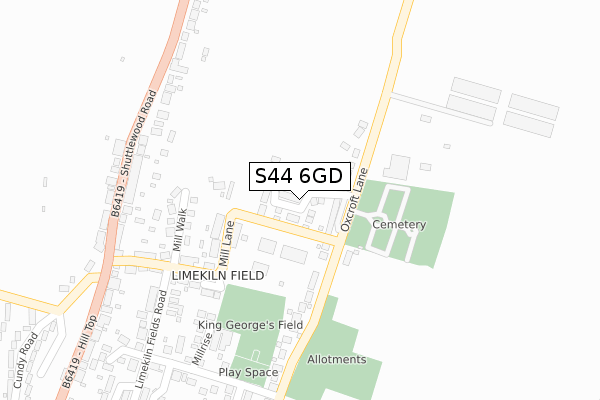
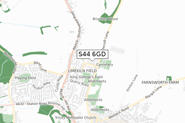
S44 6GD is located in the Bolsover North & Shuttlewood electoral ward, within the local authority district of Bolsover and the English Parliamentary constituency of Bolsover. The Sub Integrated Care Board (ICB) Location is NHS Derby and Derbyshire ICB - 15M and the police force is Derbyshire. This postcode has been in use since August 2018.


GetTheData
Source: OS Open Zoomstack (Ordnance Survey)
Licence: Open Government Licence (requires attribution)
Attribution: Contains OS data © Crown copyright and database right 2025
Source: Open Postcode Geo
Licence: Open Government Licence (requires attribution)
Attribution: Contains OS data © Crown copyright and database right 2025; Contains Royal Mail data © Royal Mail copyright and database right 2025; Source: Office for National Statistics licensed under the Open Government Licence v.3.0
| Easting | 447544 |
| Northing | 371423 |
| Latitude | 53.237735 |
| Longitude | -1.289109 |
GetTheData
Source: Open Postcode Geo
Licence: Open Government Licence
| Country | England |
| Postcode District | S44 |
➜ See where S44 is on a map ➜ Where is Bolsover? | |
GetTheData
Source: Land Registry Price Paid Data
Licence: Open Government Licence
| Ward | Bolsover North & Shuttlewood |
| Constituency | Bolsover |
GetTheData
Source: ONS Postcode Database
Licence: Open Government Licence
2024 4 JAN £368,000 |
2023 19 OCT £395,000 |
2022 24 MAY £340,000 |
2021 5 MAR £330,000 |
2021 12 FEB £289,000 |
2020 31 JUL £344,995 |
46, HAWKE BROOK CLOSE, BOLSOVER, CHESTERFIELD, S44 6GD 2020 29 APR £312,995 |
2020 27 MAR £349,995 |
34, HAWKE BROOK CLOSE, BOLSOVER, CHESTERFIELD, S44 6GD 2019 25 OCT £289,995 |
32, HAWKE BROOK CLOSE, BOLSOVER, CHESTERFIELD, S44 6GD 2019 27 SEP £289,995 |
GetTheData
Source: HM Land Registry Price Paid Data
Licence: Contains HM Land Registry data © Crown copyright and database right 2025. This data is licensed under the Open Government Licence v3.0.
| Mill Lane (Shuttlewood Road) | Bolsover | 332m |
| Mill Lane (Hill Top) | Bolsover | 341m |
| Lodge Farm (Shuttlewood Road) | Bolsover | 374m |
| Lodge Farm (Shuttlewood Road) | Bolsover | 427m |
| New Street (Hill Top) | Bolsover | 537m |
| Creswell (Derbys) Station | 5.7km |
GetTheData
Source: NaPTAN
Licence: Open Government Licence
| Percentage of properties with Next Generation Access | 100.0% |
| Percentage of properties with Superfast Broadband | 100.0% |
| Percentage of properties with Ultrafast Broadband | 94.3% |
| Percentage of properties with Full Fibre Broadband | 94.3% |
Superfast Broadband is between 30Mbps and 300Mbps
Ultrafast Broadband is > 300Mbps
| Percentage of properties unable to receive 2Mbps | 0.0% |
| Percentage of properties unable to receive 5Mbps | 0.0% |
| Percentage of properties unable to receive 10Mbps | 0.0% |
| Percentage of properties unable to receive 30Mbps | 0.0% |
GetTheData
Source: Ofcom
Licence: Ofcom Terms of Use (requires attribution)
GetTheData
Source: ONS Postcode Database
Licence: Open Government Licence


➜ Get more ratings from the Food Standards Agency
GetTheData
Source: Food Standards Agency
Licence: FSA terms & conditions
| Last Collection | |||
|---|---|---|---|
| Location | Mon-Fri | Sat | Distance |
| Shuttlewood Road (Hilltop) | 16:00 | 10:00 | 307m |
| Stratton Road | 16:00 | 11:00 | 497m |
| 31 Welbeck Road | 16:00 | 10:45 | 769m |
GetTheData
Source: Dracos
Licence: Creative Commons Attribution-ShareAlike
The below table lists the International Territorial Level (ITL) codes (formerly Nomenclature of Territorial Units for Statistics (NUTS) codes) and Local Administrative Units (LAU) codes for S44 6GD:
| ITL 1 Code | Name |
|---|---|
| TLF | East Midlands (England) |
| ITL 2 Code | Name |
| TLF1 | Derbyshire and Nottinghamshire |
| ITL 3 Code | Name |
| TLF12 | East Derbyshire |
| LAU 1 Code | Name |
| E07000033 | Bolsover |
GetTheData
Source: ONS Postcode Directory
Licence: Open Government Licence
The below table lists the Census Output Area (OA), Lower Layer Super Output Area (LSOA), and Middle Layer Super Output Area (MSOA) for S44 6GD:
| Code | Name | |
|---|---|---|
| OA | E00098537 | |
| LSOA | E01019484 | Bolsover 004B |
| MSOA | E02004048 | Bolsover 004 |
GetTheData
Source: ONS Postcode Directory
Licence: Open Government Licence
| S44 6NR | Mill Lane | 139m |
| S44 6DW | Oxcroft Lane | 144m |
| S44 6NY | Mill Walk | 192m |
| S44 6NP | Mill Lane | 209m |
| S44 6FP | Millrise | 270m |
| S44 6NU | Shuttlewood Road | 289m |
| S44 6NS | Limekiln Fields | 335m |
| S44 6NT | Quarry Road | 353m |
| S44 6DR | Stratton Road | 418m |
| S44 6NX | Shuttlewood Road | 419m |
GetTheData
Source: Open Postcode Geo; Land Registry Price Paid Data
Licence: Open Government Licence