Property/Postcode Data Search:
S42 6HR maps, stats, and open data
S42 6HR is located in the Wingerworth electoral ward, within the local authority district of North East Derbyshire and the English Parliamentary constituency of North East Derbyshire. The Sub Integrated Care Board (ICB) Location is NHS Derby and Derbyshire ICB - 15M and the police force is Derbyshire. This postcode has been in use since February 2020.
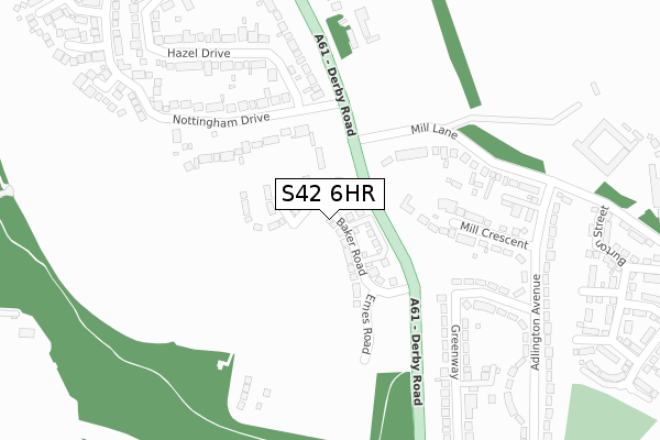
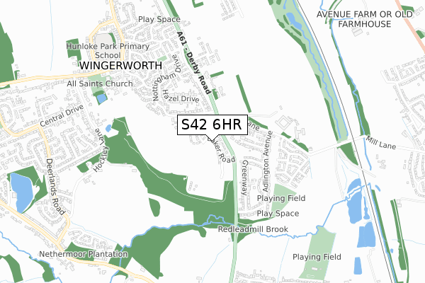
S42 6HR maps


Source: OS Open Zoomstack (Ordnance Survey)
Licence: Open Government Licence (requires attribution)
Attribution: Contains OS data © Crown copyright and database right 2025
Source: Open Postcode Geo
Licence: Open Government Licence (requires attribution)
Attribution: Contains OS data © Crown copyright and database right 2025; Contains Royal Mail data © Royal Mail copyright and database right 2025; Source: Office for National Statistics licensed under the Open Government Licence v.3.0
Licence: Open Government Licence (requires attribution)
Attribution: Contains OS data © Crown copyright and database right 2025
Source: Open Postcode Geo
Licence: Open Government Licence (requires attribution)
Attribution: Contains OS data © Crown copyright and database right 2025; Contains Royal Mail data © Royal Mail copyright and database right 2025; Source: Office for National Statistics licensed under the Open Government Licence v.3.0
S42 6HR geodata
| Easting | 438915 |
| Northing | 367067 |
| Latitude | 53.199283 |
| Longitude | -1.418918 |
Where is S42 6HR?
| Country | England |
| Postcode District | S42 |
Politics
| Ward | Wingerworth |
|---|---|
| Constituency | North East Derbyshire |
House Prices
Sales of detached houses in S42 6HR
16, PERCEVAL STREET, WINGERWORTH, CHESTERFIELD, S42 6HR 2024 31 MAY £349,950 |
14, PERCEVAL STREET, WINGERWORTH, CHESTERFIELD, S42 6HR 2024 31 MAY £394,950 |
18, PERCEVAL STREET, WINGERWORTH, CHESTERFIELD, S42 6HR 2024 17 MAY £349,950 |
30, PERCEVAL STREET, WINGERWORTH, CHESTERFIELD, S42 6HR 2024 19 APR £349,950 |
32, PERCEVAL STREET, WINGERWORTH, CHESTERFIELD, S42 6HR 2024 28 MAR £394,950 |
28, PERCEVAL STREET, WINGERWORTH, CHESTERFIELD, S42 6HR 2024 21 MAR £349,950 |
10, PERCEVAL STREET, WINGERWORTH, CHESTERFIELD, S42 6HR 2024 29 FEB £429,950 |
12, PERCEVAL STREET, WINGERWORTH, CHESTERFIELD, S42 6HR 2023 19 DEC £347,500 |
8, PERCEVAL STREET, WINGERWORTH, CHESTERFIELD, S42 6HR 2023 25 AUG £425,000 |
4, PERCEVAL STREET, WINGERWORTH, CHESTERFIELD, S42 6HR 2023 31 JUL £284,950 |
Source: HM Land Registry Price Paid Data
Licence: Contains HM Land Registry data © Crown copyright and database right 2025. This data is licensed under the Open Government Licence v3.0.
Licence: Contains HM Land Registry data © Crown copyright and database right 2025. This data is licensed under the Open Government Licence v3.0.
Transport
Nearest bus stops to S42 6HR
| Nottingham Drive (Derby Road) | Wingerworth | 171m |
| Hazel Drive (Nottingham Drive) | Wingerworth | 182m |
| Hazel Drive (Nottingham Drive) | Wingerworth | 191m |
| Nottingham Drive (Derby Road) | Wingerworth | 267m |
| Adlington Avenue | Wingerworth | 361m |
Nearest railway stations to S42 6HR
| Chesterfield Station | 4.3km |
Deprivation
2.8% of English postcodes are less deprived than S42 6HR:Food Standards Agency
Three nearest food hygiene ratings to S42 6HR (metres)
The Hunloke Arms

Derby Road
409m
Rob's A61 Diner

Derby Road
502m
Hunloke Park Primary School Extended Services

Hunloke Park Primary School
752m
➜ Get more ratings from the Food Standards Agency
Nearest post box to S42 6HR
| Last Collection | |||
|---|---|---|---|
| Location | Mon-Fri | Sat | Distance |
| Nottingham Drive | 16:00 | 11:30 | 205m |
| Halcyon Approach | 16:00 | 11:15 | 436m |
| 124 Longedge Lane | 16:00 | 10:30 | 795m |
S42 6HR ITL and S42 6HR LAU
The below table lists the International Territorial Level (ITL) codes (formerly Nomenclature of Territorial Units for Statistics (NUTS) codes) and Local Administrative Units (LAU) codes for S42 6HR:
| ITL 1 Code | Name |
|---|---|
| TLF | East Midlands (England) |
| ITL 2 Code | Name |
| TLF1 | Derbyshire and Nottinghamshire |
| ITL 3 Code | Name |
| TLF12 | East Derbyshire |
| LAU 1 Code | Name |
| E07000038 | North East Derbyshire |
S42 6HR census areas
The below table lists the Census Output Area (OA), Lower Layer Super Output Area (LSOA), and Middle Layer Super Output Area (MSOA) for S42 6HR:
| Code | Name | |
|---|---|---|
| OA | E00100353 | |
| LSOA | E01019830 | North East Derbyshire 010D |
| MSOA | E02004114 | North East Derbyshire 010 |
Nearest postcodes to S42 6HR
| S42 6NF | Derby Road | 164m |
| S42 6ND | Nottingham Drive | 225m |
| S42 6NN | Mill Crescent | 262m |
| S42 6NP | Greenway | 276m |
| S42 6NW | Greenway | 322m |
| S42 6NG | Mill Lane | 336m |
| S42 6NE | Hazel Drive | 358m |
| S42 6NJ | Adlington Avenue | 367m |
| S42 6NQ | Adlington Avenue | 399m |
| S42 6WD | Nottingham Drive | 412m |