S41 7QU maps, stats, and open data
S41 7QU is located in the Brockwell electoral ward, within the local authority district of Chesterfield and the English Parliamentary constituency of Chesterfield. The Sub Integrated Care Board (ICB) Location is NHS Derby and Derbyshire ICB - 15M and the police force is Derbyshire. This postcode has been in use since December 2017.
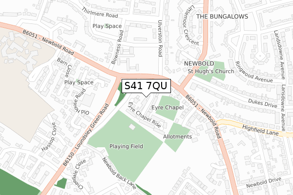
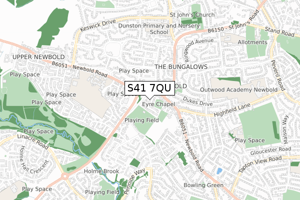
S41 7QU maps


Licence: Open Government Licence (requires attribution)
Attribution: Contains OS data © Crown copyright and database right 2025
Source: Open Postcode Geo
Licence: Open Government Licence (requires attribution)
Attribution: Contains OS data © Crown copyright and database right 2025; Contains Royal Mail data © Royal Mail copyright and database right 2025; Source: Office for National Statistics licensed under the Open Government Licence v.3.0
S41 7QU geodata
| Easting | 436792 |
| Northing | 372903 |
| Latitude | 53.251889 |
| Longitude | -1.450026 |
Where is S41 7QU?
| Country | England |
| Postcode District | S41 |
Politics
| Ward | Brockwell |
|---|---|
| Constituency | Chesterfield |
House Prices
Sales of detached houses in S41 7QU
2024 8 NOV £385,000 |
2023 16 OCT £342,000 |
2022 25 FEB £425,000 |
2019 15 NOV £329,995 |
1, SCHOOL HOUSE WAY, CHESTERFIELD, S41 7QU 2019 30 SEP £359,995 |
2018 29 JUN £287,000 |
24, SCHOOL HOUSE WAY, CHESTERFIELD, S41 7QU 2018 21 JUN £299,500 |
20, SCHOOL HOUSE WAY, CHESTERFIELD, S41 7QU 2018 7 JUN £287,000 |
18, SCHOOL HOUSE WAY, CHESTERFIELD, S41 7QU 2018 27 APR £259,000 |
2018 27 APR £365,000 |
Licence: Contains HM Land Registry data © Crown copyright and database right 2025. This data is licensed under the Open Government Licence v3.0.
Transport
Nearest bus stops to S41 7QU
| The Wheatsheaf (Newbold Road) | Newbold | 79m |
| Old House Road (Loundsley Green Road) | Newbold | 126m |
| Orwins Close (Newbold Road) | Newbold | 187m |
| Nags Head (Newbold Road) | Newbold | 191m |
| Nags Head (Newbold Road) | Newbold | 208m |
Nearest railway stations to S41 7QU
| Chesterfield Station | 2.5km |
Broadband
Broadband access in S41 7QU (2020 data)
| Percentage of properties with Next Generation Access | 100.0% |
| Percentage of properties with Superfast Broadband | 100.0% |
| Percentage of properties with Ultrafast Broadband | 100.0% |
| Percentage of properties with Full Fibre Broadband | 100.0% |
Superfast Broadband is between 30Mbps and 300Mbps
Ultrafast Broadband is > 300Mbps
Broadband speed in S41 7QU (2019 data)
Download
| Median download speed | 100.0Mbps |
| Average download speed | 108.3Mbps |
| Maximum download speed | 200.00Mbps |
Upload
Ofcom does not currently provide upload speed data for S41 7QU. This is because there are less than four broadband connections in this postcode.
Broadband limitations in S41 7QU (2020 data)
| Percentage of properties unable to receive 2Mbps | 0.0% |
| Percentage of properties unable to receive 5Mbps | 0.0% |
| Percentage of properties unable to receive 10Mbps | 0.0% |
| Percentage of properties unable to receive 30Mbps | 0.0% |
Deprivation
51.9% of English postcodes are less deprived than S41 7QU:Food Standards Agency
Three nearest food hygiene ratings to S41 7QU (metres)


➜ Get more ratings from the Food Standards Agency
Nearest post box to S41 7QU
| Last Collection | |||
|---|---|---|---|
| Location | Mon-Fri | Sat | Distance |
| Bowness Road | 16:00 | 11:15 | 160m |
| Ramsley Court | 17:00 | 11:30 | 354m |
| Green Farm Close | 16:00 | 11:00 | 404m |
S41 7QU ITL and S41 7QU LAU
The below table lists the International Territorial Level (ITL) codes (formerly Nomenclature of Territorial Units for Statistics (NUTS) codes) and Local Administrative Units (LAU) codes for S41 7QU:
| ITL 1 Code | Name |
|---|---|
| TLF | East Midlands (England) |
| ITL 2 Code | Name |
| TLF1 | Derbyshire and Nottinghamshire |
| ITL 3 Code | Name |
| TLF12 | East Derbyshire |
| LAU 1 Code | Name |
| E07000034 | Chesterfield |
S41 7QU census areas
The below table lists the Census Output Area (OA), Lower Layer Super Output Area (LSOA), and Middle Layer Super Output Area (MSOA) for S41 7QU:
| Code | Name | |
|---|---|---|
| OA | E00098920 | |
| LSOA | E01019557 | Chesterfield 008A |
| MSOA | E02004062 | Chesterfield 008 |
Nearest postcodes to S41 7QU
| S41 8AR | Newbold Road | 114m |
| S41 8EP | Newbold Road | 120m |
| S41 8AP | Newbold Road | 148m |
| S41 8RJ | Newbold Village | 167m |
| S41 8QH | Linscott Close | 168m |
| S41 8RH | Hastings Close | 171m |
| S40 4YF | Old House Road | 178m |
| S41 8AH | Bowness Road | 192m |
| S41 8EE | Ulverston Road | 210m |
| S41 8EW | Ulverston Road | 226m |