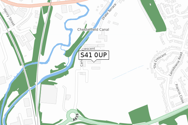
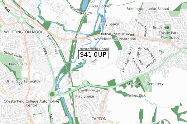
S41 0UP is located in the Brimington South electoral ward, within the local authority district of Chesterfield and the English Parliamentary constituency of Chesterfield. The Sub Integrated Care Board (ICB) Location is NHS Derby and Derbyshire ICB - 15M and the police force is Derbyshire. This postcode has been in use since April 2020.


GetTheData
Source: OS Open Zoomstack (Ordnance Survey)
Licence: Open Government Licence (requires attribution)
Attribution: Contains OS data © Crown copyright and database right 2025
Source: Open Postcode Geo
Licence: Open Government Licence (requires attribution)
Attribution: Contains OS data © Crown copyright and database right 2025; Contains Royal Mail data © Royal Mail copyright and database right 2025; Source: Office for National Statistics licensed under the Open Government Licence v.3.0
| Easting | 439138 |
| Northing | 373121 |
| Latitude | 53.253681 |
| Longitude | -1.414839 |
GetTheData
Source: Open Postcode Geo
Licence: Open Government Licence
| Country | England |
| Postcode District | S41 |
➜ See where S41 is on a map ➜ Where is Brimington? | |
GetTheData
Source: Land Registry Price Paid Data
Licence: Open Government Licence
| Ward | Brimington South |
| Constituency | Chesterfield |
GetTheData
Source: ONS Postcode Database
Licence: Open Government Licence
4, GEORGE CLOSE, CHESTERFIELD, S41 0UP 2022 30 JUN £549,995 |
8, GEORGE CLOSE, CHESTERFIELD, S41 0UP 2022 22 FEB £421,995 |
6, GEORGE CLOSE, CHESTERFIELD, S41 0UP 2022 31 JAN £275,995 |
3, GEORGE CLOSE, CHESTERFIELD, S41 0UP 2021 20 DEC £441,995 |
7, GEORGE CLOSE, CHESTERFIELD, S41 0UP 2021 17 DEC £369,995 |
5, GEORGE CLOSE, CHESTERFIELD, S41 0UP 2021 17 DEC £343,495 |
2, GEORGE CLOSE, CHESTERFIELD, S41 0UP 2021 17 DEC £421,495 |
9, GEORGE CLOSE, CHESTERFIELD, S41 0UP 2021 17 DEC £361,495 |
1, GEORGE CLOSE, CHESTERFIELD, S41 0UP 2021 26 NOV £335,995 |
GetTheData
Source: HM Land Registry Price Paid Data
Licence: Contains HM Land Registry data © Crown copyright and database right 2025. This data is licensed under the Open Government Licence v3.0.
| Sainsburys (Rother Way) | Tapton | 113m |
| Brimington Road Bottom (Brimington Road) | Tapton | 296m |
| Brimington Road Bottom (Brimington Road) | Tapton | 306m |
| Swaddale Avenue Turning Point (Lockoford Lane) | Tapton | 361m |
| Lockoford Lane 207 (Lockoford Lane) | Tapton | 407m |
| Chesterfield Station | 1.8km |
GetTheData
Source: NaPTAN
Licence: Open Government Licence
GetTheData
Source: ONS Postcode Database
Licence: Open Government Licence


➜ Get more ratings from the Food Standards Agency
GetTheData
Source: Food Standards Agency
Licence: FSA terms & conditions
| Last Collection | |||
|---|---|---|---|
| Location | Mon-Fri | Sat | Distance |
| 187 Lockoford Lane | 16:00 | 11:00 | 232m |
| 71 Landowne Road | 16:00 | 12:00 | 437m |
| Station Road | 16:00 | 12:00 | 589m |
GetTheData
Source: Dracos
Licence: Creative Commons Attribution-ShareAlike
The below table lists the International Territorial Level (ITL) codes (formerly Nomenclature of Territorial Units for Statistics (NUTS) codes) and Local Administrative Units (LAU) codes for S41 0UP:
| ITL 1 Code | Name |
|---|---|
| TLF | East Midlands (England) |
| ITL 2 Code | Name |
| TLF1 | Derbyshire and Nottinghamshire |
| ITL 3 Code | Name |
| TLF12 | East Derbyshire |
| LAU 1 Code | Name |
| E07000034 | Chesterfield |
GetTheData
Source: ONS Postcode Directory
Licence: Open Government Licence
The below table lists the Census Output Area (OA), Lower Layer Super Output Area (LSOA), and Middle Layer Super Output Area (MSOA) for S41 0UP:
| Code | Name | |
|---|---|---|
| OA | E00098787 | |
| LSOA | E01019533 | Chesterfield 005B |
| MSOA | E02004059 | Chesterfield 005 |
GetTheData
Source: ONS Postcode Directory
Licence: Open Government Licence
| S41 0UG | Fuller Drive | 158m |
| S41 0UD | Douglas Road | 198m |
| S41 0UH | Witham Close | 229m |
| S41 0UE | Darwent Road | 262m |
| S41 0UF | Malia Road | 305m |
| S41 0SS | Muirfield Close | 348m |
| S43 1LR | Station Road | 364m |
| S41 0TF | Brimington Road | 367m |
| S41 0TQ | Lockoford Lane | 389m |
| S41 0TG | Lockoford Lane | 406m |
GetTheData
Source: Open Postcode Geo; Land Registry Price Paid Data
Licence: Open Government Licence