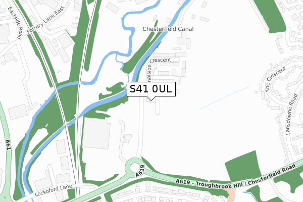
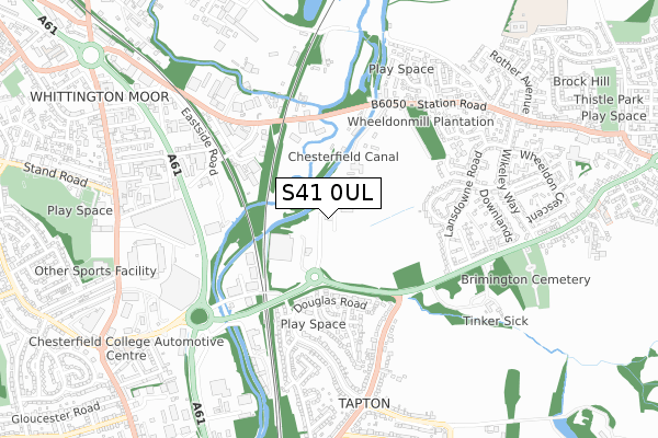
S41 0UL is located in the Brimington South electoral ward, within the local authority district of Chesterfield and the English Parliamentary constituency of Chesterfield. The Sub Integrated Care Board (ICB) Location is NHS Derby and Derbyshire ICB - 15M and the police force is Derbyshire. This postcode has been in use since June 2019.


GetTheData
Source: OS Open Zoomstack (Ordnance Survey)
Licence: Open Government Licence (requires attribution)
Attribution: Contains OS data © Crown copyright and database right 2025
Source: Open Postcode Geo
Licence: Open Government Licence (requires attribution)
Attribution: Contains OS data © Crown copyright and database right 2025; Contains Royal Mail data © Royal Mail copyright and database right 2025; Source: Office for National Statistics licensed under the Open Government Licence v.3.0
| Easting | 439186 |
| Northing | 373228 |
| Latitude | 53.254639 |
| Longitude | -1.414107 |
GetTheData
Source: Open Postcode Geo
Licence: Open Government Licence
| Country | England |
| Postcode District | S41 |
➜ See where S41 is on a map ➜ Where is Brimington? | |
GetTheData
Source: Land Registry Price Paid Data
Licence: Open Government Licence
| Ward | Brimington South |
| Constituency | Chesterfield |
GetTheData
Source: ONS Postcode Database
Licence: Open Government Licence
2024 21 NOV £466,000 |
2024 12 SEP £390,000 |
4, POPPY CRESCENT, CHESTERFIELD, S41 0UL 2023 28 APR £462,995 |
7, POPPY CRESCENT, CHESTERFIELD, S41 0UL 2022 13 DEC £410,495 |
9, POPPY CRESCENT, CHESTERFIELD, S41 0UL 2022 28 OCT £351,995 |
48, POPPY CRESCENT, CHESTERFIELD, S41 0UL 2021 29 OCT £350,495 |
2021 29 OCT £385,995 |
46, POPPY CRESCENT, CHESTERFIELD, S41 0UL 2021 29 OCT £401,995 |
40, POPPY CRESCENT, CHESTERFIELD, S41 0UL 2021 29 OCT £350,995 |
44, POPPY CRESCENT, CHESTERFIELD, S41 0UL 2021 29 OCT £340,596 |
GetTheData
Source: HM Land Registry Price Paid Data
Licence: Contains HM Land Registry data © Crown copyright and database right 2025. This data is licensed under the Open Government Licence v3.0.
| Sainsburys (Rother Way) | Tapton | 203m |
| Brimington Road Bottom (Brimington Road) | Tapton | 357m |
| Lansdowne Road | Brimington | 368m |
| Brimington Road Bottom (Brimington Road) | Tapton | 369m |
| Lansdowne Road | Brimington | 380m |
| Chesterfield Station | 1.9km |
GetTheData
Source: NaPTAN
Licence: Open Government Licence
| Percentage of properties with Next Generation Access | 100.0% |
| Percentage of properties with Superfast Broadband | 100.0% |
| Percentage of properties with Ultrafast Broadband | 100.0% |
| Percentage of properties with Full Fibre Broadband | 100.0% |
Superfast Broadband is between 30Mbps and 300Mbps
Ultrafast Broadband is > 300Mbps
| Percentage of properties unable to receive 2Mbps | 0.0% |
| Percentage of properties unable to receive 5Mbps | 0.0% |
| Percentage of properties unable to receive 10Mbps | 0.0% |
| Percentage of properties unable to receive 30Mbps | 0.0% |
GetTheData
Source: Ofcom
Licence: Ofcom Terms of Use (requires attribution)
GetTheData
Source: ONS Postcode Database
Licence: Open Government Licence


➜ Get more ratings from the Food Standards Agency
GetTheData
Source: Food Standards Agency
Licence: FSA terms & conditions
| Last Collection | |||
|---|---|---|---|
| Location | Mon-Fri | Sat | Distance |
| 187 Lockoford Lane | 16:00 | 11:00 | 348m |
| 71 Landowne Road | 16:00 | 12:00 | 374m |
| Station Road | 16:00 | 12:00 | 474m |
GetTheData
Source: Dracos
Licence: Creative Commons Attribution-ShareAlike
The below table lists the International Territorial Level (ITL) codes (formerly Nomenclature of Territorial Units for Statistics (NUTS) codes) and Local Administrative Units (LAU) codes for S41 0UL:
| ITL 1 Code | Name |
|---|---|
| TLF | East Midlands (England) |
| ITL 2 Code | Name |
| TLF1 | Derbyshire and Nottinghamshire |
| ITL 3 Code | Name |
| TLF12 | East Derbyshire |
| LAU 1 Code | Name |
| E07000034 | Chesterfield |
GetTheData
Source: ONS Postcode Directory
Licence: Open Government Licence
The below table lists the Census Output Area (OA), Lower Layer Super Output Area (LSOA), and Middle Layer Super Output Area (MSOA) for S41 0UL:
| Code | Name | |
|---|---|---|
| OA | E00098791 | |
| LSOA | E01019536 | Chesterfield 005E |
| MSOA | E02004059 | Chesterfield 005 |
GetTheData
Source: ONS Postcode Directory
Licence: Open Government Licence
| S43 1LR | Station Road | 251m |
| S41 0UG | Fuller Drive | 275m |
| S41 0UD | Douglas Road | 307m |
| S41 0UH | Witham Close | 341m |
| S43 1AZ | The Crescent | 354m |
| S41 0UE | Darwent Road | 376m |
| S43 1LS | Station Road | 386m |
| S43 1AY | Lansdowne Road | 396m |
| S41 0UF | Malia Road | 407m |
| S43 1BA | Lansdowne Road | 417m |
GetTheData
Source: Open Postcode Geo; Land Registry Price Paid Data
Licence: Open Government Licence