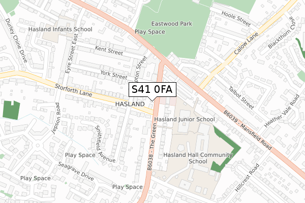
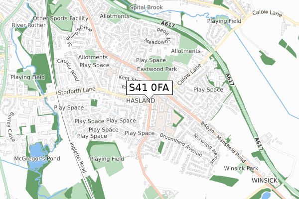
S41 0FA is located in the Hasland electoral ward, within the local authority district of Chesterfield and the English Parliamentary constituency of Chesterfield. The Sub Integrated Care Board (ICB) Location is NHS Derby and Derbyshire ICB - 15M and the police force is Derbyshire. This postcode has been in use since October 2018.


GetTheData
Source: OS Open Zoomstack (Ordnance Survey)
Licence: Open Government Licence (requires attribution)
Attribution: Contains OS data © Crown copyright and database right 2025
Source: Open Postcode Geo
Licence: Open Government Licence (requires attribution)
Attribution: Contains OS data © Crown copyright and database right 2025; Contains Royal Mail data © Royal Mail copyright and database right 2025; Source: Office for National Statistics licensed under the Open Government Licence v.3.0
| Easting | 439581 |
| Northing | 369358 |
| Latitude | 53.219826 |
| Longitude | -1.408666 |
GetTheData
Source: Open Postcode Geo
Licence: Open Government Licence
| Country | England |
| Postcode District | S41 |
➜ See where S41 is on a map ➜ Where is Chesterfield? | |
GetTheData
Source: Land Registry Price Paid Data
Licence: Open Government Licence
| Ward | Hasland |
| Constituency | Chesterfield |
GetTheData
Source: ONS Postcode Database
Licence: Open Government Licence
1, THE GREEN MEWS, HASLAND, CHESTERFIELD, S41 0FA 2021 23 APR £217,500 |
3, THE GREEN MEWS, HASLAND, CHESTERFIELD, S41 0FA 2021 16 APR £166,000 |
3, THE GREEN MEWS, HASLAND, CHESTERFIELD, S41 0FA 2020 21 FEB £176,750 |
2, THE GREEN MEWS, HASLAND, CHESTERFIELD, S41 0FA 2019 21 AUG £260,000 |
GetTheData
Source: HM Land Registry Price Paid Data
Licence: Contains HM Land Registry data © Crown copyright and database right 2025. This data is licensed under the Open Government Licence v3.0.
| The Green Nursing Home (The Green) | Hasland | 31m |
| The Green Nursing Home (The Green) | Hasland | 45m |
| Smithfield Avenue (Storforth Lane) | Hasland | 54m |
| Smithfield Avenue (Storforth Lane) | Hasland | 85m |
| Storforth Lane (The Green) | Hasland | 124m |
| Chesterfield Station | 2.2km |
GetTheData
Source: NaPTAN
Licence: Open Government Licence
| Percentage of properties with Next Generation Access | 100.0% |
| Percentage of properties with Superfast Broadband | 100.0% |
| Percentage of properties with Ultrafast Broadband | 0.0% |
| Percentage of properties with Full Fibre Broadband | 0.0% |
Superfast Broadband is between 30Mbps and 300Mbps
Ultrafast Broadband is > 300Mbps
| Percentage of properties unable to receive 2Mbps | 0.0% |
| Percentage of properties unable to receive 5Mbps | 0.0% |
| Percentage of properties unable to receive 10Mbps | 0.0% |
| Percentage of properties unable to receive 30Mbps | 0.0% |
GetTheData
Source: Ofcom
Licence: Ofcom Terms of Use (requires attribution)
GetTheData
Source: ONS Postcode Database
Licence: Open Government Licence


➜ Get more ratings from the Food Standards Agency
GetTheData
Source: Food Standards Agency
Licence: FSA terms & conditions
| Last Collection | |||
|---|---|---|---|
| Location | Mon-Fri | Sat | Distance |
| The Green | 17:00 | 11:15 | 88m |
| Hasland Post Office | 17:00 | 11:15 | 165m |
| Storforth Lane | 17:00 | 11:00 | 311m |
GetTheData
Source: Dracos
Licence: Creative Commons Attribution-ShareAlike
The below table lists the International Territorial Level (ITL) codes (formerly Nomenclature of Territorial Units for Statistics (NUTS) codes) and Local Administrative Units (LAU) codes for S41 0FA:
| ITL 1 Code | Name |
|---|---|
| TLF | East Midlands (England) |
| ITL 2 Code | Name |
| TLF1 | Derbyshire and Nottinghamshire |
| ITL 3 Code | Name |
| TLF12 | East Derbyshire |
| LAU 1 Code | Name |
| E07000034 | Chesterfield |
GetTheData
Source: ONS Postcode Directory
Licence: Open Government Licence
The below table lists the Census Output Area (OA), Lower Layer Super Output Area (LSOA), and Middle Layer Super Output Area (MSOA) for S41 0FA:
| Code | Name | |
|---|---|---|
| OA | E00098867 | |
| LSOA | E01019547 | Chesterfield 012C |
| MSOA | E02004066 | Chesterfield 012 |
GetTheData
Source: ONS Postcode Directory
Licence: Open Government Licence
| S41 0LJ | The Green | 74m |
| S41 0LW | The Green | 86m |
| S41 0JD | Park View | 87m |
| S41 0LH | Hampton Street | 99m |
| S41 0JA | Mansfield Road | 109m |
| S41 0JB | Mansfield Road | 148m |
| S41 0PW | Storforth Lane | 154m |
| S41 0LN | The Green | 159m |
| S41 0AJ | Chapel Lane East | 174m |
| S41 0PR | Smithfield Avenue | 186m |
GetTheData
Source: Open Postcode Geo; Land Registry Price Paid Data
Licence: Open Government Licence