S35 7FB maps, stats, and open data
- Home
- Postcode
- S
- S35
- S35 7
S35 7FB is located in the Penistone East electoral ward, within the metropolitan district of Barnsley and the English Parliamentary constituency of Penistone and Stocksbridge. The Sub Integrated Care Board (ICB) Location is NHS South Yorkshire ICB - 02P and the police force is South Yorkshire. This postcode has been in use since October 2017.
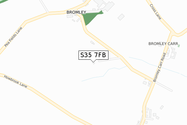
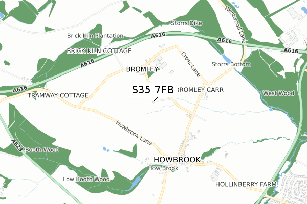
S35 7FB maps


Source: OS Open Zoomstack (Ordnance Survey)
Licence: Open Government Licence (requires attribution)
Attribution: Contains OS data © Crown copyright and database right 2025
Source: Open Postcode GeoLicence: Open Government Licence (requires attribution)
Attribution: Contains OS data © Crown copyright and database right 2025; Contains Royal Mail data © Royal Mail copyright and database right 2025; Source: Office for National Statistics licensed under the Open Government Licence v.3.0
S35 7FB geodata
| Easting | 432407 |
| Northing | 398616 |
| Latitude | 53.483289 |
| Longitude | -1.513119 |
Where is S35 7FB?
| Country | England |
| Postcode District | S35 |
Politics
| Ward | Penistone East |
|---|
| Constituency | Penistone And Stocksbridge |
|---|
Transport
Nearest bus stops to S35 7FB
| Carr Head Road (Howbrook Lane) | Howbrook | 469m |
| Berry Lane (Howbrook Lane) | Howbrook | 493m |
| Hollinberry Lane | Howbrook | 807m |
| Holly House Farm (Hollinberry Lane) | Howbrook | 809m |
| Boothwood Lodge (Penistone Road) | Wortley | 1,131m |
Nearest railway stations to S35 7FB
Broadband
Broadband access in S35 7FB (2020 data)
| Percentage of properties with Next Generation Access | 100.0% |
| Percentage of properties with Superfast Broadband | 100.0% |
| Percentage of properties with Ultrafast Broadband | 100.0% |
| Percentage of properties with Full Fibre Broadband | 100.0% |
Superfast Broadband is between 30Mbps and 300Mbps
Ultrafast Broadband is > 300Mbps
Broadband limitations in S35 7FB (2020 data)
| Percentage of properties unable to receive 2Mbps | 0.0% |
| Percentage of properties unable to receive 5Mbps | 0.0% |
| Percentage of properties unable to receive 10Mbps | 0.0% |
| Percentage of properties unable to receive 30Mbps | 0.0% |
Deprivation
44.7% of English postcodes are less deprived than
S35 7FB:
Food Standards Agency
Three nearest food hygiene ratings to S35 7FB (metres)
Boxing Science Performance Centre
Suite 3 Maple House Unit 4
1,272m
High Green Working Mens Club
The Wentworth
➜ Get more ratings from the Food Standards Agency
Nearest post box to S35 7FB
| | Last Collection | |
|---|
| Location | Mon-Fri | Sat | Distance |
|---|
| Bromley Carr Lane | 17:30 | 09:00 | 269m |
| Howbrook Lane | 17:30 | 08:45 | 485m |
| Ashwood Road | 17:45 | 08:00 | 1,330m |
S35 7FB ITL and S35 7FB LAU
The below table lists the International Territorial Level (ITL) codes (formerly Nomenclature of Territorial Units for Statistics (NUTS) codes) and Local Administrative Units (LAU) codes for S35 7FB:
| ITL 1 Code | Name |
|---|
| TLE | Yorkshire and The Humber |
| ITL 2 Code | Name |
|---|
| TLE3 | South Yorkshire |
| ITL 3 Code | Name |
|---|
| TLE31 | Barnsley, Doncaster and Rotherham |
| LAU 1 Code | Name |
|---|
| E08000016 | Barnsley |
S35 7FB census areas
The below table lists the Census Output Area (OA), Lower Layer Super Output Area (LSOA), and Middle Layer Super Output Area (MSOA) for S35 7FB:
| Code | Name |
|---|
| OA | E00037627 | |
|---|
| LSOA | E01007421 | Barnsley 027A |
|---|
| MSOA | E02001535 | Barnsley 027 |
|---|
Nearest postcodes to S35 7FB


