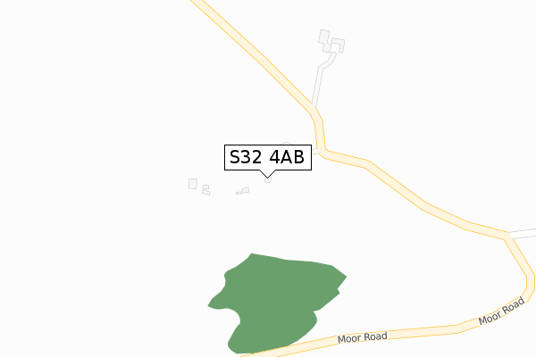
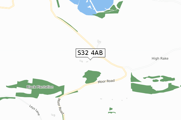
S32 4AB is located in the Calver & Longstone electoral ward, within the local authority district of Derbyshire Dales and the English Parliamentary constituency of Derbyshire Dales. The Sub Integrated Care Board (ICB) Location is NHS Derby and Derbyshire ICB - 15M and the police force is Derbyshire. This postcode has been in use since June 2019.


GetTheData
Source: OS Open Zoomstack (Ordnance Survey)
Licence: Open Government Licence (requires attribution)
Attribution: Contains OS data © Crown copyright and database right 2025
Source: Open Postcode Geo
Licence: Open Government Licence (requires attribution)
Attribution: Contains OS data © Crown copyright and database right 2025; Contains Royal Mail data © Royal Mail copyright and database right 2025; Source: Office for National Statistics licensed under the Open Government Licence v.3.0
| Easting | 420027 |
| Northing | 373336 |
| Latitude | 53.256673 |
| Longitude | -1.701264 |
GetTheData
Source: Open Postcode Geo
Licence: Open Government Licence
| Country | England |
| Postcode District | S32 |
➜ See where S32 is on a map | |
GetTheData
Source: Land Registry Price Paid Data
Licence: Open Government Licence
| Ward | Calver & Longstone |
| Constituency | Derbyshire Dales |
GetTheData
Source: ONS Postcode Database
Licence: Open Government Licence
| Moor Road (Main Street) | Great Longstone | 1,448m |
| Moor Road (Main Street) | Great Longstone | 1,455m |
| Silverdale House (Main Street) | Rowland | 1,564m |
GetTheData
Source: NaPTAN
Licence: Open Government Licence
GetTheData
Source: ONS Postcode Database
Licence: Open Government Licence


➜ Get more ratings from the Food Standards Agency
GetTheData
Source: Food Standards Agency
Licence: FSA terms & conditions
| Last Collection | |||
|---|---|---|---|
| Location | Mon-Fri | Sat | Distance |
| Great Longstone Post Office | 16:00 | 09:00 | 1,562m |
| Rowland | 16:30 | 10:00 | 1,573m |
| Great Longstone | 16:00 | 10:00 | 1,637m |
GetTheData
Source: Dracos
Licence: Creative Commons Attribution-ShareAlike
The below table lists the International Territorial Level (ITL) codes (formerly Nomenclature of Territorial Units for Statistics (NUTS) codes) and Local Administrative Units (LAU) codes for S32 4AB:
| ITL 1 Code | Name |
|---|---|
| TLF | East Midlands (England) |
| ITL 2 Code | Name |
| TLF1 | Derbyshire and Nottinghamshire |
| ITL 3 Code | Name |
| TLF13 | South and West Derbyshire |
| LAU 1 Code | Name |
| E07000035 | Derbyshire Dales |
GetTheData
Source: ONS Postcode Directory
Licence: Open Government Licence
The below table lists the Census Output Area (OA), Lower Layer Super Output Area (LSOA), and Middle Layer Super Output Area (MSOA) for S32 4AB:
| Code | Name | |
|---|---|---|
| OA | E00174337 | |
| LSOA | E01019618 | Derbyshire Dales 002D |
| MSOA | E02004069 | Derbyshire Dales 002 |
GetTheData
Source: ONS Postcode Directory
Licence: Open Government Licence
| DE45 1UA | Moor Road | 1322m |
| DE45 1TR | Barn Furlong | 1417m |
| DE45 1UB | Butts Road | 1442m |
| DE45 1TB | Church Lane | 1499m |
| DE45 1TZ | Main Street | 1529m |
| DE45 1TA | Main Street | 1576m |
| DE45 1TJ | Main Street | 1578m |
| DE45 1NR | 1595m | |
| DE45 1TF | Main Street | 1611m |
| DE45 1TG | Main Street | 1621m |
GetTheData
Source: Open Postcode Geo; Land Registry Price Paid Data
Licence: Open Government Licence