S2 1BU maps, stats, and open data
- Home
- Postcode
- S
- S2
- S2 1
S2 1BU is located in the Manor Castle electoral ward, within the metropolitan district of Sheffield and the English Parliamentary constituency of Sheffield Central. The Sub Integrated Care Board (ICB) Location is NHS South Yorkshire ICB - 03N and the police force is South Yorkshire. This postcode has been in use since November 2019.
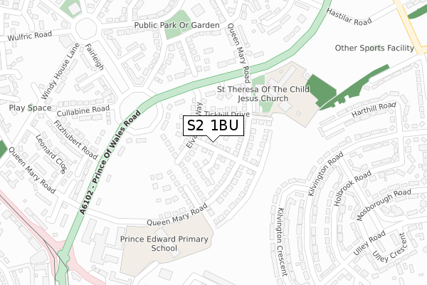
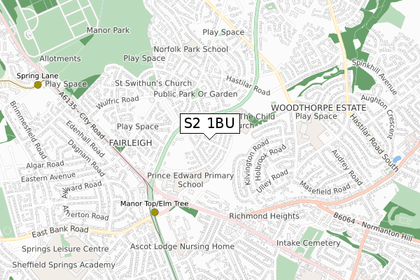
S2 1BU maps


Source: OS Open Zoomstack (Ordnance Survey)
Licence: Open Government Licence (requires attribution)
Attribution: Contains OS data © Crown copyright and database right 2025
Source: Open Postcode GeoLicence: Open Government Licence (requires attribution)
Attribution: Contains OS data © Crown copyright and database right 2025; Contains Royal Mail data © Royal Mail copyright and database right 2025; Source: Office for National Statistics licensed under the Open Government Licence v.3.0
S2 1BU geodata
| Easting | 438486 |
| Northing | 385295 |
| Latitude | 53.363152 |
| Longitude | -1.423140 |
Where is S2 1BU?
| Country | England |
| Postcode District | S2 |
Politics
| Ward | Manor Castle |
|---|
| Constituency | Sheffield Central |
|---|
Transport
Nearest bus stops to S2 1BU
| Queen Mary Road (Prince Of Wales Road) | Manor | 188m |
| Fairleigh (Prince Of Wales Road) | Manor | 195m |
| Queen Mary Road (Prince Of Wales Road) | Manor | 207m |
| Fairleigh (Prince Of Wales Road) | Manor | 233m |
| Cullabine Road (Fairleigh) | Manor | 291m |
Nearest underground/metro/tram to S2 1BU
| Manor Top - Elm Tree (Sheffield Supertram) (Off Ridgeway Road) | Manor Top | 529m |
| Spring Lane (Sheffield Supertram) (Park Grange Road) | Fairleigh | 1,095m |
| Hollinsend (Sheffield Supertram) (Ridgeway Road) | Gleadless | 1,238m |
Nearest railway stations to S2 1BU
| Darnall Station | 2.5km |
| Sheffield Station | 3.1km |
| Woodhouse Station | 4.4km |
Broadband
Broadband access in S2 1BU (2020 data)
| Percentage of properties with Next Generation Access | 100.0% |
| Percentage of properties with Superfast Broadband | 100.0% |
| Percentage of properties with Ultrafast Broadband | 92.3% |
| Percentage of properties with Full Fibre Broadband | 23.1% |
Superfast Broadband is between 30Mbps and 300Mbps
Ultrafast Broadband is > 300Mbps
Broadband limitations in S2 1BU (2020 data)
| Percentage of properties unable to receive 2Mbps | 0.0% |
| Percentage of properties unable to receive 5Mbps | 0.0% |
| Percentage of properties unable to receive 10Mbps | 0.0% |
| Percentage of properties unable to receive 30Mbps | 0.0% |
Deprivation
95.7% of English postcodes are less deprived than
S2 1BU:
Food Standards Agency
Three nearest food hygiene ratings to S2 1BU (metres)
REVUP WELLNESS LTD
Waterfall Elior
St Theresa's Catholic Primary School
249m
Waterfall Elior
Prince Edward Primary
302m
➜ Get more ratings from the Food Standards Agency
Nearest post box to S2 1BU
| | Last Collection | |
|---|
| Location | Mon-Fri | Sat | Distance |
|---|
| Manor Post Office | 15:00 | 12:00 | 452m |
| Intake Post Office | 17:30 | 12:20 | 465m |
| Fretson Road | 18:00 | 09:00 | 468m |
S2 1BU ITL and S2 1BU LAU
The below table lists the International Territorial Level (ITL) codes (formerly Nomenclature of Territorial Units for Statistics (NUTS) codes) and Local Administrative Units (LAU) codes for S2 1BU:
| ITL 1 Code | Name |
|---|
| TLE | Yorkshire and The Humber |
| ITL 2 Code | Name |
|---|
| TLE3 | South Yorkshire |
| ITL 3 Code | Name |
|---|
| TLE32 | Sheffield |
| LAU 1 Code | Name |
|---|
| E08000019 | Sheffield |
S2 1BU census areas
The below table lists the Census Output Area (OA), Lower Layer Super Output Area (LSOA), and Middle Layer Super Output Area (MSOA) for S2 1BU:
| Code | Name |
|---|
| OA | E00172439 | |
|---|
| LSOA | E01008013 | Sheffield 039C |
|---|
| MSOA | E02001649 | Sheffield 039 |
|---|
Nearest postcodes to S2 1BU


