S13 7AA maps, stats, and open data
S13 7AA is located in the Woodhouse electoral ward, within the metropolitan district of Sheffield and the English Parliamentary constituency of Sheffield South East. The Sub Integrated Care Board (ICB) Location is NHS South Yorkshire ICB - 03N and the police force is South Yorkshire. This postcode has been in use since October 2018.
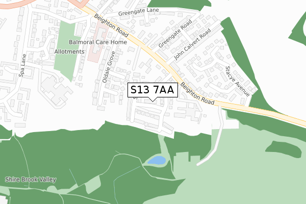
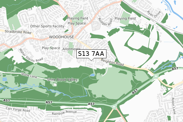
S13 7AA maps


Licence: Open Government Licence (requires attribution)
Attribution: Contains OS data © Crown copyright and database right 2025
Source: Open Postcode Geo
Licence: Open Government Licence (requires attribution)
Attribution: Contains OS data © Crown copyright and database right 2025; Contains Royal Mail data © Royal Mail copyright and database right 2025; Source: Office for National Statistics licensed under the Open Government Licence v.3.0
S13 7AA geodata
| Easting | 442552 |
| Northing | 384460 |
| Latitude | 53.355336 |
| Longitude | -1.362157 |
Where is S13 7AA?
| Country | England |
| Postcode District | S13 |
Politics
| Ward | Woodhouse |
|---|---|
| Constituency | Sheffield South East |
House Prices
Sales of detached houses in S13 7AA
2021 26 MAR £235,950 |
2021 29 JAN £242,500 |
2018 26 OCT £209,950 |
3, LYSANDER PLACE, SHEFFIELD, S13 7AA 2018 26 OCT £239,950 |
5, LYSANDER PLACE, SHEFFIELD, S13 7AA 2018 26 OCT £209,950 |
9, LYSANDER PLACE, SHEFFIELD, S13 7AA 2018 26 OCT £209,950 |
7, LYSANDER PLACE, SHEFFIELD, S13 7AA 2018 26 OCT £239,950 |
2018 28 SEP £224,950 |
Licence: Contains HM Land Registry data © Crown copyright and database right 2025. This data is licensed under the Open Government Licence v3.0.
Transport
Nearest bus stops to S13 7AA
| John Calvert Road (Beighton Road) | Woodhouse | 121m |
| John Calvert Road (Beighton Road) | Woodhouse | 121m |
| Massey Road (Beighton Road) | Woodhouse | 256m |
| Massey Road (Beighton Road) | Woodhouse | 284m |
| Station Road (Beighton Road) | Woodhouse | 365m |
Nearest underground/metro/tram to S13 7AA
| Moss Way (Sheffield Supertram) (Moss Way) | Waterthorpe | 1,463m |
| Hackenthorpe (Sheffield Supertram) (Off Sheffield Road) | Hackenthorpe | 1,814m |
Nearest railway stations to S13 7AA
| Woodhouse Station | 1km |
| Darnall Station | 4.7km |
Broadband
Broadband access in S13 7AA (2020 data)
| Percentage of properties with Next Generation Access | 100.0% |
| Percentage of properties with Superfast Broadband | 100.0% |
| Percentage of properties with Ultrafast Broadband | 100.0% |
| Percentage of properties with Full Fibre Broadband | 100.0% |
Superfast Broadband is between 30Mbps and 300Mbps
Ultrafast Broadband is > 300Mbps
Broadband limitations in S13 7AA (2020 data)
| Percentage of properties unable to receive 2Mbps | 0.0% |
| Percentage of properties unable to receive 5Mbps | 0.0% |
| Percentage of properties unable to receive 10Mbps | 0.0% |
| Percentage of properties unable to receive 30Mbps | 0.0% |
Deprivation
79.6% of English postcodes are less deprived than S13 7AA:Food Standards Agency
Three nearest food hygiene ratings to S13 7AA (metres)


➜ Get more ratings from the Food Standards Agency
Nearest post box to S13 7AA
| Last Collection | |||
|---|---|---|---|
| Location | Mon-Fri | Sat | Distance |
| 1 Massey Road | 18:00 | 10:00 | 299m |
| Market Street | 18:00 | 10:00 | 415m |
| 2 Skelton Walk | 17:45 | 10:00 | 507m |
S13 7AA ITL and S13 7AA LAU
The below table lists the International Territorial Level (ITL) codes (formerly Nomenclature of Territorial Units for Statistics (NUTS) codes) and Local Administrative Units (LAU) codes for S13 7AA:
| ITL 1 Code | Name |
|---|---|
| TLE | Yorkshire and The Humber |
| ITL 2 Code | Name |
| TLE3 | South Yorkshire |
| ITL 3 Code | Name |
| TLE32 | Sheffield |
| LAU 1 Code | Name |
| E08000019 | Sheffield |
S13 7AA census areas
The below table lists the Census Output Area (OA), Lower Layer Super Output Area (LSOA), and Middle Layer Super Output Area (MSOA) for S13 7AA:
| Code | Name | |
|---|---|---|
| OA | E00040383 | |
| LSOA | E01007969 | Sheffield 044B |
| MSOA | E02001654 | Sheffield 044 |
Nearest postcodes to S13 7AA
| S13 7PP | Beighton Road | 128m |
| S13 7NB | Oldale Court | 133m |
| S13 7ND | Oldale Close | 135m |
| S13 7NA | Oldale Grove | 197m |
| S13 7RZ | Trenton Rise | 201m |
| S13 7PR | Beighton Road | 228m |
| S13 7RX | Stacye Rise | 228m |
| S13 7PW | John Calvert Road | 237m |
| S13 7QA | Greengate Road | 247m |
| S13 7PN | Beighton Road | 248m |